
The Cleveland Way 2024: Day Six

The route today.

An overcast morning in Saltburn-by-the-sea sees me setting off a little later as it's only a shorter walk today. There's a few people milling about on the sea front as I stride on through. Today is the first of five days walking along the Yorkshire coast. This route is also designated as the King Charles III England Coast Path! Passing behind The Ship Pub I begin the climb up to Hunt Cliff, reaching a marker stone for the Cleveland Heritage Coast.

I'm walking along the cliff top in the Hunt Cliff Nature Reserve and all along here at regular intervals there are where the vegetation has been trampled giving nearer access to the cliff. There are also many slates laid on the ground at these points. Hunt Cliff is unfortunately a suicide black spot and the messages of hope are intended to prevent desperate people from jumping. I only took a photo of this one, but there were many as well as signs for the Samaritans suicide helpline. It's a stark reminder of how fragile life is.

"Way of St Hild – St Hilda’s Church, Hartlepool to Whitby Abbey – 47 miles, 5 days. This coastal route is a pilgrimage initiative that has its own smartphone app to bring alive the history around St Hild, faith and spirituality, human life in general 1400 years ago and the landscape and nature. A modern approach to ancient history then, given that the Headland, where you start, is one of the oldest centres of Christianity in England. The Anglo-Saxon monastery of Hartlepool Abbey was founded by St Aidan in 640AD, and St Hild was its second abbess in 647AD. Hild presided here before setting up her double monastery, Whitby Abbey, this route’s destination." British Pilgrimage Trust. I've see a few of these St Hild signs along the way.
There's plenty of wildflowers to catch the eye, these harebells were bobbing in the wind!
The path runs between the cliffs and a railway line at the bottom of Warsett Hill, this serves a steelworks at Skinningrove and the Boulby Potash Mine.

In the distance I can see the infamous 'giants charm bracelet', and as I approach a couple are sitting on the bench nearby. I take a couple of photos and a selfie and the chap says "of course you know you'll not be the first person to have your photo taken wi' that" Made me smile! The good views stretch out in front of me!
"The artworks official name is Circle, but the locals fondly know it as “the Charm bracelet”. The piece was created by Richard Farrington and was commissioned by Common Ground in 1990 as part of a partnership with British Steel and Northern Arts. The fact it is made from steel reflects the historic importance of the local smelting and metal working industries. The inner section of the circle is made from an old mine shaft mast and the outer part from material used to reinforce the hulls of trawlers. Sadly the original sculpture was destroyed one night in 1996 under the cover of darkness. It was a deliberate act using power tools to unfasten the ring from the base, then the sculpture was rolled into the sea. Whilst local rumours as to who did it exist, no one was ever prosecuted. The circle was reclaimed from the sea and some of the charms were also recovered. A new bracelet was produced with a new thicker circle – it was re-installed and much more firmly anchored. New steel charms were created to replace the originals which were lost. The charms include a belemnite (an old Jurassic Squid), a mermaid, a cat, a mermaids purse (fish egg pouch), a bird, a ring and a horse. The charms are all three dimensional and whilst debate continues as to what exactly each one represents, Farrington confirmed that each one represented a story about local culture, folklore or tradition." from Tim Barber's blog.

Norbert and I getting a selfie with 'the circle'

There are plenty of other footpaths off The Cleveland Way making it very accessible. Gradually the path goes down the hill and turns into several flights of steps before becoming a sandy path weaving it's way through dunes covered in sharp, spiky marram grass. I'm almost at the bottom when I look to my left and spy a familiar figure sitting, reading on the beach! I make my way down to him.
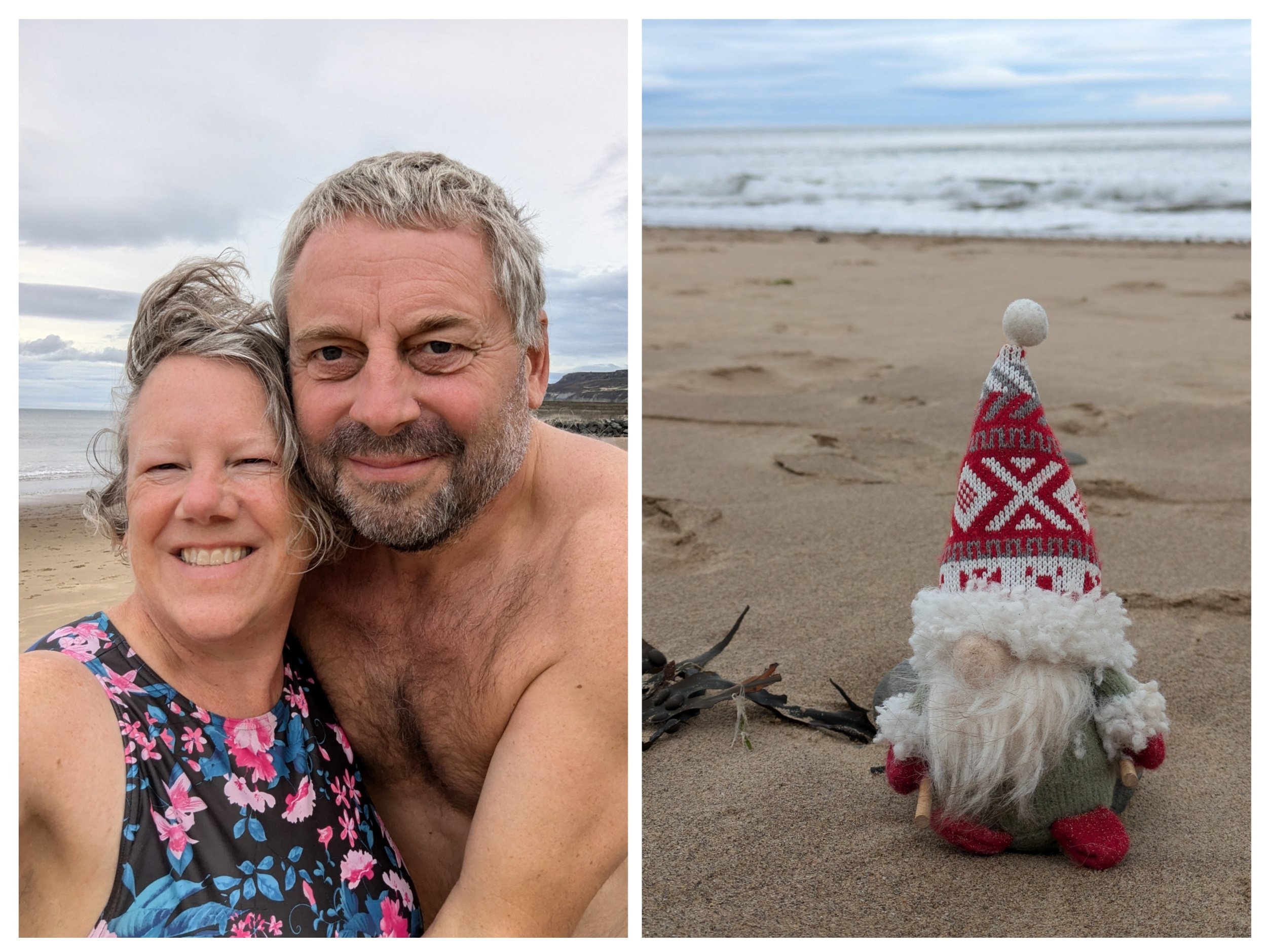
Even though it's overcast we can't resist having a dip (it was refreshing!), but changing afterwards we end up with sand everywhere as it's quite windy today. Sticky sandy feet are not a great combo with walking! Norbert has never seen sand before!

After our swim we head through a gap in a concrete jetty, around past the huge boulders that form sea defences to the small harbour. Pausing at Clara to have a cuppa (in my flask) and a snack - it begins to rain! The Repus was a traditional fishing coble now acting as a memorial to those lost at sea.

Leaving Steve and Clara behind I walk towards the houses and across a bridge, passing a Cleveland Way marker bench (I discover afterwards that this is the official halfway point on The Cleveland Way) and also a intricately detailed metal memorial bench towards a small boatyard. From here to the right is a steep climb up many. many steps (almost 200 apparently) Bottom right pic is looking back down towards Skinningrove.
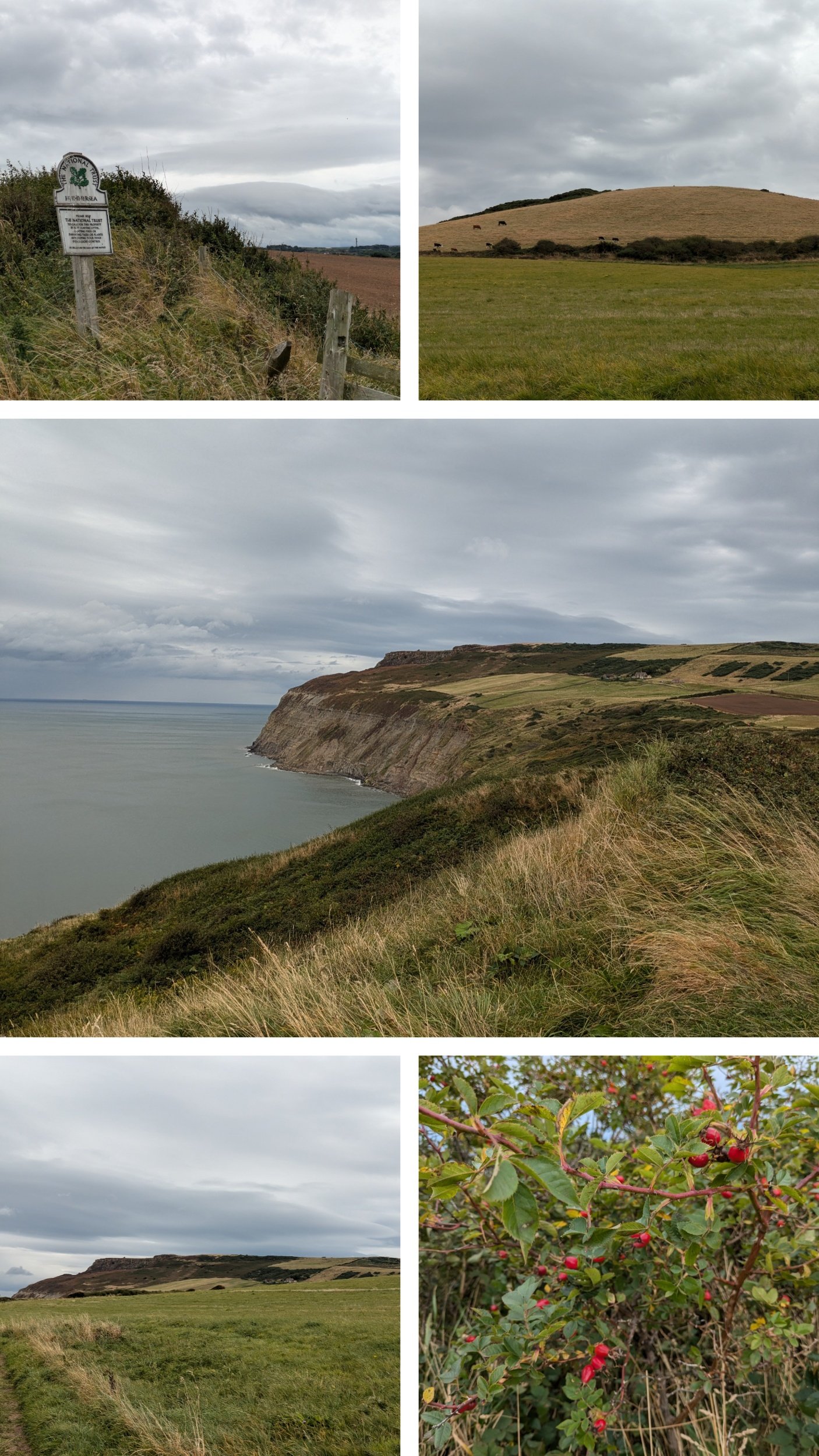
I'm now on Hummersea Cliff where the path levels out onto a grassy cliff-top, with views aplenty. The rose bushes are abounding with luscious red rosehips all along here.

The path undulates gently before moving inland, there are a few spaces with benches to take in the views from the cliff tops and I have a little pause at one. The cliffs are craggy with heather and the other side of the path is farming land with dry-stone walls and fields of green.

The top photo is a beautiful example of how all stiles should look! Also Yorkshire has very aggressive Gorse bushes, my legs though brambles were bad enough! Here I continue to walk between fields and the cliff edge which feels dangerously close at times! I pass the extensive Loftus Alum Quarries and enjoy vast views ahead along the coastal path. The quarries of Loftus Alum Works were in operation from the late 1650s until the 1860s. They occupy an area on the cliff-edge approximately 1km in length and form 5 distinct areas, each of which displays 2 or 3 levels of shale extraction. Some have large spoil heaps associated with them. Alum is not found in a natural state in Britain but can be manufactured from some types of shale.
"Making alum was a complicated process. The aim was to transform alum shales into alum crystals. The first stage in this process was to quarry the shale out of the ground. This work was done by hand with picks, shovels and wheelbarrows. To produce one ton of finished alum you would need up to 100 tons of shale. Once quarried the next stage was to burn the shale in large piles called clamps. These clamps could be up to 100 metres long and 30 metres tall and would be burnt for as long as twelve months. The burning would usually take place on the quarry floor. After burning in the clamp the shale was steeped in freshwater to draw out all the useful chemicals. The waste shale was then disposed of – usually by throwing it off the nearest cliff. The liquid was then transported to the alum house – this is where the transformation happened. In the alum house some water was evaporated off in large tanks heated by coal fires. A second chemical was added to the concentrated mixture in the form of human urine – shipped in from major cities like Hull, London and Newcastle. Burnt seaweed ashes were also used. This liquid was then cooled and allowed to crystallise. Once all the alum had crystallised all the remaining liquid was drained off and the pure alum could be washed and packed into cases for final crystallisation and shipment." from Tees Valley Wildlife Trust.

Here the route climbs onto the highest part of the cliffs, around 200m above sea level. The path is descending, the bees are loving the ragwort - every clump has loads of bees on it. I come across this poem inscribed on a precarious bit of cliff. "Pauline, in Spring I saw you, your eyes shone like dew, in Summer we shared a love we had so true, in Autumn they told us there is nothing we can do, it became Winter when you left, Ted." On further investigation this hand-carved (taking him over 64 days) poem was penned by 64 year old Ted, form East Cleveland when he lost his partner of 16 years. "I wanted to do something different and I couldn’t build her the Taj Mahal.”

Looks like the weather is rapidly changing ahead and so I'm glad to be nearing the end of todays walk. I pass a row of former alum workers' cottages and walk down a narrow road and can see Clara ahead!

Looking ahead to views of what is to come on the Cleveland Way and weather shaped trees making tunnels of paths. There's also a lot of cow parsley heads silhouetted against the sea along this stretch! One of my favourites!