
The Cleveland Way 2024: Day Ten, the final day.
The Cleveland Way Nordic Walk, Thursday 19th September 2024
Planned route: Scarborough to Filey Brigg.
Official mileage: 10.47 miles
Strava mileage: 11.47 miles
Elevation gain: 950ft
Moving time: 3:41:08
Steps: 25,294

Todays route part one.
The second part of todays route to the finish!
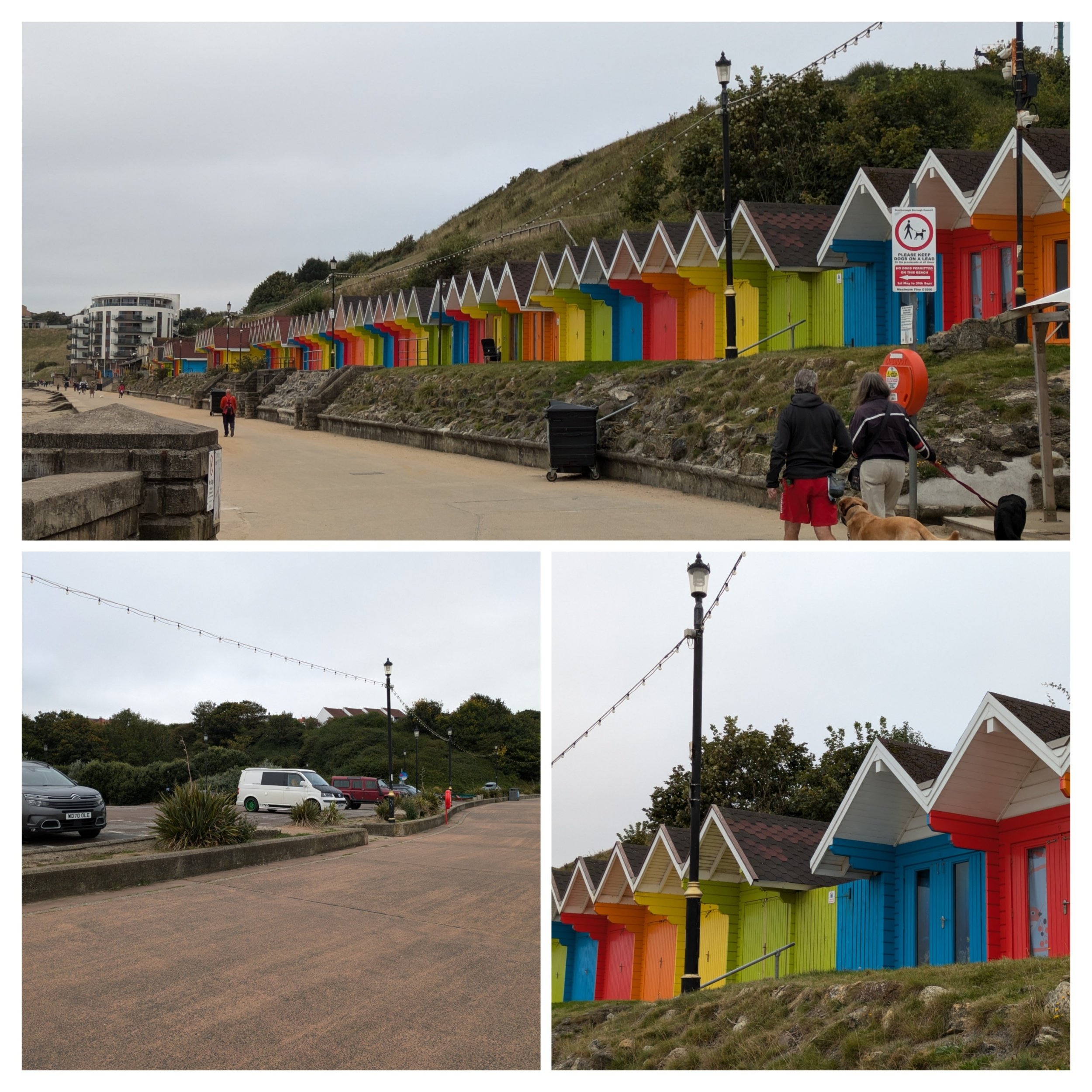
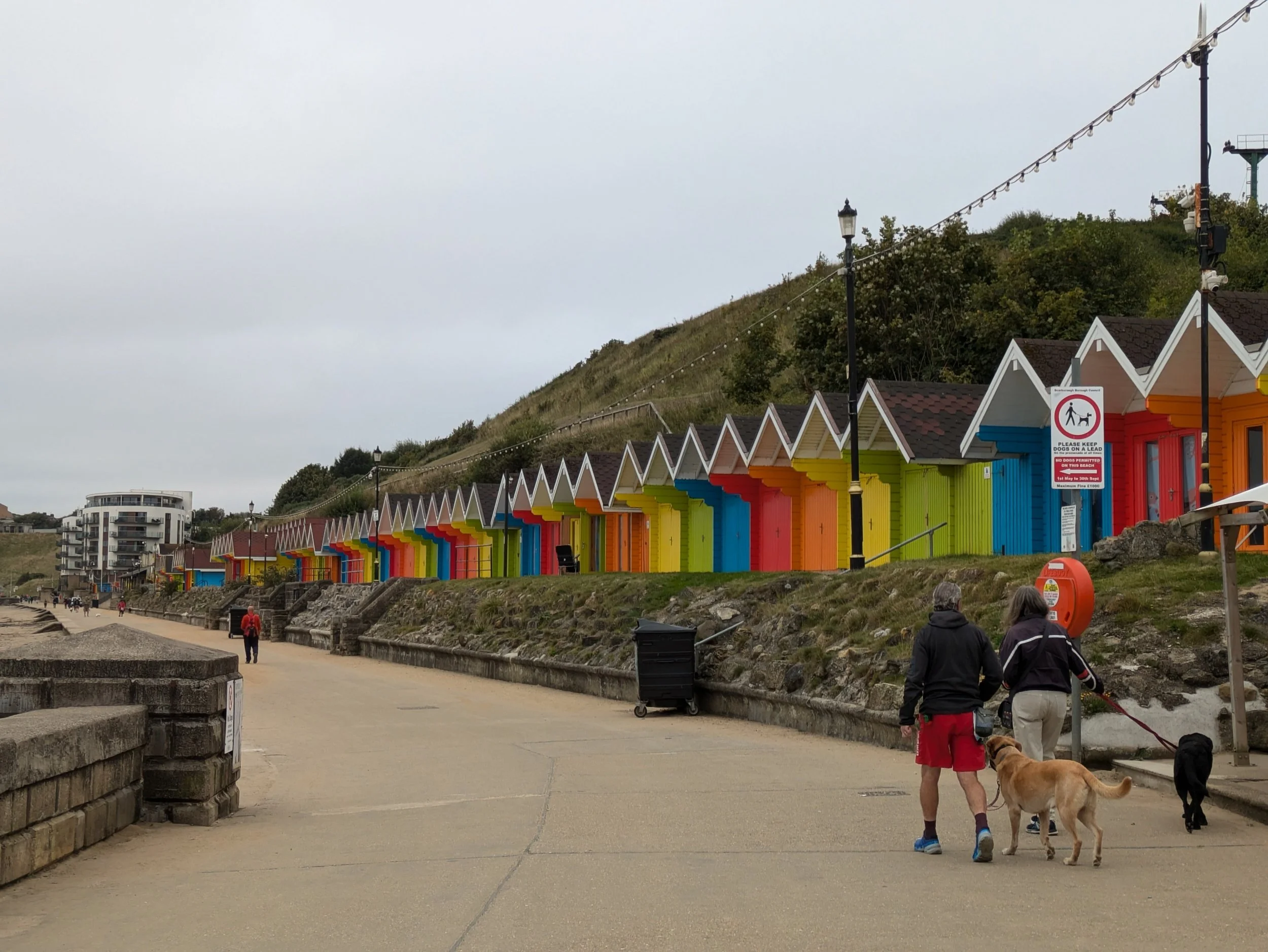
I'm back at the Sea-Life Centre near Scalby Mills on the edge of North Bay in Scarborough, I'm a little late starting today as we've had to pack up camp before setting off, I'm so exhausted from yesterday that I'm not in hurry to start anyway! However the first three miles are relatively flat as I'm about to walk around Scarborough's North and South Bays. The guide book tells me there is no official route through Scarborough which I find weird, no waymarkers or signposts, it even suggests you could get a bus! I opt for a Nordic walk along Royal Albert Drive and then Marine Drive. There's quite a few folk already taking advantage of the easy walking as well as pushchairs and mobility scooters. It's entirely possible the distance I cover will be greater weaving around human obstacles this morning! There's a distinctive row of rainbow coloured beach huts along here which cheers up an otherwise dreary scene, some of them are two storey ones you can stay overnight in.
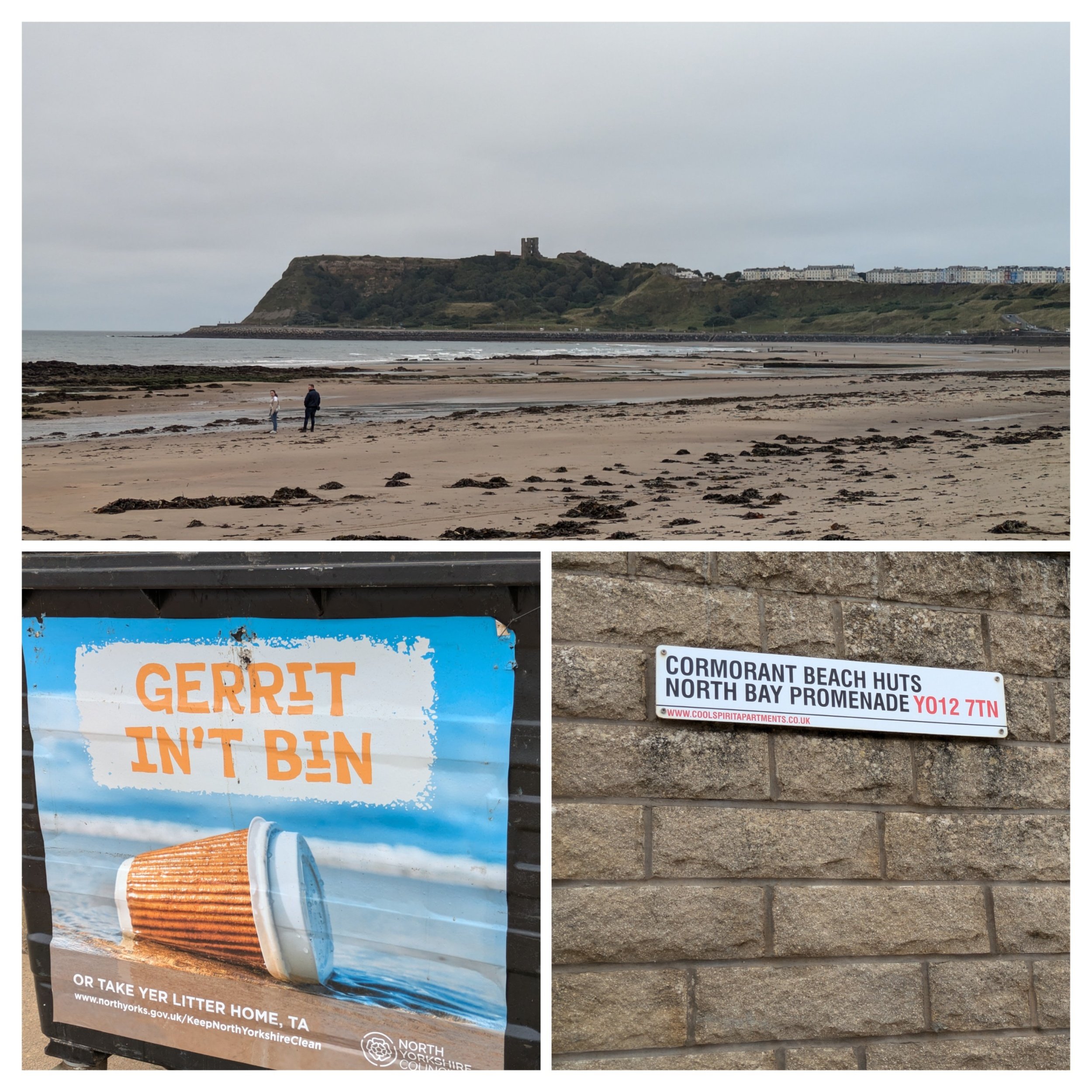
The tide is out this morning revealing a large expanse of beach and I can see the castle in the distance overlooking the bay. I love the Yorkshire sense of humour, this 'Gerrit in't bin' sign is on all the bins down here.

Made from weathering steel, this sculpture depicts Freddie Gilroy, a former soldier who participated in the liberation of Bergen-Belsen concentration camp, sitting on a bench in his old age. Gilroy was a friend of the sculptor and Lonsdale made the piece partly as a tribute to him, but also as a wider war and Holocaust memorial. Originally intended to sit on the seafront as a 4-week loan in 2011, a local resident donated money to purchase the sculpture for the town.
Gilroy and the bench are sculpted at twice lifescale, making the figure almost 3.5 metres (11 ft) in length.The sculpture, fabricated of weathering Corten steel, took artist Lonsdale three months to make. Gilroy, a South Hetton brickmaker and colliery worker, served with the Royal Artillery during the Second World War and became one of the first Allied troops to help liberate Bergen-Belsen concentration camp in April 1945. One of his duties was to guard the camp physician Fritz Klein.

Surf's up! Surf lesson tale place here in North Bay and the bottom edge of the sea wall here is decorated with waves, the castle looms closer, Steve is visiting the castle while I'm walking this morning. I continue to make my way around the bottom of the castle cliff on my way to the harbour.
Bronze age settlers are said to have been the first to fortify the headland here. The Romans operated a signal station on a line of sight linked with other coastal signal stations at Ravenscar and Filey Brigg. In the 12th century Scarborough Castle was built on the headland. The remaining ruins can be visited, they're looked after by English Heritage.

Looking back across North Bay before it disappears from view, the harbour at Scarborough. There's been a harbour in Scarborough since 1225 and it still has commercial fisheries and the fishing fleet is of mixed vessels, it certainly smelt fishy as I walked through! The anchor outside the fish and chip restaurant of the same name was raised from the seabed in 1987, it represents Scarborough's maritime history. The building behind is called Herring Girls House, a rentable holiday home.

Stained glass windows above the doors of Herring Girls House, Scarborough.

These are some old buildings around the harbourside and on Foreshore Road as I walked through. The Newcastle Packet is Grade II listed and is one of the oldest pubs in Scarborough. I think the other building is a fishery, I just love old buildings. The top pic is South Bay beach.

After following the busy promenade and coming through round the harbour South Bay beach opens up and is much sandier than North Bay it's overlooked by the imposing Grand Hotel.
"The Grand Hotel Scarborough was first devised in the early 1860s, when a group of Yorkshire businessmen saw potential in building a lavish hotel in the up and coming seaside town of Scarborough. In 1863, building began, after funding issues it finally opened on July 24, 1867 as ‘the largest and handsomest hotel in Europe’.
Along with its vast size, The Grand Hotel, Scarborough was built in unusual V-shaped style in honour of Queen Victoria (the head of the monarchy at the time). What also made this building so interesting was the unique motif: four towers to represent the seasons, twelve floors for the months of the year, fifty-two chimneys for the weeks of the year and 365 bedrooms to represent the days in the year. Another intriguing selling point of the hotel was that it offered extra taps that let its customers bathe in salt water as well as fresh water. These quirks, coupled with the high standards of service and clientele, made The Grand Hotel a favourite among holidaymakers. The additional taps in the hotel’s spa were particularly popular, and many guests chose to stay at the Grand for this reason specifically. At this time, The Grand Hotel was also named as the largest hotel and the largest brick structure in Europe." From Britannia Hotels
Fin the fish encourages recycling on the beachfront!

In 1826 the Cliff Bridge Company set about building a new footbridge that would link the centre of town with the new south side attractions. A bridge was seen as a necessary addition due to the steep ravine which separated St Nicholas Cliff from the Spa making access for a large numbers of visitors problematic. Cliff Bridge is constructed of iron, it rests on four imposing pillars and is 414 feet long and 75 feet high.
The wide expanse of sandy beach at South Bay exposed by the receding tide.

Continuing round South Bay I come towards the Spa complex at the end of the road on South Bay and I make my best way through with no way markers to navigate the complex paths around and through the South Cliff Gardens up steps , down slopes and even having to make a u-turn at a dead end I'm thankful the tide is out as the guide book says the sea can break the sea wall here and you might need to divert. Why are there no waymarkers??? "Eventually I find my way following the sea wall and across the beach at the end (hard going).
It was in the early seventeenth century that natural mineral waters were discovered in Scarborough. A Mrs Farrow or Farrer is said to have been the person who discovered that the waters could have medicinal properties. Within decades, Scarborough was well established as somewhere nice to 'take the waters'. By the early 1700s a spa house had been built to sell the waters to eager visitors to the town, who were determined to improve their health. As a spa town, Scarborough enjoyed considerable growth in the 18th century, leading to the town's claim of being England's first true seaside resort. Apart from taking the waters visitors could enjoy boating, horse racing on the beach and bathing in the sea." The BBC

"The company who built the footbridge also turned their attentions to the Spa buildings as well. A 'gothic' saloon, designed by Henry Wyatt, was opened in 1839. It included a concert hall that could seat 500 people, gardens and a promenade. There was also an outside area where orchestras could entertain the visitors. By the time the new buildings were opened though, they were considered too small for the hordes of visitors that Victorian Scarborough was attracting. Sir Joseph Paxton was called in to redesign the buildings. Sir Joseph had worked on the grounds of Chatsworth in Derbyshire and the famous Crystal Palace. His building, which opened in 1858, consisted of a central assembly hall with adjoining galleries, that could seat 2000 people. Outside, the sea wall was extended to include a double promenade with a carriage road, a colonnade with shops and an open air bandstand. The waters had changed over the centuries and by the 1960s public consumption of the waters ceased altogether. Unfortunately, the remains of the wells are no longer open to the public due to health and safety regulations. Despite alterations over the years, the Spa complex today, which consists of the Spa Theatre, the Grand Hall for concerts, the Ocean Room, Promenade Lounge, Sun Court, bar areas, cafes and other rooms, still owes a great deal to the architecture of the 1880s." From The BBC

Pretty flowers alongside the path before going through the tunnel under the funicular. Scarborough was the first town to have a funicular railway and at one time it had five, the two in North Bay have been demolished and only two in South Bay are currently in use.

Climbing up from the beach and finally there's a signpost for the Cleveland Way! It's quite a climb up to the top and the path turns off left before reaching a car park. There's a lot of college students lurking around with lanyards on around here, must be lunchtime! The path comes out on the edge of South Cliff Golf Course and runs between the course and the sea.

The path goes down some stone steps before turning right up a track, I follow a grassy path on the edge of woodland until reaching houses where the path goes along the back of the houses on a very narrow path which comes out onto a road. Spotted some Sea Buckthorn bushes along the edge of the woodland.

Farmers here are still hard at work harvesting and gathering. The road leads to Osgodby and a footpath down into woodland on Tennant's Cliff with over 100 steps down and virtually no markers in the woods, a German couple coming the other way are looking perplexed at a junction and we help each other onto the right track!
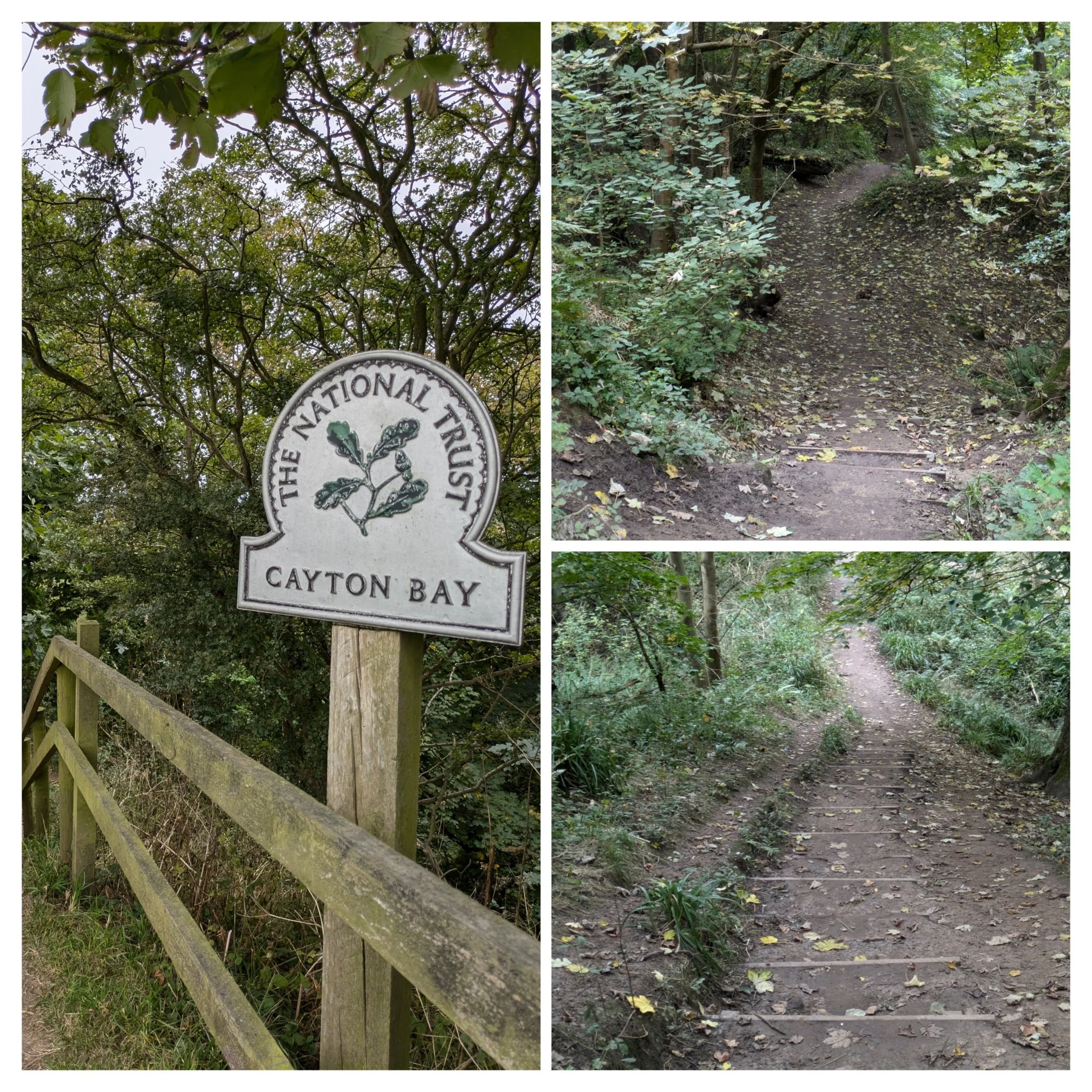
Steps, steps and more steps.

Cayton Bay looks lovely, wish the sun was shining though. There are second world war pillboxes on the beach here that used to be on the clifftop! Then I'm climbing up steep uneven steps AGAIN...turning left at the top to go down a grassy slope.
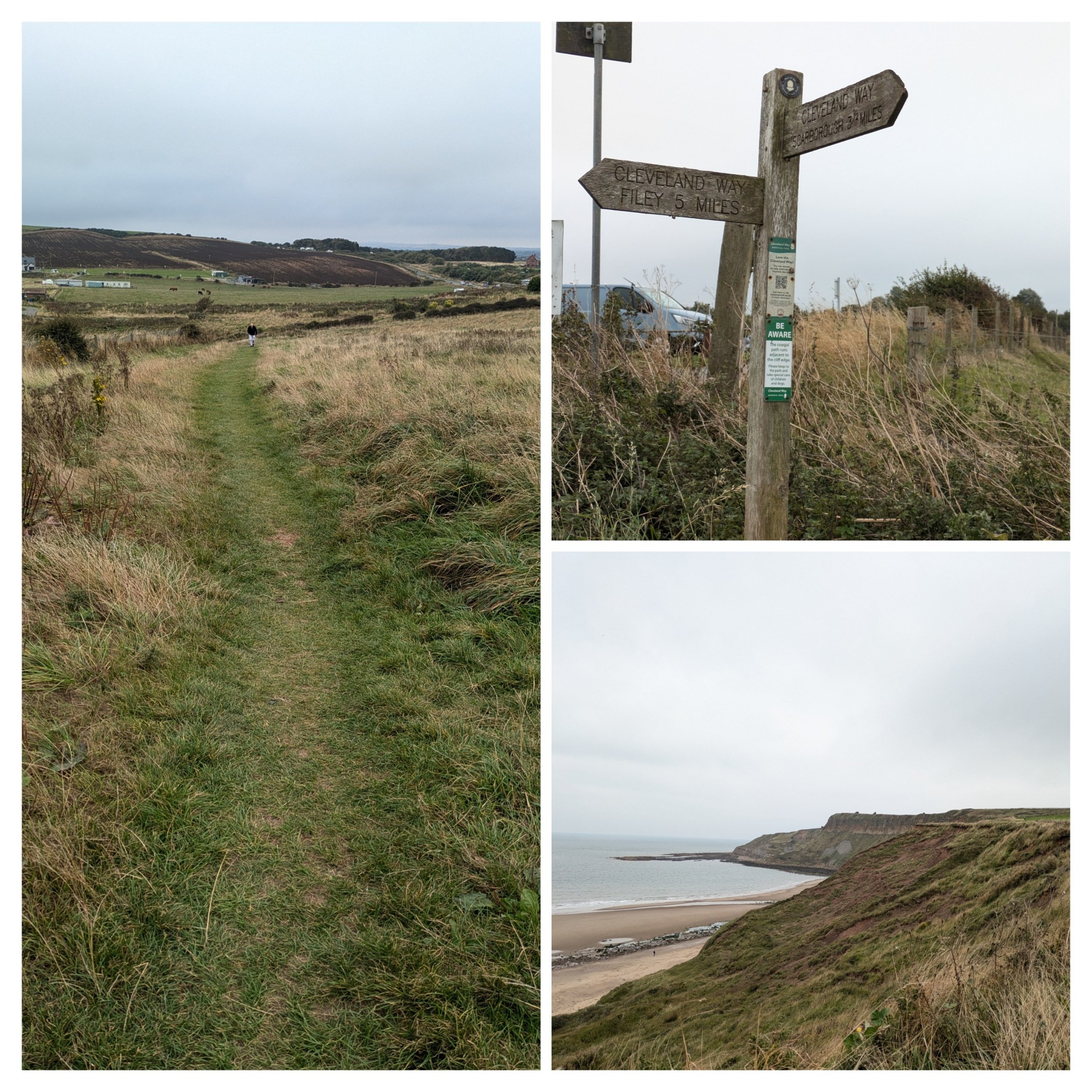
Crossing a beach access road a small climb and I can see Clara in the car park on the cliff top near a surf shop (not open) I'm so glad to be stopping, it feels like it's been a very long morning. My feet are aching, but from here there is just 5 miles left to walk. I stop for lunch with Steve, it's chilly on the clifftop, but stopping, taking off my socks and shoes having a cuppa and some food energises me for the last push.

After lunch looking back over Cayton Bay, shame about the weather. I plug into an audio book as I could do with the distraction, I'm listening to the latest Robert Galbraith book, The Running Grave (it's a bit harrowing if I'm honest)

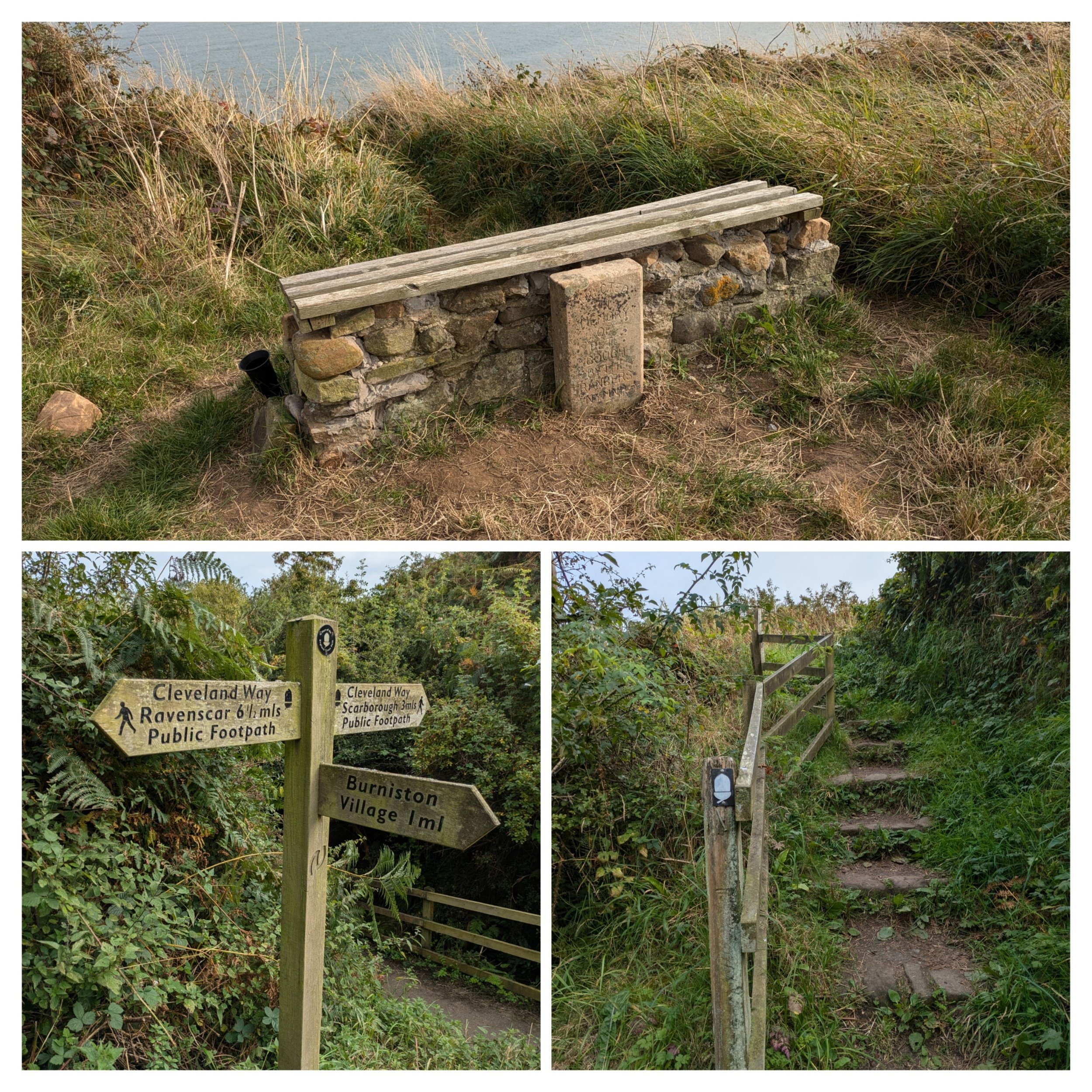
The path climbs steadily to Lebberston Cliff and there are good views back towards Scarborough. I pass a thick wooden post that has these two lions head on it, no idea why!

Once again moving uphill along Gristhorpe Cliff the path passes right in front of some static caravans on a holiday park, the path has been diverted here as a stretch of cliff path collapsed in 2023 on Cunstone Nab. There's quite a few dog walkers around.

The grassy path continues around Newbiggin Cliff and reaches North Cliff.

At North Cliff there is another rocket post, this time a restored one, but without the crows nest of others I have seen along the route.

I pass the last Cleveland Way signpost which is pointing back to Helmsley 109 miles, I've done it, I've walked the whole of the Cleveland Way, grinning like a cheshire cat, with my uncontrollable hair going everywhere(thanks wind) I then take the last few steps down a grassy path to reach the official stone marker. Steve is sitting on the stone waiting for me.

Norbert (and my Nordic walking poles) has ably accompanied me these past 10 days so he gets his moment in the spotlight too, there's a thru-walker who finished just before me and I joke to him we could carry onto the Yorkshire Wolds Way now! The official marker stone has all the names of the stage towns carved into it and a lovely acorn at the top.

At the start of the Cleveland Way in Helmsley and 109 miles (120.7 miles according to Strava) later at the finish in Filey Brigg. Tired, but happy and feeling accomplished. Steve bought us celebratory Tesco's finest chocolate eclairs!

The route of The Cleveland Way - I Nordic walked it all!

The Cleveland Way 2024: Day Nine
The Cleveland Way Nordic Walk, Wednesday 18th September 2024
Planned route: Robin Hood’s Bay to Scarborough
Official mileage: 13.78 miles
Strava mileage: 14.63 miles
Elevation gain: 1,893 ft
Moving time: 5:00:38
Steps: 33,584

The route today

Today is my penultimate day on The Cleveland Way and I'm walking into Robin Hood's Bay from the campsite Middlewood Farm where we've been staying the last couple of nights. It's a 15 minute walk, which is obviously well used with a good path all the way. Back in Robin Hood's bay the path brings me right to the National Trail path.

However before heading onto the path, I pop down to the seashore by the Bay Hotel as the tide is out. I also might have popped into a gift shop that was shut yesterday!

Norbert wanted his photo taken before we got too far today! Not far from there was this very old worn stone with a plaque giving the worn-out inscription. (little did I know there was sufferance to come!)

Walking up the steep Flagstaff Steps I turn right to climb up 100 more wooden steps. The path from here is paved in places and has obviously been suffering from landslips as there are some slabs hanging in mid-air! I look back over the beach and village behind.

My new friend Gary! I pass a field with several donkeys quietly grazing and make friends with one.

Eventually the easy path turns down steps into a wooded valley leading over a footbridge to Boggle Hole, a small cove where a stunning Youth Hostel sits (originally a corn mill). As I approach (looking for the loo) a guy says to me "you're Nordic Walking the Cleveland Way aren't you, you're putting some good stuff out on social media" fame at last! They were about to set off on one of their Festival of Walking social walks. There's also a cafe here.

Leaving Boggle Hole the path crosses a road and then goes up 100 steep steps to go along a lower cliff path before going back down, crossing a footbridge over Stoupe Beck. This then turns into a narrower track up yet more steps to a road beside a car park alongside Stoupe Bank Farm. I called this tree - last tree standing! Turning left I pick up the cliff path again.

There are views from here back to Robin Hood's Bay and the path is grassy again - I'm relieved for its flatter gradients!

Beautiful Gorse flowers on the way to Ravenscar. Gates and footbridges are the theme along this stretch which now heads inland.

Robin's Pincushion Gall on a Dogwood Rose, caused by wasps. The footbridges eventually lead past the Peak Alum Works.

Owned by The National Trust. the remains of Peak Alum Works are well preserved and give a good idea of the processes which took place. I can hear the famous Seal colony down on the beach below, but can't see them!
"Incredibly, there are over 300 seals in the colony living on the rocky beach at the foot of Ravenscar. The majority of the grey seal colony can be spotted further out on the large flat rock furthest away from the beach. If you take a pair of binoculars you can get a good look and watch them in their natural habitat – what a wonderful thing to see. Some of the seals will lounge on the beach right where the below route brings you out and you may spot some in the sea too. Both grey and common seals are found here, common seals are actually the less numerous of the two resident UK seal species. In Yorkshire, you are lucky enough to get to see both species." from the Whitby Guide
The 'castle' in the distance is Raven Hall. "Raven Hall was originally built by Captain William Childs of London. A Captain in the King's Regiment of light Dragoons, he first came to Yorkshire with the army. In 1763 Captain Childs became the owner of the Alum Works at Ravenscar and we assume that it is this commercial interest - combined with the breath-taking beauty of the area, which led him to build his family holiday home here. Until Raven Hall (which was formerly known as Peak Hall) was built in 1774, Ravenscar was a scattered hamlet of farm buildings. Staintondale was the main community in the area. However, there was in 1540 a large farm known as Peak house on the site of the 5th-century Roman fort, owned by a Mr John Beswick and his family. Nothing remains of the old fort except the foundations which were rediscovered during the building of Raven Hall." From Raven Hall Hotel

Here the path goes further inland rising through woodland and out on a track studded with locally made bricks until it reaches a road junction by the Raven Hall Country House Hotel. There's also a National Trust tearoom and coastal visitor centre here.

Cycling is popular in this area! Continuing along the main road past Raven Hall, the path is signposted left down a wide and very stony track to re-join the cliff top path.

The path continues on a grassy path undulating past fields and rugged cliff faces.

The path passes the remains of the local coastal defence radar system for the protection of the UK during the Second World War. It was one of a chain of stations built along the east coast during 1941 to detect approaching aircraft. There are four buildings. The site operated with about thirty RAF personnel on duty in shifts. All the buildings and the remains of the barracks are a Scheduled Monument. There is also a coast guard lookout. This was built in 1935 for the Auxiliary Coast Guard Watch but during the war, it was taken over as a War Watch Station which was connected by telephone to the radar station. It ceased to be used by the Coast Guard in 1972. I went up into this, but decided it looked to precarious to actually look out at the view!

At War Dike Gate there is a permissive path that I take as it enables me to meet Steve with Clara for lunch. It's the first up and over step stile I've seen on this walk, there were loads of them when I walked Hadrians Wall!

After lunch I continue to follow the regularly undulating path with good views of the headlands to come. At Hayburn Wyke the path descends steeply into a wooded valley using uneven stone steps and several flights of wooden steps which need to be navigated carefully, I also come across the only really bad stretch of muddy path on the whole 109 mile walk! Now crossing two footbridges bring me out at the top of the very bouldery beach and I make my way down to consider if I should swim there. There is also a waterfall that spouts out into a small pool on the beach, but the boulders are slippery, the tide is coming in and the waterfall pool looks dodgy, so I decide to carry on walking.

Boulders at Hayburn Wyke.

The tide is coming in over the slippery boulders and the slim waterfall at Hayburn Wyke, there wasn't great access to that pool either! These are the start of the stone steps that take you out of Hayburn Wyke and there are several twists and turns and more steps to reach the top.

A lovely tribute bench and small garden where I sat for a snack and to rest a while before continuing the relatively arduous rollercoaster of path between here and Scalby. The mileage on the signposts didn't decrease quickly enough and I was really feeling it in my legs - they had no va, va, voom.

Don't get me wrong this part was beautiful, it was just my body was struggling. I'm not sure if being able to see just how much farther you have to go helps.

Steps, steps ans yet more steps. It's the regular ups and downs that zap your energy, you have to concentrate on where your feet are going, also trying to make sure you're engaging your glutes for maximum help up each step!

It was nice to have a distraction every so often and something to read!
This bench was built by the North York Moors Rangers as a tribute to a colleague. Just 3 miles to go...'just' Oh look more steps.

Ahead I can see just how far away Scarborough appears to be, but in reality I don't really know just how many more flights of steps I will need to walk up and down or how many more fields I will pass. So I just have to dig deep and find my resilience. I stop and have another snack and a couple of jelly babies. There's lots of horsetail plants along here! It may be overcast, but it is quite warm and muggy.

I pass a signpost indicating the start of the Tabular Hills Walk which is a 48 mile walk that will take you back to Helmsley to make a circular route (another time maybe) for now I'd just like to get to Scarborough so I can stop for the day!

A walk around the final headland leads to 75 steps down to a bushy slope and then I can see Clara parked across the water at the Sealife Centre! Crossing the footbridge past the Old Scalby Mills Pub and I can stop! That was a hard day, I'm very relieved to see Steve and after stretching my stiff and tired body we head back to the campsite.
The river meets the sea here by the Old Scalby Mills Pub, further down where the sea crashes in it's not so still!

Th Cleveland Way 2024: Day Eight
The Cleveland Way Nordic Walk, Tuesday 17th September 2024
Planned route: Sandsend to Robin Hood’s Bay
Official mileage: 10.25 miles
Strava mileage: 11.49 miles
Elevation gain: 1,184 ft
Moving time: 3:40:39
Steps: 24.564

The first part of todays route.

The second half of today’s route.

The sunshine and blue skies are back this morning and Steve drops me off on the cliff-top at Sandsend. The Cleveland Way follows the main A174 road gently uphill all the way along to the Whitby Golf Club before turning left just beyond it. There is an big caravan site opposite - I've never seen so many caravans!

The road leads down to Upgang beach and goes underneath a footbridge that transports golfers to the other part of the golf course, although it looks a little precarious so I'm not actually sure it is used anymore. The path goes across a slope back up to the cliff top and follows the beach all the way to Whitby itself, it's at this point I wish I had read the guidebook more closely as I could have walked all the way along the beach as the tide was out. It would have been much nicer!

It's a beautiful beach at Whitby, wishing I was down there!

The Cleveland way is easily followed at this point as there is good signage, there are A LOT of benches along this cliff top, perfect for people watching!

There's a crescent of beautiful Georgian town houses just before the town, which is The Royal Crescent built in the 1850's. The crowning glory of George Hudson's development plans for the West Cliff was to be a Crescent that "would equal if not out-rival that of Bath".
Sadly, only half of the Crescent had been built when Hudson's creditors foreclosed - and the Crescent was never completed. Opposite is a sculpture of a crow's nest that is part of a history trail in the town.

I reach the famous whalebone arch and cam see Whitby Abbey in the distance. This arch is made up real whale bones (the bones come from a bowhead whale) and is a reminder of Whitby’s history as a whaling town.
In the17th century large-scale commercial whaling began in Whitby. The hunting whales helped the town develop into a thriving hub of the industry. The town’s location on the Yorkshire coast made it the perfect place to process and ship whale products to the rest of the world. Whales would be brought back to Whitby and processed for oil used for lighting, lubrication, and fuel, while whalebone was used to make a variety of products such as corsets and umbrella ribs.
There is also a statue to Captain Cook here as he moved to Whitby after living in Staithes and became a trainee with a local shipping firm. Later, he joined the Royal Navy and was rapidly promoted to a command. It is as Captain Cook that the world still knows him – the man who charted the coast of New Zealand and the eastern coast of Australia and who was one of the greatest surveyors as well as one of the finest sailors and explorers of all time. He learned his craft in Whitby vessels trading to the Baltic.

I walk through the whalebone arch and along the steps down the steep slope to the harbour area. After paying 50p to have a comfort break where the automatic hand wash machines don't work properly..grrr. I have a wander around past another sculpture. The Herring Girls. One of 9 sculptures which make up the Whitby Heritage Sculpture Trail by local artist Emma Stothard. This captures an image you would have seen in the late eighteenth and early nineteenth centuries. A fishing fleet followed the shoals of herrings along this coast and the ‘Herring Lasses' followed by train, they would be there ready and waiting to gut and pack the day’s catch. This sculpture represents the fiercely strong and independent women who would work in small teams of two's and three's. Two girls would gut and salt the herrings and the third would pack the fish into barrels.

I wander down the road past St John's Church and St Hilda's Church and some back streets before emerging back on the harbourside by the authentic replica of HMS Endeavour - which was sailed by Captain James Cook during his scientific expedition of 1768 - has been traditionally built by Whitby craftsmen and stands in the water some 40% of the ships original size.

I head over to the very busy swing bridge which crosses the tidal mouth of the river Esk and spend some time wandering the narrow streets seeing what I can spot!
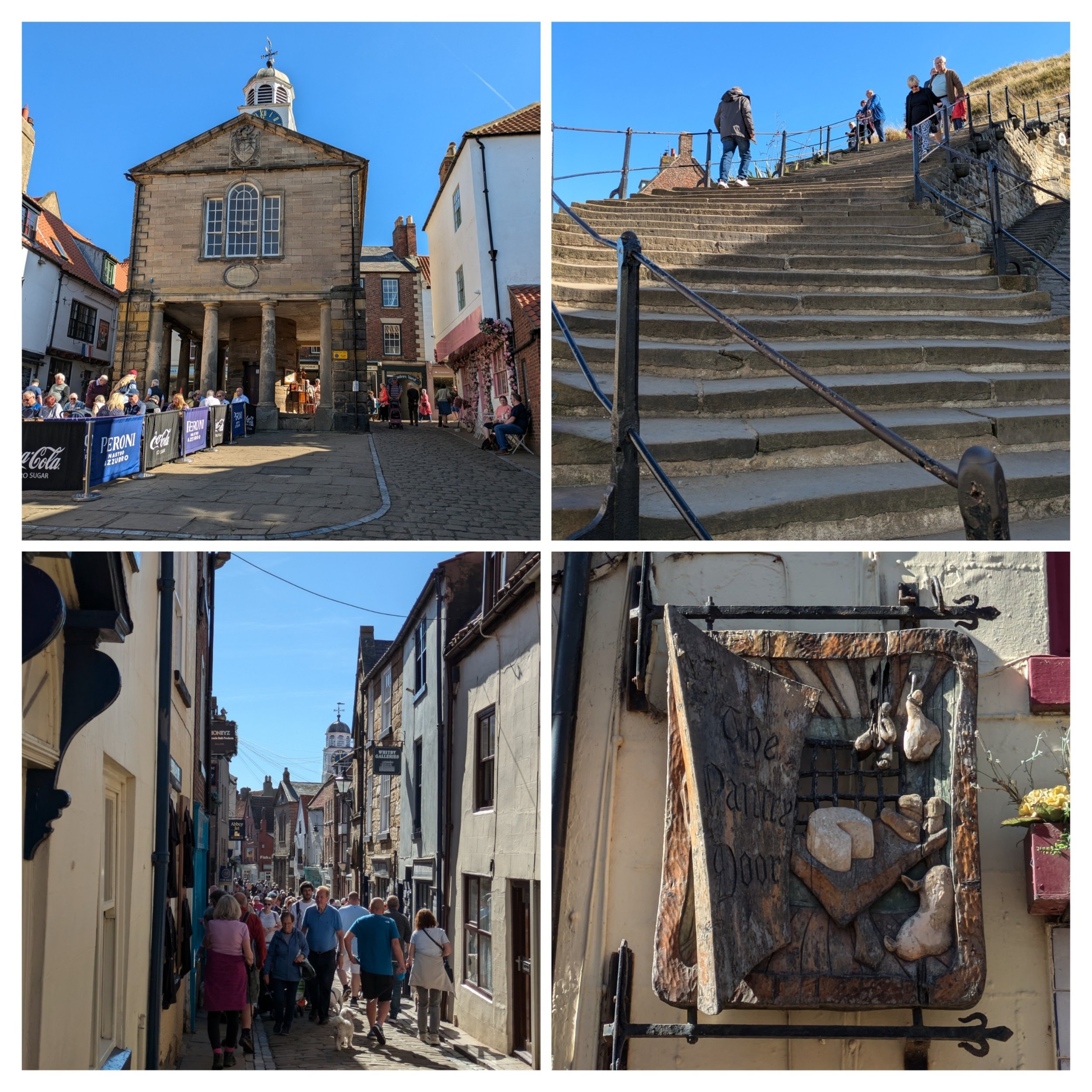
The old town hall was built in 1788 (top left pic) and the narrow, cobbled streets were bustling with visitors. I also spot this gorgeously carved shop sign for The Pantry Door. Always look up! I then make my way round to the famous 199 stone steps up towards St Mary's Church and Whitby Abbey.

I pause at the top of the steps to look back and take this photo of Whitby looking gorgeous in the sunshine. There is a cross is in the graveyard of St Mary's Church, it is Caedmon's Cross. a late Victorian-style Celtic cross that commemorates the famous 7th century Anglo-Saxon poet, Caedmon. He lived for most of his life at St Hilda’s monastic community of Streonaeshalch (Whitby), as a laybrother and herdsman. The cross is richly decorated on all four sides is almost 20 feet high and stands upon a solid stone-base. It was made from a hard type of sandstone quarried close by Hadrian’s Wall. Then there is Whitby Abbey itself, we visited the Abbey in 2020, so didn't feel it necessary to revisit it. If you'd like to read more about Whitby Abbey you can always read Steve's blog from our Clara and the Cathedrals trip. https://claraandthecathedrals.wordpress.com/2020/09/19/whitby-abbey/

Whitby Abbey was a 7th-century Christian monastery that later became a Benedictine Abbey. The first monastery was founded in 657 AD by the Anglo-Saxon era King of Northumbria, Oswy (Oswiu). He appointed Lady Hilda, Abbess of Hartlepool Abbey as founding abbess. The first incarnation of the Abbey under St Hilda lasted 200 years. At this time the North-East of England was invaded by the Danes. The invasion of the Danes wrought great destruction across the region and led to the fall of the Abbey. For the next 200 years, the Abbey was derelict, deserted, and destroyed by the ravages of time. The next incarnation of the Abbey was in the 11th century shortly after the Norman Conquest. It is these ruins that remain today. On the 14th December 1539, Henry VIII ordered Whitby Abbey to close. Upon closure, Whitby Abbey was stripped of all the fixtures and fittings of value; glass from the windows, lead from the roof and left to decay. The roof of the great church and the central tower all eventually fell.
The Cleveland Way continues opposite the abbey and now shares the same path as the King Charles III England Coast Path. The path here looks to have been renewed recently, great for a bit of speedy Nordic Walking to make up too much time spent wandering in Whitby!

I continue following the cliff path on towards Saltwick Bay and enjoy the great coastal scenery. I meet Steve just past the Whitby Holiday Village where there is some parking bays, you can access the beach here. The weather is still glorious and my lunch is consumed soaking up the sun on a picnic blanket outside the van.

Backtracking slightly to the clifftop path I pass fields of purple flowers which turn out to be a green manure plant called Phacelia, there are a few other plants including the odd sunflower! I took this photo of the beach at Saltwick from further around the path - looks to be a nice beach! There is evidence of coastal erosion and also of the extensive Alum shale quarrying that happened all along this coastline. This sea stack is called Black Nab.

Top pic is a fine example of how the landslips caused by excessive rain have literally left the path hanging in places. Here the path continues to follow the cliffs going through fields and passing this foghorn and a lighthouse. Whitby's Foghorns were sounded through a pair of ‘Rayleigh Trumpets,’ locally known as the ‘Hawsker Bull,’ It was operational from 1903 and remained in use until 1987. The equipment was updated in 1955. Each trumpet, 20 feet long and 8 feet high, was mounted on the engine room’s roof and set about 120º apart. Two horizontal 25-horsepower oil engines compressed the air needed to activate the horns. The siren blasted four times every ninety seconds and you could hear it up to 10 miles away.
The Whitby High Lighthouse, constructed in 1858, has safeguarded sailors for over a century. The Whitby High Lighthouse is the remaining half of a pair of towers initially positioned in a North-South alignment. They were collectively referred to as the twin lights of Whitby. Each lighthouse was furnished with paraffin lamps, and a pair of single-story keeper’s cottages were connected to each tower. The South Lighthouse is the only one that remains. The North lighthouse was demolished, and the foghorns took its place. Whitby High lighthouse was electrified in 1976 and the light was automated in 1992. The keeper’s cottages still stand and are available to rent.

Here the path climbs higher and then rolls gently up and down, sometimes with steps!

Boardwalks are also used in particularly wet or boggy areas. Near Hawkser the Coast to Coast path joins the Cleveland Way. I think the sign in the bottom pic might have been tampered with.

The National Trust is responsible for a lot of the coastal land along here and when the path isn't going through steep-sided wooded valleys the path is broad and grassy! "Two of the last two remaining rocket posts along our coastline were situated at Ravenscar and Robin Hoods Bay but eventually succumbed to age and the weather. Until very recently the only evidence still on the ground was the name of the field just north of Bay village where the National Trust sign announces Rocket Post Field. Firing a line from the cliff or shore in foul weather took a great deal of skill and in order to perfect this art the coastguard set up practice posts close to the coastal villages where they stored their apparatus. These 'rocket posts' were once a common feature along our cliff tops. Usually set in a field a short distance back from the cliff the post was topped by a metal crow's nest reached by simple step holds up the post. During practice sessions a coastguard would man the crow's nest to act as a mariner on a stranded vessel. The rescue team would then fire a line from 2 to 300 yards away to which was attached a heavier rope. If the shot was successful, the heavy rope was hauled in and secured and a breeches buoy attached. In a real life situation this would then be used to haul the crew, one at a time, to the shore." From geocaching.com

Walking around Ness Point, Robin Hood's bay is seen in the distance and I walk past the rocket posr.

Here the path turns right and joining The Cinder Track and old railway line that once linked Whitby to Scarborough. It's a 21.7 mile cycle track, but I'm only on it for a short while before turning onto Mount Pleasant North. Here the route has been permanently diverted. I'm meeting Steve in a car park near here and we wander down into Robin Hood's Bay together.

I've heard of Robin Hood's Bay but never been before, it's a picturesque old fishing village on the coast of the North York Moors. It apparently has a sandy beach, as well as rock pools to explore although the tide was in when we were there. We wandered down through its narrow, twisting cobbled streets and alleyways, it has a wide range of cafes, pubs, restaurants, small shops (most of these were already closed) and places to explore.
"The actual origin of the name remains a mystery. There is not a scrap of evidence to suggest that Robin Hood of Sherwood Forest folklore visited the Bay. The name is more likely to have grown from legends with local origin and probably from more than one legend. Robin Hood was the name of an ancient forest spirit similar to Robin Goodfellow and the use of the name for such an elf or spirit was widespread in the country. Many natural features were named after these local folk of legend and, in time, stories crossed over from one legend to another. The traditional anecdotes probably go way back in time but as to their origin - who knows?
What we are more certain of is that in the 18th century, Robin Hood’s Bay was reportedly the busiest smuggling community on the Yorkshire coast. Its natural isolation, protected by marshy moorland on three sides, offered a natural aid to this well-organised business which, despite its dangers, must have paid better than fishing.
Smuggling at sea was backed up by many on land who were willing to finance and transport contraband. Fisherfolk, farmers clergy and gentry alike were all involved. Fierce battles ensued between smugglers and excise men, both at sea and on land, and Bay wives were known to pour boiling water over excise men from bedroom windows in the narrow alleyways. Hiding places, bolt holes and secret passages abounded. It is said that a bale of silk could pass from the bottom of the village to the top without leaving the houses." from https://www.robin-hoods-bay.co.uk/about-rhb/history
We grabbed an ice-cream sundae from the shop with the post-office in on our way back to Clara!

The Cleveland Way 2024: Day Seven
The Cleveland Way Nordic Walk, Monday 16th September 2024
Planned route: Boulby to Sandsend
Official mileage: 9.78 miles
Strava mileage: 10.93 miles
Elevation gain: 1,069 ft
Moving time: 3:28:48
Steps: 23,998

The route today

Steve drops me off just beyond Boulby Lodge and I immediately turn right onto the path leading down through fields. Just off the path I pass this sculpture of a miner sitting at a table.
"The artwork is called The Miner’s Bait Table, commissioned by ICL Ltd the owners of Boulby Mine to celebrate the history of the mine and its 50 years of existence. The mine originally mined Potash, a potassium rich salt formed in underground deposits from evaporated sea beds from 250 million years ago. It was valuable as a fertiliser and Boulby Mine functioned as a potash mine until 2018 when potash mining stopped. The mine still functions but now solely produced polyhalite another salt used as a fertiliser but one which contains calcium and magnesium as well as potassium. ICL commissioned local artist Katy Ventress to design and produce the piece which she did at her local studio in Hinderwell. Her inspiration for the piece was the “bait tables” where miners would eat their snacks or lunch whilst underground. Each table contained a communications board with phone and they were mobile, being able to be moved around as required. Katie’s sculpture features a life-size miner in galvanised steel sitting at the bench carrying the equipment such as helmet and lamp, they would have done in the early days of the Boulby mine. The piece is functional and walkers can sit down and eat their pack ups and spend a short while taking in the stunning coastal views. The bait table itself is laser cut stainless steel and also contains a map showing how far the mine stretched beneath the ground as well as further information about the history of the mine. The elaborate picnic-style bench took just over three months to produce, after which it was sent to the galvanizer for careful processing. Galvanizing was essential to protect the sculpture from the outside elements and limit need for maintenance bearing in mind its position on the top of the cliffs on the coast. After galvanizing Katie Ventress also applied acid etching to create striking highlight effects " from Tim Barber's blog.

After Boulby the path has fallen into the sea in several places and I'm advised to walk further inland on the road, which is barred to traffic (but has been moved further inland itself on several occasions!). This leads to a junction with the road with traffic. I follow this road left down into Staithes.

Staithes main village is reached by a footbridge over the harbour. The narrow alleys and higgledy-piggledy houses have a certain charm and have attracted a creative collective in the village.

The narrow, crooked natural harbour and protective cliff face at Cowbar Nab made Staithes an ideal retreat for fishermen, traders and smugglers in decades past.

I bump into this shady looking character on my way through Staithes! Love the seahorse door knocker! After walking through the narrow, cobbled streets the path follows a stone paved path uphill allowing me to get a good look back down the narrow streets below.

At the top of the stone paved path I turn left past a farm and turn left again along a broad, grass track. The path is steadily climbing.

On Beacon Hill the path reaches almost to 100m above sea level affording me grand views all around.

Port Mulgrave is a tiny hamlet and you can access the shale beach and harbour down a number of steps. You can apparently spot the ruins of the harbour at the bottom of the cliff where locally-mined ironstone would once have been exported.

Top pic is Port Mulgrave seen from further around the cliffs above. The Cleveland Way goes along the top of the Rosedale Cliffs and I go up and down a flight of steps, passing a pond and then turning right inland to reach the top of Runswick Bay.

Beautiful weather and wide paths making Nordic Walking the Cleveland Way even more enjoyable. This part of the Cleveland Way feel very different to the early days on the North York Moors!

I continue to walk down the road towards the beach, it's busy with folk enjoying the good weather. I'm meeting Steve here for lunch, but am struggling to locate him, lack of phone signal means WhatsApp hasn't update either of our locations recently and calls aren't getting through either! Eventually we find each other and set off for an area of the beach less inhabited.
Runswick Bay is a picture postcard North Yorkshire coastal village, boasting a mile of secluded bay and gorgeous beach and this forms part of the Cleveland Way which runs along it. It is part of the Jurassic coast and famed for its fossils. The beach is sandy and is popular with dog owners, as it is one of the few beaches along this stretch of coast that doesn’t have any restrictions on dogs. Runswick has been popular with holidaymakers for centuries. In more recent times, it has become known for its surf, and the brave and adventurous can be seen frequenting the coldest of its tidal waters.

Couldn't wait to get my walkng boots off and get in the sea for a dip! Stark contrast to yesterday as it is calm and sunny! Less sand invading stuff! After a dip and lunch (this felt like we were on holiday!), I head off down the beach to find the exit point. Hilariously the guide book says if the tide is high and the beach is blocked, then the best course of action is to wait for it to recede!

Once I am past the crumbling cliff at Hobb Holes, I find the exit up a river bed cutting through crumbly layers of slippery shale. A guy coming the other way advises me to hold onto the hand rail as he has just slipped and bashed his knee. So I take it very gingerly scrambling up the shale, I don't need a fall! The path incredibly is up that right-hand side where the wooden balustrade is! I can't imagine what it must be like when there is more water running through it! Then there's a climb up 95 steps followed by 160 more up 100m of cliff to the top.

Excellent views of Runswick Bay from the top of the cliff. I now follow the grassy cliff-top path around Kettle Ness headland.

Cattle and signposts around every corner almost! The cattle barely acknowledge my existence!

The farming community are hard at work bringing in the harvest, literally making hay while the sun shines! Norbert finds himself a less risky photo location with the National Trail acorn logo and this handmade sign with distances back to Helmsley and ahead to Filey makes me smile with it's added missing L. 75 miles done, 37 to go!

More farming action (I got a wave from this farmer!) and the path begins it's descent down a wooded slope on steeply-pitched stairs.

Once down all the stairs the route goes along the old trackbed of a disused railway, through a cutting and along an embankment, passing an old Alum workings at Sandsend Ness. After another short wooded section the path takes steps down into a car park below the old station site. I then follow the road into Sandsend passing a cluster of older looking cottages on my right.

Sandsend has some surprisingly characterful properties and a stunning sandy beach, I walk along the A174 looking for Clara in the parking spaces, dump my rucksack and poles and stop at the ice-cream van to buy Magnums on the way to find Steve reading on the beach. Magnums consumed it is time for a second sea dip of the day. This time the sea is a little rougher! Lovely to finish the days walking with a refreshing dip!

The Cleveland Way 2024: Day Six

The route today.

An overcast morning in Saltburn-by-the-sea sees me setting off a little later as it's only a shorter walk today. There's a few people milling about on the sea front as I stride on through. Today is the first of five days walking along the Yorkshire coast. This route is also designated as the King Charles III England Coast Path! Passing behind The Ship Pub I begin the climb up to Hunt Cliff, reaching a marker stone for the Cleveland Heritage Coast.

I'm walking along the cliff top in the Hunt Cliff Nature Reserve and all along here at regular intervals there are where the vegetation has been trampled giving nearer access to the cliff. There are also many slates laid on the ground at these points. Hunt Cliff is unfortunately a suicide black spot and the messages of hope are intended to prevent desperate people from jumping. I only took a photo of this one, but there were many as well as signs for the Samaritans suicide helpline. It's a stark reminder of how fragile life is.

"Way of St Hild – St Hilda’s Church, Hartlepool to Whitby Abbey – 47 miles, 5 days. This coastal route is a pilgrimage initiative that has its own smartphone app to bring alive the history around St Hild, faith and spirituality, human life in general 1400 years ago and the landscape and nature. A modern approach to ancient history then, given that the Headland, where you start, is one of the oldest centres of Christianity in England. The Anglo-Saxon monastery of Hartlepool Abbey was founded by St Aidan in 640AD, and St Hild was its second abbess in 647AD. Hild presided here before setting up her double monastery, Whitby Abbey, this route’s destination." British Pilgrimage Trust. I've see a few of these St Hild signs along the way.
There's plenty of wildflowers to catch the eye, these harebells were bobbing in the wind!
The path runs between the cliffs and a railway line at the bottom of Warsett Hill, this serves a steelworks at Skinningrove and the Boulby Potash Mine.

In the distance I can see the infamous 'giants charm bracelet', and as I approach a couple are sitting on the bench nearby. I take a couple of photos and a selfie and the chap says "of course you know you'll not be the first person to have your photo taken wi' that" Made me smile! The good views stretch out in front of me!
"The artworks official name is Circle, but the locals fondly know it as “the Charm bracelet”. The piece was created by Richard Farrington and was commissioned by Common Ground in 1990 as part of a partnership with British Steel and Northern Arts. The fact it is made from steel reflects the historic importance of the local smelting and metal working industries. The inner section of the circle is made from an old mine shaft mast and the outer part from material used to reinforce the hulls of trawlers. Sadly the original sculpture was destroyed one night in 1996 under the cover of darkness. It was a deliberate act using power tools to unfasten the ring from the base, then the sculpture was rolled into the sea. Whilst local rumours as to who did it exist, no one was ever prosecuted. The circle was reclaimed from the sea and some of the charms were also recovered. A new bracelet was produced with a new thicker circle – it was re-installed and much more firmly anchored. New steel charms were created to replace the originals which were lost. The charms include a belemnite (an old Jurassic Squid), a mermaid, a cat, a mermaids purse (fish egg pouch), a bird, a ring and a horse. The charms are all three dimensional and whilst debate continues as to what exactly each one represents, Farrington confirmed that each one represented a story about local culture, folklore or tradition." from Tim Barber's blog.
Norbert and I getting a selfie with 'the circle'

There are plenty of other footpaths off The Cleveland Way making it very accessible. Gradually the path goes down the hill and turns into several flights of steps before becoming a sandy path weaving it's way through dunes covered in sharp, spiky marram grass. I'm almost at the bottom when I look to my left and spy a familiar figure sitting, reading on the beach! I make my way down to him.
Even though it's overcast we can't resist having a dip (it was refreshing!), but changing afterwards we end up with sand everywhere as it's quite windy today. Sticky sandy feet are not a great combo with walking! Norbert has never seen sand before!

After our swim we head through a gap in a concrete jetty, around past the huge boulders that form sea defences to the small harbour. Pausing at Clara to have a cuppa (in my flask) and a snack - it begins to rain! The Repus was a traditional fishing coble now acting as a memorial to those lost at sea.

Leaving Steve and Clara behind I walk towards the houses and across a bridge, passing a Cleveland Way marker bench (I discover afterwards that this is the official halfway point on The Cleveland Way) and also a intricately detailed metal memorial bench towards a small boatyard. From here to the right is a steep climb up many. many steps (almost 200 apparently) Bottom right pic is looking back down towards Skinningrove.
I'm now on Hummersea Cliff where the path levels out onto a grassy cliff-top, with views aplenty. The rose bushes are abounding with luscious red rosehips all along here.

The path undulates gently before moving inland, there are a few spaces with benches to take in the views from the cliff tops and I have a little pause at one. The cliffs are craggy with heather and the other side of the path is farming land with dry-stone walls and fields of green.

The top photo is a beautiful example of how all stiles should look! Also Yorkshire has very aggressive Gorse bushes, my legs though brambles were bad enough! Here I continue to walk between fields and the cliff edge which feels dangerously close at times! I pass the extensive Loftus Alum Quarries and enjoy vast views ahead along the coastal path. The quarries of Loftus Alum Works were in operation from the late 1650s until the 1860s. They occupy an area on the cliff-edge approximately 1km in length and form 5 distinct areas, each of which displays 2 or 3 levels of shale extraction. Some have large spoil heaps associated with them. Alum is not found in a natural state in Britain but can be manufactured from some types of shale.
"Making alum was a complicated process. The aim was to transform alum shales into alum crystals. The first stage in this process was to quarry the shale out of the ground. This work was done by hand with picks, shovels and wheelbarrows. To produce one ton of finished alum you would need up to 100 tons of shale. Once quarried the next stage was to burn the shale in large piles called clamps. These clamps could be up to 100 metres long and 30 metres tall and would be burnt for as long as twelve months. The burning would usually take place on the quarry floor. After burning in the clamp the shale was steeped in freshwater to draw out all the useful chemicals. The waste shale was then disposed of – usually by throwing it off the nearest cliff. The liquid was then transported to the alum house – this is where the transformation happened. In the alum house some water was evaporated off in large tanks heated by coal fires. A second chemical was added to the concentrated mixture in the form of human urine – shipped in from major cities like Hull, London and Newcastle. Burnt seaweed ashes were also used. This liquid was then cooled and allowed to crystallise. Once all the alum had crystallised all the remaining liquid was drained off and the pure alum could be washed and packed into cases for final crystallisation and shipment." from Tees Valley Wildlife Trust.

Here the route climbs onto the highest part of the cliffs, around 200m above sea level. The path is descending, the bees are loving the ragwort - every clump has loads of bees on it. I come across this poem inscribed on a precarious bit of cliff. "Pauline, in Spring I saw you, your eyes shone like dew, in Summer we shared a love we had so true, in Autumn they told us there is nothing we can do, it became Winter when you left, Ted." On further investigation this hand-carved (taking him over 64 days) poem was penned by 64 year old Ted, form East Cleveland when he lost his partner of 16 years. "I wanted to do something different and I couldn’t build her the Taj Mahal.”

Looks like the weather is rapidly changing ahead and so I'm glad to be nearing the end of todays walk. I pass a row of former alum workers' cottages and walk down a narrow road and can see Clara ahead!

Looking ahead to views of what is to come on the Cleveland Way and weather shaped trees making tunnels of paths. There's also a lot of cow parsley heads silhouetted against the sea along this stretch! One of my favourites!

The Cleveland Way 2024: Day Five
The Cleveland Way Nordic Walk, Friday 13th September 2024
Planned route: Gribdale Gate to Skelton Green, but pushed on to Saltburn-by-the-sea
Official mileage: 12.14miles
Strava mileage: 13.65 miles
Elevation gain: 1,712 ft
Moving time: 4:35:33
Steps: 30,038

My revised route for today
Steve dropped me back at Gribdale Gate and I started walking around 10.20am. A nice climb first thing to warm the bones! I did look back from near the top and we waved at each other before he set off on his own adventure. The stone steps are uneven and you really have to concentrate where you are putting your pole tips! I reach Great Ayton Moor and the hill flattens out slightly.

As I'm walking along I spot this beautiful Fox moth caterpillar crossing over the path, later I also spotted a snake crossing the path, but wasn't quick enough with my phone to snap it! Along the path here there is a substantial wall and a small birch woodland to the left with open moorland on my right. I follow the track around following the wall, passing a York Moors boundary stone. The wall turns a corner abruptly and I go through a gate on Newton Moor to access Roseberry Topping.

Views of Roseberry Topping from the path belie its true height! to climb or not to climb, that is the question. The climb to the summit is considered part of the Cleveland Way and I decide it would annoy me in days to come if I didn't climb it! Dubbed as the 'Yorkshire Matterhorn' I hope it brings me a mountain-top experience!

I go through a gate and drop down onto a relatively steep paved path reaching a grassy flat path, before climbing up another steep stone path as it winds itself around the peak. I stop to chat to another solo female walker and she tells me I'm brave to walk alone. We have a discussion about perceived threats and she tells me she only does shorter out and back walks since she lost her husband last year, they were both keen walkers. Our chat gives my heart rate time to settle and I climb the last few turns of the path. Roseberry Topping has a programme of repair works in progress. "Roseberry Topping, a hill on the edge of the North York Moors, has seen "significant path erosion" with its 10 trails in "dire need of repair", the British Mountaineering Council said. About 100 tonnes of pathway stones will be used during the repair work which is expected to take between two and three years. The project is being run by the National Trust and North York Moors National Park." from the BBC.

Just before the top it looks like there is no-one else up there, turns out that was a false summit and when I reach the true summit, it is full of people! Norbert gets to bag another Trig point and I enjoy the 360 degree views, whilst trying not to fall over anyone. You can see the distant Pennines, Industrial Teesmouth and all across the nearby North York Moors. The American group from day one are here too. The top pic is the view back down from where I came.

Middle right pic is the false summit. I was disappointed to find so many people at the summit. A lady I spoke to said "it's the Instagram generation looking to post their mountain-top pics, they just park as close as possible and it looks like they've done a hard hike to get here" There was a woman putting her dog on the trig point for a selfie...I'll just keep quiet about Norbert for now. I have to admit though no-one up there looked particularly like they were bothered about Instagram!

I retrace my steps both back down the steep, unevenly paved stone steps and back up the other side to reach the gate I came through. Following a gravel path which cuts straight across the heather moorland I pass this memorial post to John Storey who apparently loved Hutton Moor and his family have funded the path works in his memory, much improving the conditions of the path on this stretch of the Cleveland Way

I go through a small gate and turn right to follow a track through mixed forest and along a fence, passing a gate at a junction and turn right through another gate to leave the forest. Here I re-encounter the solo lady walker from Roseberry Topping, I've caught her up, we walk together for a bit, chatting as we go, her name is Gillian. We're following a track up a moorland slope and then onto a stone-paved path, the slab in the photo is one half of a broken 1961 dedication stone from Holy Trinity School, Halifax. I wonder how that came to be part of this path?

Passing through a couple of kissing gates we continue walking together down another path, passing beech trees. Turning right and following the signpost across a track we then turn right to climb up a stone path that climbs alongside an old quarry on Highcliff Nab (top pic) we then turn along the top edge of the quarry and admire the view over the local town of Guisborough. Not long after this Gilllian announces she has come as far as she's going today and needs to turn back to Gribdale where she set off from this morning. We stand chatting for a bit and then go our separate ways. I spot this beautiful Shaggy Inkcap fungi on the side of the path.

I follow a track through the forest, stopping by a bench to eat my roll. The path through Guisborough Woods undulates and twists and turns (you could easily get lost) and I spot my first Fly Agaric fungi!!

Eventually the path reaches a gate to exit the forest and I turn left to head downhill on a concrete road through trees.

I turn right crossing a cattle grid and walk along the bottom edge of another stretch of woodland, keeping to the narrower path rather than the alum-shale wide tracks used by the local trials motorbike club. I have to keep a close eye on the path markers here!

The path leaves the serene wooded area and follows alongside the A171 for a bit crossing at the Chase Cafe Fox and Hound. Here the path heads between nearby cottages and rises on steps (almost 200 steps) up to an old quarry. Alongside the path are many gorse bushes and an abundance of broom (Cytisus).

As I'm walking I keep hearing popping sounds (akin to the sound of pinecones crackling open in the top of pine trees in the south of France on a hot August day) and it's not until something hits me in the face from a nearby broom shrub that I work out what is going on. Cytisus plants disperse their seeds ballistically from the pod with an audible pop, a ripe black seed pod had popped as I walked by. At the top of the hill, I come across Pippa and her owners eating a late lunch and we stand a chat for a bit. I leave them and continue straight uphill and then turn right to continue between a beech wood and a field.

Bottom left pic is the track that runs all the way down past Airy Hill Farm and into Skelton Green where Steve and Clara are waiting for me, I'm not stopping, just off-loading some stuff for the final part of todays journey. Originally I was going to finish here, but the weather is too nice and Sundays forecast is not that great. Steve hands me a very welcome cold can of Coke Zero. As I leave Steve behind I come across Pippa and her owners again and they suggest we could walk the next section into Saltburn-by-the-sea together. From Skelton Green we follow a tarmac path fenced through fields, down a narrow road before turning right and then left down a flight of steps into Skelton, We cross the High Street and the route takes us on a magical mystery tour of the streets of Skelton winding its way through to a new housing estate (where we lose the actual Cleveland Way despite three of us looking out for waymarkers) We pick up the path further on and end up in a quiet wooded area with the path taking us down the hill on wide steps.

Turning right we reach Skelton Beck and the path goes alongside for a bit, crossing over a footbridge and beneath the towering arches of the brick built Saltburn Viaduct.

"The Saltburn Viaduct started being built in 1865 by the North Eastern Railway Company and was completed in 1872 – in which the purpose of the railway viaduct was to help with transportation to and from Skinningrove Limestone Mine. The Grade II listed viaduct was closed to passengers in 1958 – however, it is still in operation today, as it helps to operate goods to and from the Boulby Potash mine." from saltburn.org.uk
The viaduct has 10 red brick piers and 11 arches that stretch over Skelton Beck and Mill Fields, it stands 180 metres tall!

The path runs through Saltburn Valley Gardens with some interesting bench furniture. The quote says:
"So close, no matter how far, couldn't be much more from the heart, forever trust in who we are, and nothing else matters." It's from a Metallica song ( I had to do quite a bit of research to find that one out!)

We pass the nearest to half way signpost and catch up with another couple of walkers we have bumped into a few times. They are finishing their walk in Saltburn-by-the-sea and so we say goodbye. We go up a few steps onto Albion Terrace where there are some big beautiful buildings and this wire sculpture in front of the bandstand. We follow this road down towards the sea where I say goodbye to Pippa and her owners as I won't see them again as I'm taking a day off the next day.

I continue on down the road towards the sea, finding Steve waiting in the car park round the corner. He has literally just paid for parking, so we decide to head to the seafront and treat ourselves to an ice cream! Top pic is a hurriedly taken, slightly blurry image of Saltburn Scar.

End of day ice-creams and the pier at Saltburn-by-the-sea.

The Cleveland Way 2024, Day Four
The Cleveland Way Nordic Walk, Thursday 12th September 2024
Planned route: Clay Bank to Kildale, but actually finished at Gribdale Gate
Official mileage: 12.03 miles
Strava mileage: 12.41 miles
Elevation gain: 1,448 ft
Moving time: 3:48:10
Steps: 26,196

This was my planned route for today, but ended up pushing on past Captain Cooks Monument to Gribdale Gate.

Roughly 3 extra miles to Gribdale Gate.
The guide book says this is the most remote part of the Cleveland Way, travelling through the highest part of the North York Moors, with no access to any facilities, so it feels like it could be a lonely day. It recommends finishing at Kildale for a 9.5 mile walk.

Leaving Steve at the bottom by the B1257, my walk today starts with a steep climb alongside a wall on yet more stone slabs (my favourite, not) I pass a lady and a dog and then go through a gate where the path turns to grass and becomes gentler in nature. I am rewarded for my efforts by a stunning field full of Belted Galloway cattle (my second favourite cattle), they stand out so much against this terrain. This crest is named Carr Ridge and stands some 380m tall. There are great views of where I have already walked and the patchwork of fields at the foot is looking colourful in the sunshine.

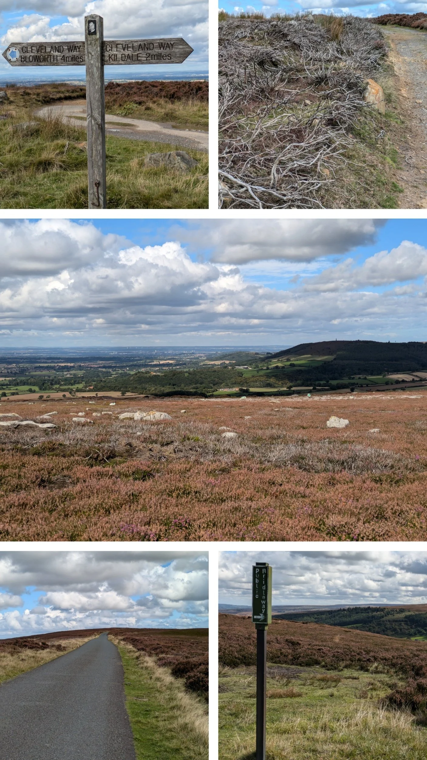
Although this is a remote and exposed section of the Cleveland Way, it has become gentler, even softer than the previous section. Most of the paths are now gravelly and are flanked by heather, grass and sometimes bilberry bushes. There are standing stones (moorland marker stones, 18th century) whose purpose it is to guide the walker during bad weather and there are also plenty of acorns and signposts to keep me on track.

Norbert gets to bag a trig, but a couple and their dog, Pippa are having a coffee at what we believe is the highest point on the Cleveland Way (454m) and on the North York Moors. This trig point sits atop a burial mound on Round Hill and the chap (I forget his name, even though we kept crossing paths for the next few days on the way) offered to take a photo of us both. I'm not sure what some people make of me carrying around Norbert, but hey, who cares!

The paths continue to be great for Nordic Walking and I'm enjoying a speedier pace today. I passed this moorland pond covered in waterlilies.

The route runs down a moorland slope and after a short climb then picks up the old trackbed of the Roseldale Railway. This railway operated between 1861 and 1929 transporting iron ore from Rosedale to County Durham to be smelted. At Bloworth Crossing the path takes a sharp turn left and gently climbs again on a broad, but stony path. There are fantastic views across these moors! I pass a couple of groups of walkers going in the other direction who are keen to know my destination for the day.
Top picture is looking back to the peaks of yesterdays walk. The path passes these two standing stones, the taller one is dated 1888 and is a boundary stone between moorland estates, but the shorter one is considerably older and is known as Jenny Bradley's Cross, not the name of a person, but derived from 'Broad Ley' or a broad trackway. I saw a lot of these wierd stone edged pits and later learnt they are Grouse Butts. Grouse are ‘driven’, where birds are flushed by a line of beaters and fly over the people shooting (the ‘Guns’), who are stationary in a line. On grouse moors they typically stand in a line of ‘butts’ – specially constructed shooting positions often built out of wood, stone and turf.
When I see the sign for Kildale and it is 2 miles away, it's only 12.20pm, which means I have covered 7.5 miles in the last 2.5 hours, but Steve is not expecting me at Kildale until at least 3pm...I decide to let him know I may be earlier than expected!
I keep seeing patches of burnt heather and I know burning is one of the methods used to control it. Globally, heather moorland is rare. It is virtually confined to Britain and Ireland, where in the main it is maintained through cutting, grazing and/or managed burning. I've crossed Ingleby Moor and Battersby Moor (love the names of moors!) and I come to a gate on the bend of a minor road, so minor it is just a dotted line track on the map!

The tarmacked road stretches out to what seems like infinity and my instructions are to follow the road straight ahead crossing a rise on Kildale Moor. The wind has been blowing an absolute hoolie today, it's so tiring! The road goes over a cattle-grid between a dry-stone wall and I decide to stop here as I will get some shelter from the wind. On the opposite side of the road are these, what I presume, bee hives and I note after a bit of research that there is a honey called Kildale Heather Honey! Whilst eating my lunch and watching grouse pop up in the heather I do rather regret taking a seat opposite beehives... didn't get stung, but I was bothered by several bees taking an interest in my leggings! While I was eating lunch I had another look at the map and decide as the weather is set fair and I'm not feeling ready to stop just yet, I will push on past the Captain Cook memorial and let Steve know where to meet me, it's about another 3 miles according to the map.
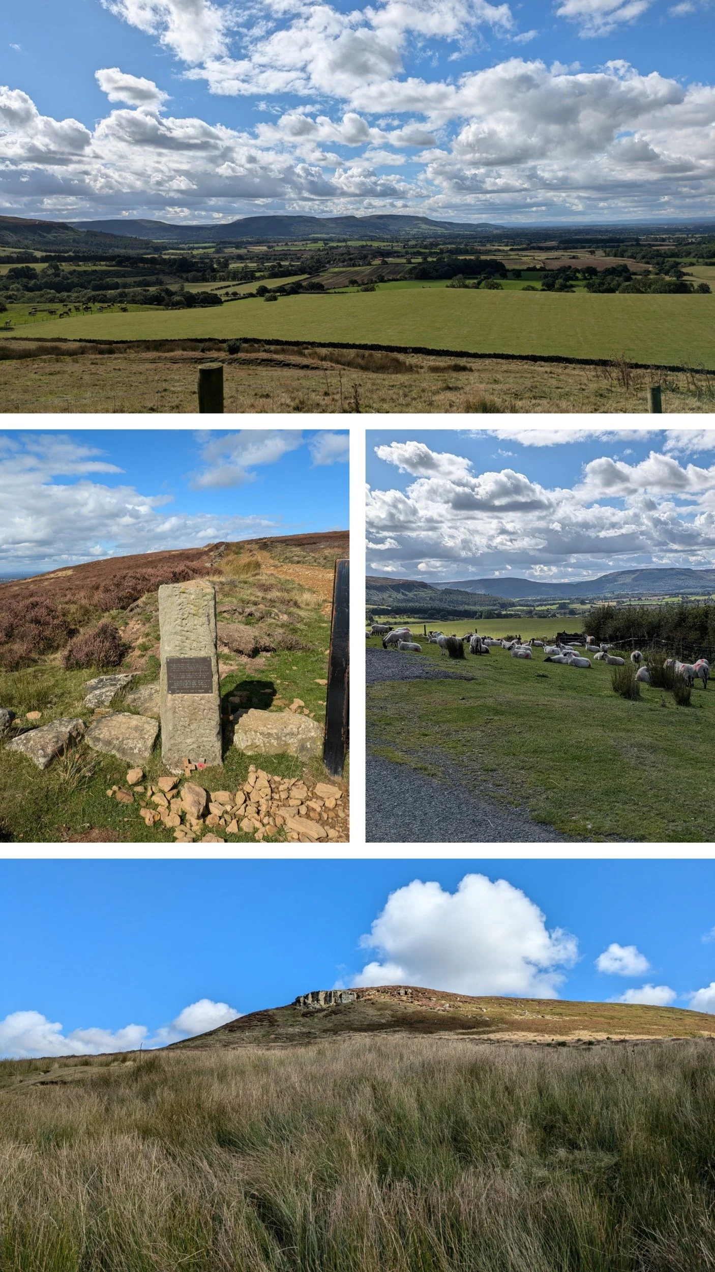
The road gently undulates, with a steady downwards trajectory, passing this stone memorial to a crashed aircraft. Round the slopes of Park Nab (bottom pic) A small edge of hard, quick-drying sandstone with face climbing on small edges. There are sheep ont' road here! The road reaches a junction and I turn right to go through the village of Kildale. The top pic is looking back at those climbs form yesterday again.

Kildale is a small, pretty little village where John Wesley (one of the founders of Methodism) is said to have preached (there is a stone commemorating it) I take a turn off to the left signposted The Cleveland Way and that leads under the railway and across a river, the road bends round then climbs quite steeply up past Bankside Farm.
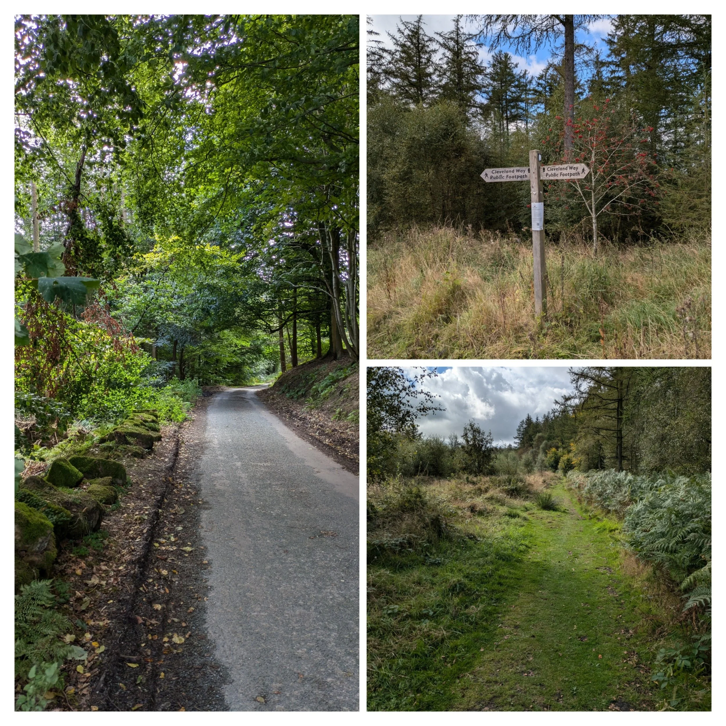
I then take a left turn at the top of the road to pick up a forest track. This track crosses Coate Moor and I only see a couple of people along here.

It starts as a narrow track and widens as it turns gravelly, then it begins to climb on a stone paved section and through a gap in a wall. Now on Easby Moor, the heather is back and ahead is the rather imposing structure that is Captain Cooks monument. The Captain Cook Monument itself was erected in 1827 and paid for by a Whitby banker named Robert Campion. The monument is 51ft high and can be seen from miles around.

Views out across the plains from the Captain Cook monument. The bottom photo zooms in on Fletchers Farm, where we are camping!

There are quite a group of people when I arrive and so Norbert and I go and look at the view from the edge. Once the group has left, I return to have a closer look.
The inscription on the stone reads: "In memory of the celebrated circumnavigator Captain James Cook F.R.S. A man of nautical knowledge inferior to none, in zeal prudence and energy, superior to most. Regardless of danger he opened an intercourse with the Friendly Isles and other parts of the Southern Hemisphere. He was born at Marton Oct. 27th 1728 and massacred at Owythee Feb. 14th 1779 to the inexpressible grief of his countrymen. While the art of navigation shall be cultivated among men, whilst the spirit of enterprise, commerce and philanthropy shall animate the sons of Britain, while it shall be deemed the honour of a Christian Nation to spread civilisation and the blessings of the Christian faith among pagan and savage tribes, so long will the name of Captain Cook stand out amongst the most celebrated and most admired benefactors of the human race".
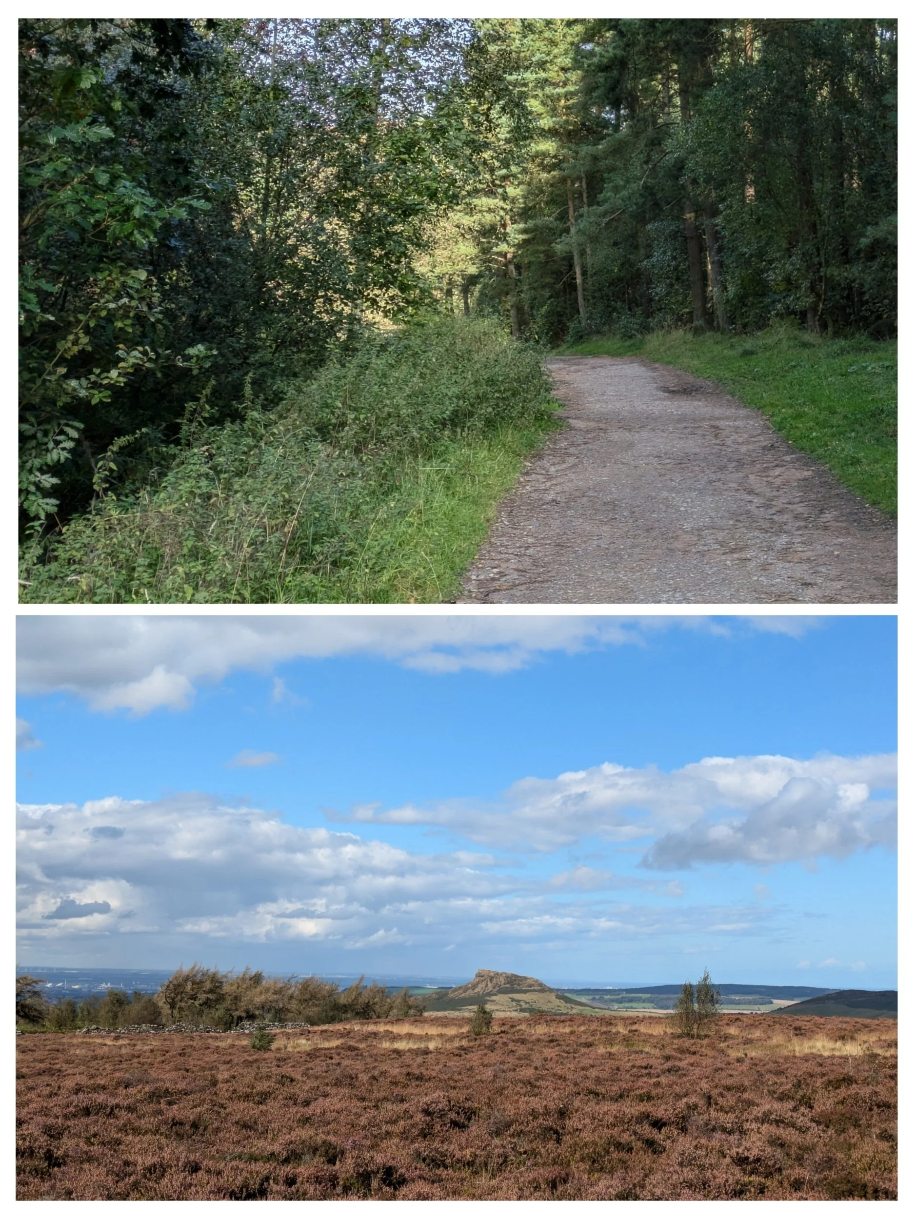
Walking away from the monument following a stone-paved path and then a track down a forested slope to the road at Gribdale Gate. Steve is parked on a little lay-by to the left sitting in the sunshine! The bottom picture is looking towards what is to come from the monument. That is Roseberry Topping in the distance!

The Cleveland Way 2024: Day Three
The Cleveland Way Nordic Walk, Wednesday 11th September 2024
Osmotherley to Clay Bank
Official mileage: 11.32 miles
Strava mileage: 12.34 miles
Elevation gain: 2,758 ft
Moving time: 4:41:29
Steps: 28,814

The route today
The guidebook describes this part of The Cleveland Way as ‘remarkably hilly, rather like a monstrous rollercoaster’ so strap in for the ride!

The day starts with blue skies and sunshine and I'm able to leave directly from the campsite today, leaving Steve to pack up and move on. It's a climb out of the campsite, but not before I get myself lost trying to locate the footpath out that I can see on the map, turns out it's the actual lane out that happens to have a footpath on it. I re-trace my steps from yesterday and pass the pinfold once more then taking a turn right along Ruebury Lane, signposted The Cleveland Way. The road climbs gently passing a few houses and comes to a fork where a footpath to The Lady Chapel is signposted. I decide to take the detour and along the footpath are stations of the cross, each with a different part of the story of Christ on them. Eventually reaching the top of the wooded hill, I come to a clearing.

The Lady Chapel is a Roman Catholic Chapel, attached to a house, said to have been built by Catherine of Aragon in 1515 for the recluse Thomas Parkinson. It is believed that a number of miracles have taken place here and the chapel remains a popular site of pilgrimage. I particularly liked the outdoor structure with big stone altar, very Aslan-esque! The chapel itself was small, simple, but pretty. Having taken the detour it was a relief to discover I didn't have to retrace my steps to re-join the path. There was a short path from the other side of the chapel to link back up with The Cleveland Way.

There are great views from the hillside and the path passes these pretty brown and white cows, too busy munching to take any notice of me saying hello.

Keeping straight on and through another gate, then the path starts to descend going through a gate into Arncliffe Wood. Here we meet the Coast to Coast Path and share paths for a while.

The path continues to undulate gently, then continues along the inside edge of woodland, hugging a beautiful dry-stone wall over the crest of a hill.

Norbert is sad that he can't get to this Trig point (299m) beause it is behind the dry-stone wall and barbed wire! Coming into view is the British Telecom station on Beacon Hill, it's argued that between the Trig point and here is the official start of The Lyke Wake Walk, which is a challenging 40-mile walk across the North Yorkshire Moors. It's considered one of the UK's oldest walking challenges and was once a popular choice in the 1970s and 1980s. No clue as to what the 6 brick plinths are for, answers on a postcard please.

Once past the BT station the path descends through a couple of gates to reach Scarth Wood Moor where heather grows in abundance. Major Herbert Peake, of Bawtry Hall in Doncaster, gifted the 220 acres or so of Scarth Wood Moor upon the National Trust back in 1935. In the distance the view takes in what is to come on following days on The Cleveland Way. Here the paths for the Coast to Coast and The Lyke Wake Walk all share the same route with The Cleveland Way path. The clear paved path rolls into the distance ahead of me, taking a turn down a much steeper slope heading down to reach a road.

A short walk down the road, crossing a cattle grid I take the next woodland path signposted to Huthwaite Green. Continuing along this path until a left-hand turn brings me to a commemorative stone to Bill Cowley.
"Bill was a former Indian Civil Servant, North Yorkshire farmer, local historian, journalist and broadcaster. In August 1955, he wrote an article, published in the Dalesman, suggesting the possibility of walking the 67km expanse of the North Yorkshire Moors National Park in less than 24 hours and The Lyke Wake Walk was born. In the fifty years that followed, it is thought over 160,000 people walked the Lyke Wake Walk - and during the peak of its popularity in the 60's and 70's as many as 15,000 walkers a year were completing the challenge. The volume of walkers however, started to have an impact on the surrounding land, and unfortunate damage started to occur to the delicate and fragile moorland ecology. Gradually over time more challenge walks became available to walkers, and the popularity of the Lyke Wake Walk lessened. Bill Cowley died in 1994, and with the agreement of the family of Bill Cowley and the majority of club members and officials, on the 1st October 2005 a final 'Golden Jubilee Wake' was held and the Lyke Wake Club was laid to rest, at the Raven Hall Hotel - fifty years to the day from where it had all started." from lykewakewalk.co.uk

Here the path walks down a flight of steps, it's steeper than it looks and I feel sorry for the mountain biker I meet at the bottom! Then follows a lovely flat, wide track perfect for a good stretch of Nordic walking.

Alongside the woodland path I spy teeny tiny mushrooms popping up and the elderflower trees are dripping with luscious dark purple berries. I also spot this hole in a tree and wonder who lives in there? It's a truly serene part of the walk.

The beautiful woodland walk pops out at the top of a grassy hill, gently descending to a track and I cross a wooden footbridge across a stream to continue up to a road, turning left to cross the river in the wooded valley of Scugdale. Here I continue up the road to come to a junction at Huthwaite Green where I am meeting Steve for lunch.

Norbert and I had a little wait for Steve to arrive and were very glad there was a bench and that it wasn't raining! A few walkers, runners and mountain bikers have passed by, I might have looked a bit weird with my shoes and socks off! After a lovely cuppa and lunch in the sun (mostly) I head off through the gate to the side of the signpost. Up another woodland path and I come across a scene of bleating sheep all following each other hurriedly the hill in the field to my left and a farmer on a quad bike hurtling down the path towards me. It's at this point I notice three sheep beyond the fence to my right, running downhill! Once past me the farmer leaps off the quad and over the fence, presumably they're not meant to be in there! So the group of sheep were rubbernecking their flock-mates on the escape!

Rubbernecking sheep on an ironstone spoil heap, woodland paths and fine views at the top.

The paths continue climbing through the heather less steeply on a stone-paved moorland path and levels out as it crosses the summit of Live Moor (312m). Amazing views across the North York Moors!

Dotted across the North York Moors are various standing stones, cairns, burial mounds, some with explanations others just guiding stones. This sign is how I know about the piles of stones actually being burial mounds!

The Cleveland Way paths continue to cross the moors undulating gently (for now) and then climbing up to Holey Moor. The weather is great for taking fantastic pictures showing off the beauty of this landscape.

I pass another Trig point at 408m on Carlton Moor, but daren't let Norbert have a photo as it is extremely windy, as you can tell from my new hairdo!
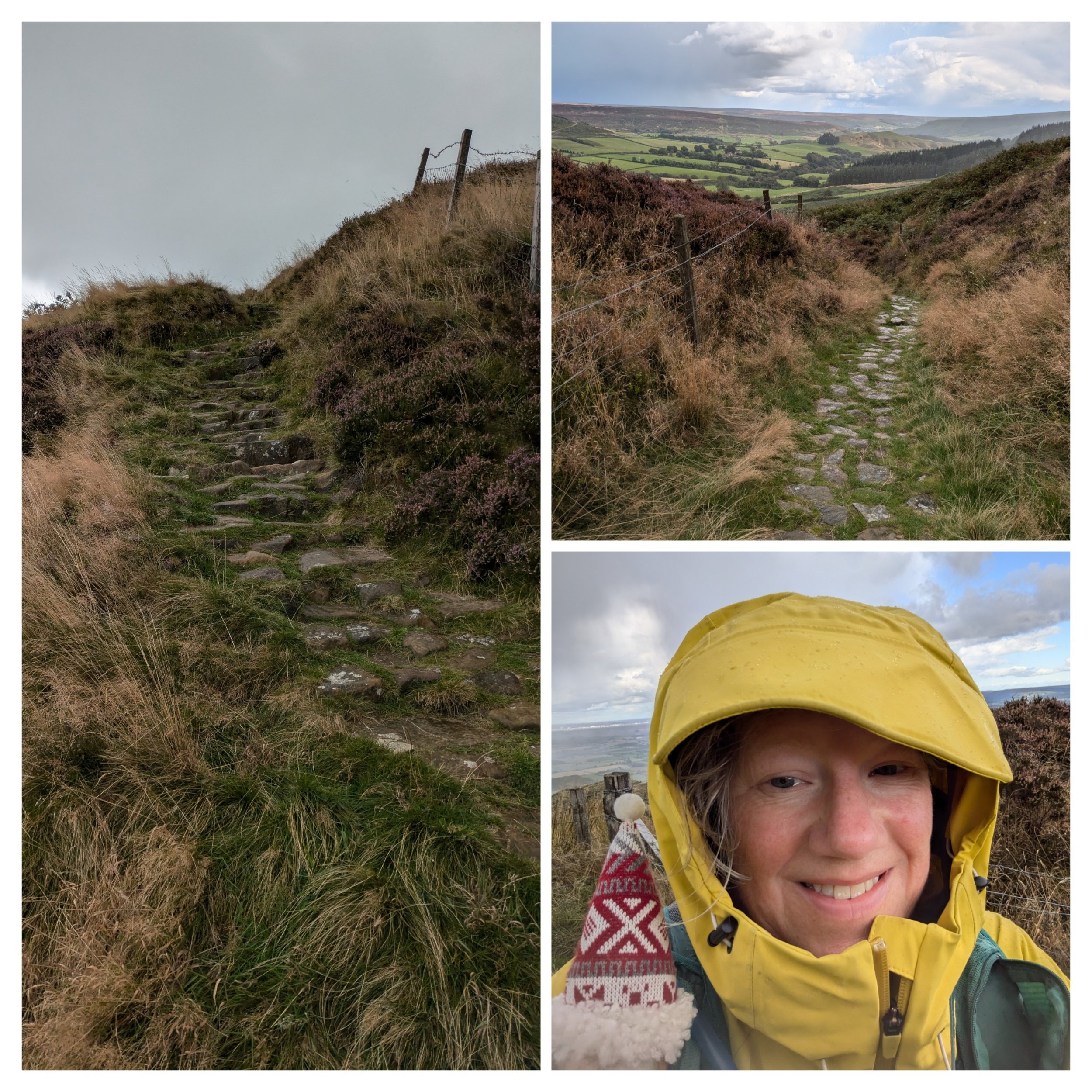
Here the path goes steeply down and the weather takes a turn for the worse and I put my phone away as I can literally see what is coming my way! What I hadn't realised was those rainclouds actually held freezing hailstones! The temperature plummets and I'm regretting the decision to leave my woolly hat and gloves in the van, thankful I have a raincoat, cap and rucksack cover, but I'm already too wet to put my waterproof trousers on!

I cross a road and pass through a small country park (which is very shut, no sign of the cafe or restaurant mentioned in the guidebook and the toilets are locked, there is also camping and glamping here apparently.) as the weather clears. The memorial stone I pass has me intrigued, I've not heard of The Samaritan Way, but apparently it's "A strenuous high-level route across the North York Moors National Park, crossing Commondale, Great Fryup Dale, Glaisdale and Farndale Moors to return via Westerdale, Baysdale and part of the Cleveland Way National Trail. This walk can be started anywhere but Guisborough is recommended." from the LDWA website.
After following a path out of the country park, I go through a gate to reach a paved path that continues alongside a drystone wall, when I get to Cringle End there is a viewpoint with a stone seat dedicated to local rambler Alec Falconer.
"Alec Falconer was a founder member in 1912 of the “Middlesbrough and District Countrywide Holidays Association and Holiday Fellowship Rambling Club” which went on to become known as the Middlesbrough Rambling Club. He was also an active campaigner for the rights of walkers under the pseudonym of “The Rambler” and was instrumental in the creation of The Cleveland Way which traverses Cringle Moor. He died a year before the trail was officially opened in 1969." Out and about website

The top image is the view from the stone seat previously mentioned. Here the path climbs higher on this fine gravelly path along the northern edge of Cringle Moor.

At least the sun has reappeared! The next section is steep and tricky to navigate with uneven stone steps, but there's brief respite in the form of a grassy path gently climbing. I go through a gate and the path begins to climb more steeply towards another summit on Cold Moor (401m) The weather closes in again, so quickly, but just rain and a freezing cold wind this time. The path drops downhill to another gate and grass.

Looking back from where I came.

I go through the gap and see rising before me yet another climb, but this one has jagged rocks at the top. These are known as the Wainstones. Long ago, or so the legend goes, a Danish chieftain met a sticky end amongst these rocky crags now known as the Wainstones, a name supposedly derived from the Old Saxon 'wanian,' meaning to lament.

It's not until you get closer that you realise you are going to have to scramble up through those jagged rocks to follow the path, literally on my hands and knees at a couple of points!

Top pic: the view back over the Wainstones Bottom pic: the relatively level stone paved path that follows it, flanked by heather.
Paved stones glinting in the post-downpour sunshine.

These paved paths are running along a moorland edge on Hasty Bank (390m), where these delightful Belted Galloway cattle are peacefully grazing.

What follows is a hideously steep descent down a narrow uneven stone path (apparently 60 steps), wet and tricky to navigate means a slow descent. They lead to the B1257 at Clay Bank where I am grateful Steve is waiting to collect me from a lay-by. I complete my usual post-walk stretches as especially today I have been up and down like a yo-yo and my quads have been like jelly on a few occasions. I reckon that was the toughest walk I have ever done. We drive to Little Ayton to find our campsite on Fletchers Farm and as we arrive there is a full double rainbow hanging over the hill ahead of us. Photo was taken through Clara's windscreen.

A beautiful sunset to end the day.

The Cleveland Way 2024: Day Two
The Cleveland Way Nordic Walk, Tuesday 10th September 2024
Sutton Bank to Osmotherley
Official mileage: 12.62 miles
Strava mileage: 13.35 miles
Elevation gain:1,143 ft
Moving time: 4:09:51
Steps: 28,150

The Route today.
Today is my 30th Wedding Anniversary and so after exchanging cards and gifts whilst enjoying a cuppa, before getting up, time is marching on. Due to the blessed A170 road being shut we have to do a longer detour to get back to Sutton Bank Visitors Centre, but eventually I begin todays leg at 10.10am. Having not really paid much attention at the end of yesterdays walk I actually have no idea where I need to go and end up going back the other side of the road to re-orientate myself! Start point found I set off for the alleged ‘Finest view in England’ as claimed by James Herriot, local author.

It's an overcast day and when the wind blows it's cold! I'll admit it is a pretty good view, shame about the sun not shining! I pass a group of three American walkers here.

The path wanders through patches of sparse woodland (Garbutt Wood) and only occasionally do you get to see a view over the 300m high cliff. Here you can see Gormire Lake, this is at the foot of Whitestone Cliff surrounded by woodland. Beyond is a beautiful patchwork of farmland, woods and hills.

It's a bit drizzly, but only light, the cap is more for the wind! The rowan trees are full of bright red berries along here. I'm following the narrow path along the cliff edge which starts to descend slowly towards Boltby Scar and the landscape surrounding me changes more to grasses, Bilberry bushes and single trees. This was the site of an Iron Age Hill Fort.

It’s a bit blowy up here!
I didn’t dare let Norbert sit on anything for a photo today!
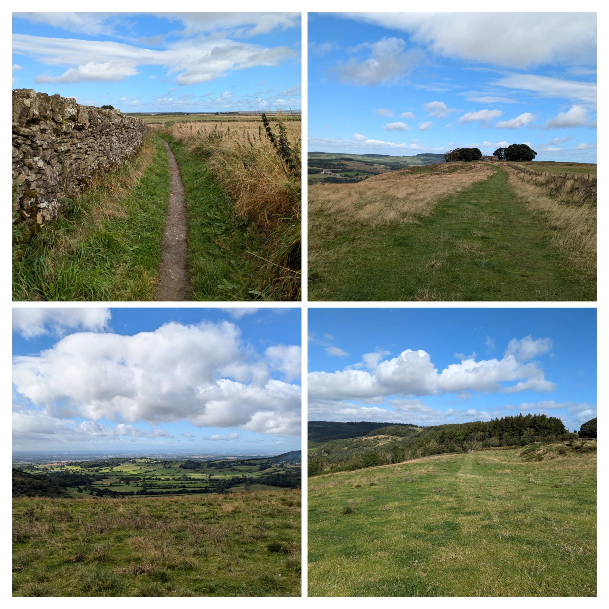
The drystone wall adds a bit of protection from the gusty wind, but soon I'm thrown back out into the wind on an exposed hillside, passing the now derelict High Barn which sat in between two small areas of woodland. It had great views! Continuing across more exposed grassy hillside, I reach a gate and cross a road (nearly got run over, as it's on a blind bend!) This is Sneck Yate Bank.

The path now takes a lovely wander through some native woodland before emerging onto a minor road.

Following the road up to the right it leads up through High Paradise Farm, this is a well-known spot to walkers with its accommodation, campsite and café (sadly not open today). Imagine if you are a through-walker who is carrying a tent, it would be lovely to have a picnic bench, your own fire-pit and some protection from the weather on your pitch. It looks like there are other communal facilities for guests too. I loved the mossy wall!

After High Paradise Farm the path turns left onto the Hambleton Drove Road - an ancient upland thoroughfare with a long history. Here there is not only the Cleveland Way Path (narrow in places), but also a parallel cycle path called the Paradise Trail. From this path you can also access Boltby Forest

After the forest-y section the path changes to run through more open moorland (Little Moor) with more stretches of heather and a drystone wall to give a bit more protection from the buffeting wind! It's along this stretch that I see Clara (campervan) in the distance, which means it's lunchtime! Steve has found his way up through some gates! The kettle is on and I get some relief from the wind by sitting down in the sun by the drystone wall to eat my lunch.

Our official 30th Wedding Anniversary selfie!

Five miles to Osmotherley! Over halfway on todays walk. Gorgeous scenery stretching away in front of me, with clearly marked paths (love the little reassuring acorns along the route)

Views, views, views! Apparently on a good clear day you can see across to the distant Pennines.

It turns out that this pile of rocks is more than likely the site of an old burial mound as I discover from my guidebook on a later section.

Sheep are an ever present feature, along with the heather. Getting closer to todays destination. I think this is Thimbleby Moor, just before Square Corner.

The path turns left after Square Corner and goes through bracken, it also becomes a narrow stone-paved path, which is tricky to navigate with poles especially as it descends, I'm so glad the weather is dry. Reaching a wooded dale I cross over a small stream on a footbridge. This leads past a reservoir (no swimming, again) and uphill past a house called Oak Dale where there are many game birds and feeding stations dotted around. Crossing another bridge the path continues uphill through woodland.

Once out of the woods, I turn left down a minor road (past some houses with interesting brick built walls (wish I had taken a photo) and the path turns right up a track. Then I have to literally squeeze me and my rucksack through a fairly tall squeeze stile leading down towards Whitehouse Farm and then down towards another footbridge. After the stream there is a wooded slope to be climbed with the aid of many, many steps (I didn't count)

The many steps lead to a beautifully paved path between fences before squeezing myself through another stile. Following the path between houses and a narrow alleyway and I find myself in the village of Osmotherley!

We are camping in a campsite on the edge of the village and so I still have to walk to there, past the market cross and up past the Village Store. I also pass this sign about a pinfold (never heard of it) It's apparently a square enclosure with a single narrow entrance which is a relic of medieval village administration, it was designed to hold stray animals until their owners paid a fine for their release. The one in Osmotherley is by all accounts a fine example, well preserved and Grade II listed!
I loved this memorial bench, which I passed on the way to the campsite.
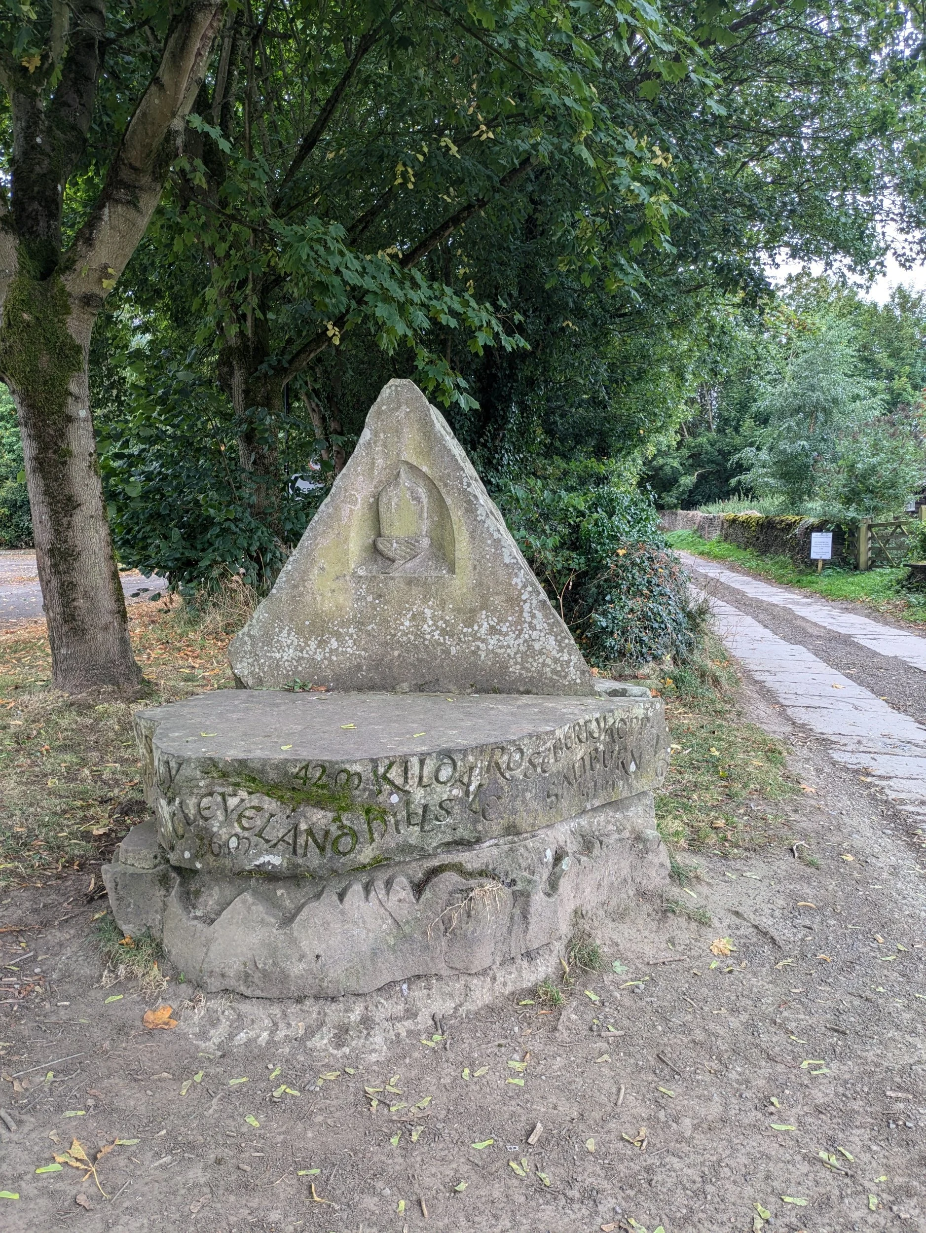
The Cleveland Way 2024: Day One
The Cleveland Way 2024 Day 1
The Cleveland Way Nordic Walk, Monday 9th September 2024
Helmsley to Sutton Bank
Official mileage: 10.5 miles
Strava mileage: 12.58 miles
Elevation gain:1,363 ft
Moving time: 4:02:24
Steps: 26,444

The route today.

I am Nordic walking The Cleveland Way over 10 days whilst on annual leave, I’m fortunate that we have a T5 campervan called Clara who will be home for the duration, also an amazing husband (Steve) who is happy to drop me off each day, meet me for lunch and pick me up. We spent Sunday driving up to North Yorkshire and our first three nights are at Cote Ghyll on the campsite. When we arrived at the campsite last night after having driven over 200 miles, Steve noticed the rear offside tyre was looking pretty flat, in fact it was registering only 9 PSI instead of at least 32. We carry an electric tyre pump and so Steve inflated it to the correct pressure and we drove onto our pitch to set-up camp and ponder what on earth was going on with the tyre. I was keen to get started in the morning and was not relishing the thought of being delayed trying to get the tyre fixed, public transport was out of the question, with no direct service from nearby to Helmsley, however with a quick shout-out on a couple of Cleveland Way Facebook Groups we discovered that Northallerton (20 mins away) had at least 3 tyre places and we opted to be at one of them on opening. In the morning the tyre seemed to be holding only slightly losing pressure overnight and we rocked up at Northallerton Tyre & Battery 15 minutes after opening and Clara was to be next on the ramp. After a thorough check the tyre was declared to be puncture free and neither us nor the mechanic could work out what the problem was, he discovered our tyre pressures were all over the place so set them all to 45 PSI and we were on our way at last!

Tyre issues and a misty, murky morning.

Setting off for Helmsley we started to travel down the A170 and kept coming across ‘Road Closed’ signs with ‘follow diversion’ signs, however the diversion never seemed to appear, until we got to the actual road closure and the guy in the blue van in front of us leapt out of his van and came to chat to us about the non-existent diversion! Taking a small road deemed ‘local traffic only’ with grass growing up the middle we made our own diversion, with the blue van following us (he wasn’t local either) We eventually got to Helmsley only 30 minutes after our initial start time plan, so not too much time lost. Helmsley is a market town in North Yorkshire and looks a bit Cotswoldy! The start of The Cleveland Way is from the Market Cross in the Market Place and I started Strava at 10.38am.

Norbert is with me for this adventure! The stone sculpture is for The Cleveland Way.
Leaving the Market Place I headed out of the town, past All Saints Church, which has a lovely Lych-gate and continue along the road looking out for a sign for the ‘Footpath to Rievaulx’. I then head down Cleveland Way (apt) and see a stone sculpture by the Cleveland Way Car Park -this is carved with the names of some of the highlights of the route (which currently mean nothing to me!) and an acorn – the symbol of all the National Trails. I now follow the Cleveland Way sign post up a clear track. The stony track heads gently uphill and goes alongside fields of crops, through kissing gates and runs parallel to a wood, then we turn into the woodland and head down some stone steps leading through a wooded valley before climbing back up yet more stone steps to reach the track which is clearly signposted. The track passes Griff Lodge before heading into more woodland down a clear track. Once at the bottom of the track I pause for my flask of tea and a snack whilst gazing out across the view over the fields. I then continue left onto a path that follows a sunken road which leads to the junction where I can turn off to visit Rievaulx Abbey.

Good paths so far

hmmm...not so sure about those stone steps up and down!

Very clear signage leads the way easily

There’s a pretty bridge across the river here and a small path leads off the road and runs alongside the river which I follow for a bit, the river is fairly shallow, but moving swiftly none-the-less. I pass the sign for Rievaulx village and spy the Abbey in the distance. I meet Steve in the car park and although I hadn’t really intended on visiting the Abbey ruins, Steve decides to join us up for an English Heritage membership, so I might as well use the opportunity!

Approach to Rievaulx

Rievaulx Abbey

Rievaulx Abbey is probably one of the most intact Abbey ruins I have visited and gives a really good idea of what it would have looked like before the reformation. It is huge! It has some spectacular architectural features too. It was the first Cistercian abbey to be established in the North of England and was founded in 1132. Under its most famous abbot, Aelred in the 1160’s it housed a 650-strong community. It was one of the most powerful and spiritually renowned centres of monasticism in Britain.

After a wander and some photographs I leave Steve to his more in-depth visit and re-trace my steps back to the junction at the bridge this time turning right in the direction of Scawton. It begins to spit with rain and by the time I reach the next road junction it’s properly raining. Another couple of walkers ahead of me have stopped to don their waterproofs and so I follow their lead and add the raincover to my rucksack at the same time. I continue to follow the road gently uphill until a gravel track on the right can be seen and turn off onto it.

leaving Rievaulx. The Saint Aelred's Pilgrimage is launched on Saturday 14th September and its 41 mile route visits 9 churches along the way.
Walking alongside woodland the track also passes some private fishing ponds (boo, definitely no swimming) and then turns right across a stream on some stepping stones, where a couple of walkers are picnicking. This turns out onto a gravel road and then left at a junction with another gravel road where several farm/country trucks have driven past in front of me. I then pass an isolated lodge/cabin where some kind of event is happening. I deduce the guys in tweed getting out of the aforementioned trucks are on ‘a shoot’ (not photography) and look like they are about to get a good lunch! I have to negotiate my way through several of their parked trucks to find my next turning right up a very rugged, stony path.

Hunting lodge in the distance, rugged stony uphill path!

This eventually comes out onto a much nicer gently sloping field through sheep and plenty of fodder for the shoot. Not sure exactly what game birds they are, possibly partridge as well as pheasant. Anyway they run ahead of me like headless chooks whilst the sheep calmly ignore my presence. After the fields this turns into another gravely track where I come upon some guys in UTV type vehicles who quite possibly are waiting for the ‘shoot’ to begin -no hearty lunch for them! The track goes uphill and passes farm buildings before popping out in the village of Cold Kirby (is there a Warm or Hot Kirby?) Steve is here already making me a brew and some lunch in Clara. We eat lunch together on a bench at the other end of the village green? The sun is intermittent and it’s a bit chilly when it goes behind a cloud.

Cold Kirby

Feet rested and lunch eaten, I make my way through the village (doesn’t take long) and head of left down a track through fields full of sheep with some great views across them too. Eventually after following the clearly marked signposts I end up alongside a forest and then I reach a farm access road near Hambleton House and pass gallops where they train racehorses. Records dating back to the 17th Century show that many good horses were trained out of Hambleton House! Following the farm road down to the eerily quiet A170 (road is closed) I turn right passing the now closed and run-down Hambleton Inn. Crossing the road at the junction for the Yorkshire Gliding Club I take the path off to the right through woodland.

Paths are a little bit muddy in places here

This eventually comes out on a new looking gravelly path on a junction where you can choose to take a detour and turn left and visit the Kilburn White Horse or go right to head straight to the visitor centre at Sutton Bank. I choose to turn left and head along the path that runs between the Yorkshire Gliding Club airfield and the cliffs of Roulston Scar. When I eventually reach the Kilburn White Horse Steve is sat on a bench waiting for me with a nice cold can of Coke Zero! The views from here are amazing and it’s a clear day too. Steve recalls we have been here before and looking down past the White Horse it does look familiar!

The Kilburn White Horse was inspired by our very own Wiltshire white horses, only these cliffs aren’t naturally chalky and so the Kilburn White Horse has to be given occasional coats of whitewash to cover the more natural oolitic limestone found here. It was cut in 1857 and measures 96m by 69m. Perhaps we came during our Clara and the Cathedrals trip in 2020? Norbert gets his first shot at fame on this walk as a passer-by calls him cute!

Norbert agrees the views are awesome from up here!


I leave Steve and double back past the junction and pass a couple of memorial stones – one to The Battle of Byland and one to aircrew of all allied nations who lost their lives in the surrounding countryside. I then cross the A170 to reach the Sutton Bank Visitor Centre (which has already closed) Steve is waiting for me in the car park and we then drive the 40 minutes diversion (thanks A170 closure) back to the campsite at Osmotherly.