
The Cleveland Way 2024, Day Four
The Cleveland Way Nordic Walk, Thursday 12th September 2024
Planned route: Clay Bank to Kildale, but actually finished at Gribdale Gate
Official mileage: 12.03 miles
Strava mileage: 12.41 miles
Elevation gain: 1,448 ft
Moving time: 3:48:10
Steps: 26,196

This was my planned route for today, but ended up pushing on past Captain Cooks Monument to Gribdale Gate.

Roughly 3 extra miles to Gribdale Gate.
The guide book says this is the most remote part of the Cleveland Way, travelling through the highest part of the North York Moors, with no access to any facilities, so it feels like it could be a lonely day. It recommends finishing at Kildale for a 9.5 mile walk.

Leaving Steve at the bottom by the B1257, my walk today starts with a steep climb alongside a wall on yet more stone slabs (my favourite, not) I pass a lady and a dog and then go through a gate where the path turns to grass and becomes gentler in nature. I am rewarded for my efforts by a stunning field full of Belted Galloway cattle (my second favourite cattle), they stand out so much against this terrain. This crest is named Carr Ridge and stands some 380m tall. There are great views of where I have already walked and the patchwork of fields at the foot is looking colourful in the sunshine.

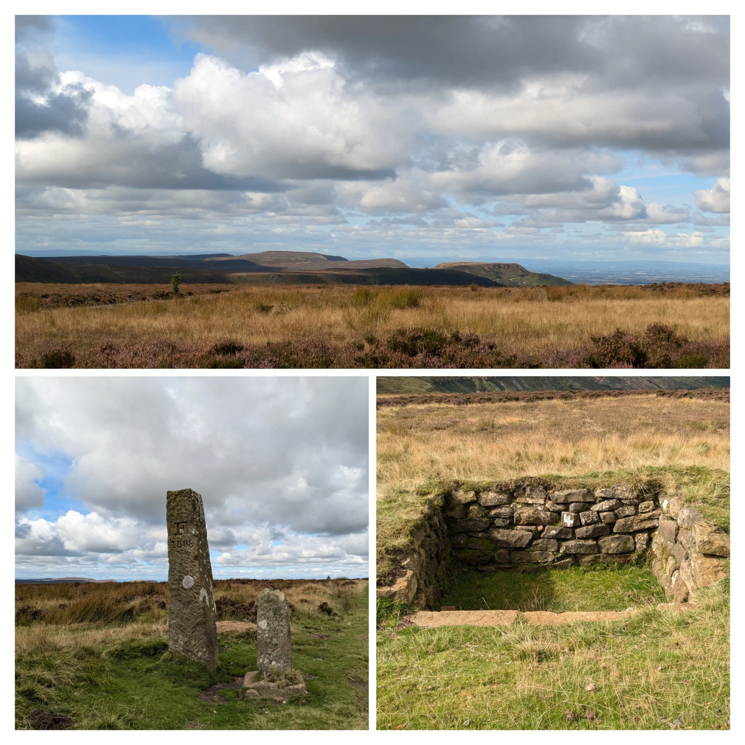
Although this is a remote and exposed section of the Cleveland Way, it has become gentler, even softer than the previous section. Most of the paths are now gravelly and are flanked by heather, grass and sometimes bilberry bushes. There are standing stones (moorland marker stones, 18th century) whose purpose it is to guide the walker during bad weather and there are also plenty of acorns and signposts to keep me on track.

Norbert gets to bag a trig, but a couple and their dog, Pippa are having a coffee at what we believe is the highest point on the Cleveland Way (454m) and on the North York Moors. This trig point sits atop a burial mound on Round Hill and the chap (I forget his name, even though we kept crossing paths for the next few days on the way) offered to take a photo of us both. I'm not sure what some people make of me carrying around Norbert, but hey, who cares!

The paths continue to be great for Nordic Walking and I'm enjoying a speedier pace today. I passed this moorland pond covered in waterlilies.

The route runs down a moorland slope and after a short climb then picks up the old trackbed of the Roseldale Railway. This railway operated between 1861 and 1929 transporting iron ore from Rosedale to County Durham to be smelted. At Bloworth Crossing the path takes a sharp turn left and gently climbs again on a broad, but stony path. There are fantastic views across these moors! I pass a couple of groups of walkers going in the other direction who are keen to know my destination for the day.
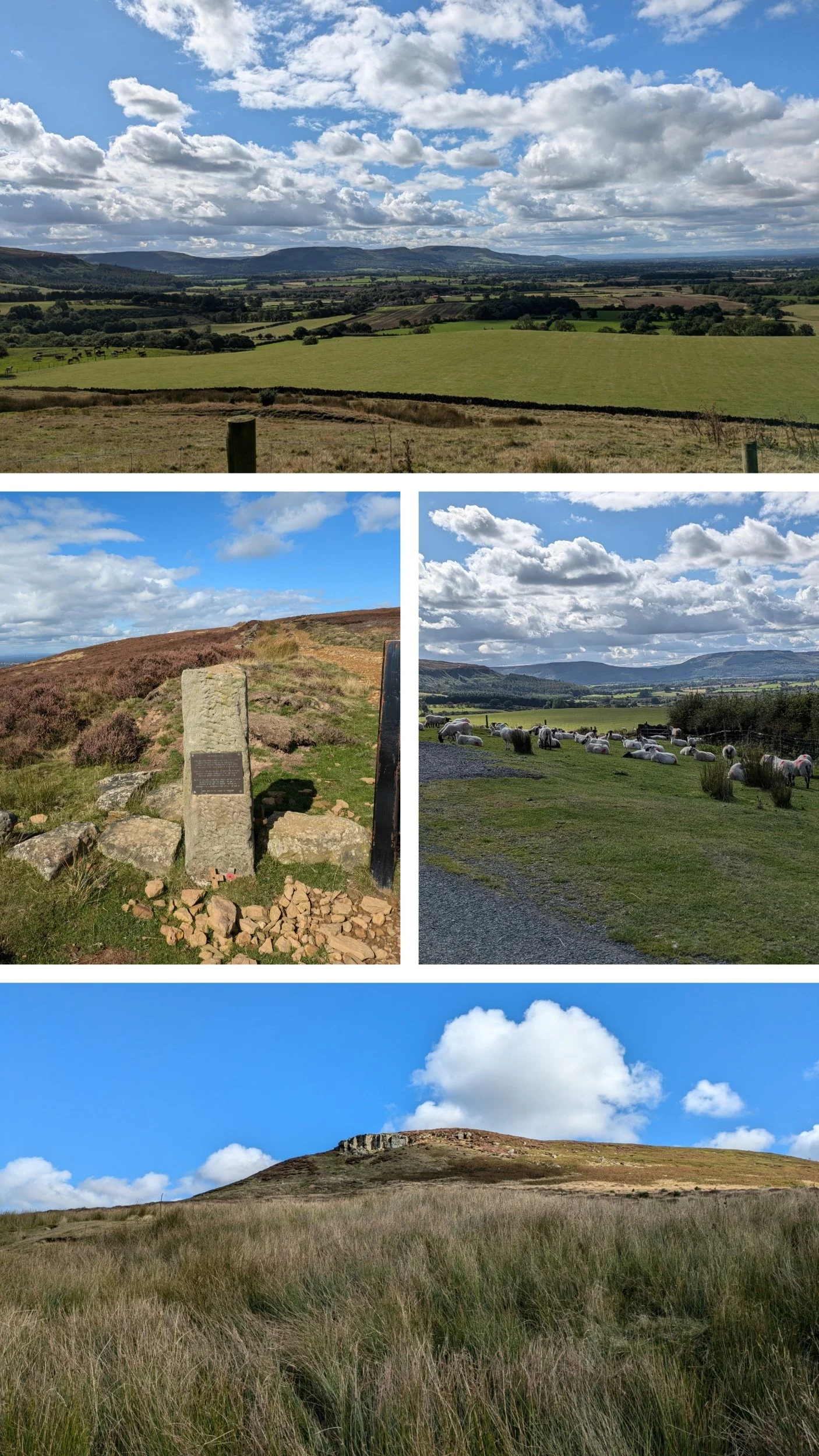
Top picture is looking back to the peaks of yesterdays walk. The path passes these two standing stones, the taller one is dated 1888 and is a boundary stone between moorland estates, but the shorter one is considerably older and is known as Jenny Bradley's Cross, not the name of a person, but derived from 'Broad Ley' or a broad trackway. I saw a lot of these wierd stone edged pits and later learnt they are Grouse Butts. Grouse are ‘driven’, where birds are flushed by a line of beaters and fly over the people shooting (the ‘Guns’), who are stationary in a line. On grouse moors they typically stand in a line of ‘butts’ – specially constructed shooting positions often built out of wood, stone and turf.
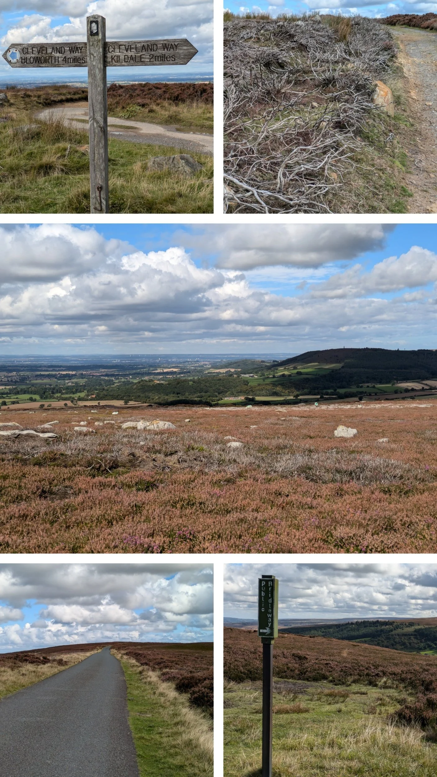
When I see the sign for Kildale and it is 2 miles away, it's only 12.20pm, which means I have covered 7.5 miles in the last 2.5 hours, but Steve is not expecting me at Kildale until at least 3pm...I decide to let him know I may be earlier than expected!
I keep seeing patches of burnt heather and I know burning is one of the methods used to control it. Globally, heather moorland is rare. It is virtually confined to Britain and Ireland, where in the main it is maintained through cutting, grazing and/or managed burning. I've crossed Ingleby Moor and Battersby Moor (love the names of moors!) and I come to a gate on the bend of a minor road, so minor it is just a dotted line track on the map!

The tarmacked road stretches out to what seems like infinity and my instructions are to follow the road straight ahead crossing a rise on Kildale Moor. The wind has been blowing an absolute hoolie today, it's so tiring! The road goes over a cattle-grid between a dry-stone wall and I decide to stop here as I will get some shelter from the wind. On the opposite side of the road are these, what I presume, bee hives and I note after a bit of research that there is a honey called Kildale Heather Honey! Whilst eating my lunch and watching grouse pop up in the heather I do rather regret taking a seat opposite beehives... didn't get stung, but I was bothered by several bees taking an interest in my leggings! While I was eating lunch I had another look at the map and decide as the weather is set fair and I'm not feeling ready to stop just yet, I will push on past the Captain Cook memorial and let Steve know where to meet me, it's about another 3 miles according to the map.
The road gently undulates, with a steady downwards trajectory, passing this stone memorial to a crashed aircraft. Round the slopes of Park Nab (bottom pic) A small edge of hard, quick-drying sandstone with face climbing on small edges. There are sheep ont' road here! The road reaches a junction and I turn right to go through the village of Kildale. The top pic is looking back at those climbs form yesterday again.

Kildale is a small, pretty little village where John Wesley (one of the founders of Methodism) is said to have preached (there is a stone commemorating it) I take a turn off to the left signposted The Cleveland Way and that leads under the railway and across a river, the road bends round then climbs quite steeply up past Bankside Farm.
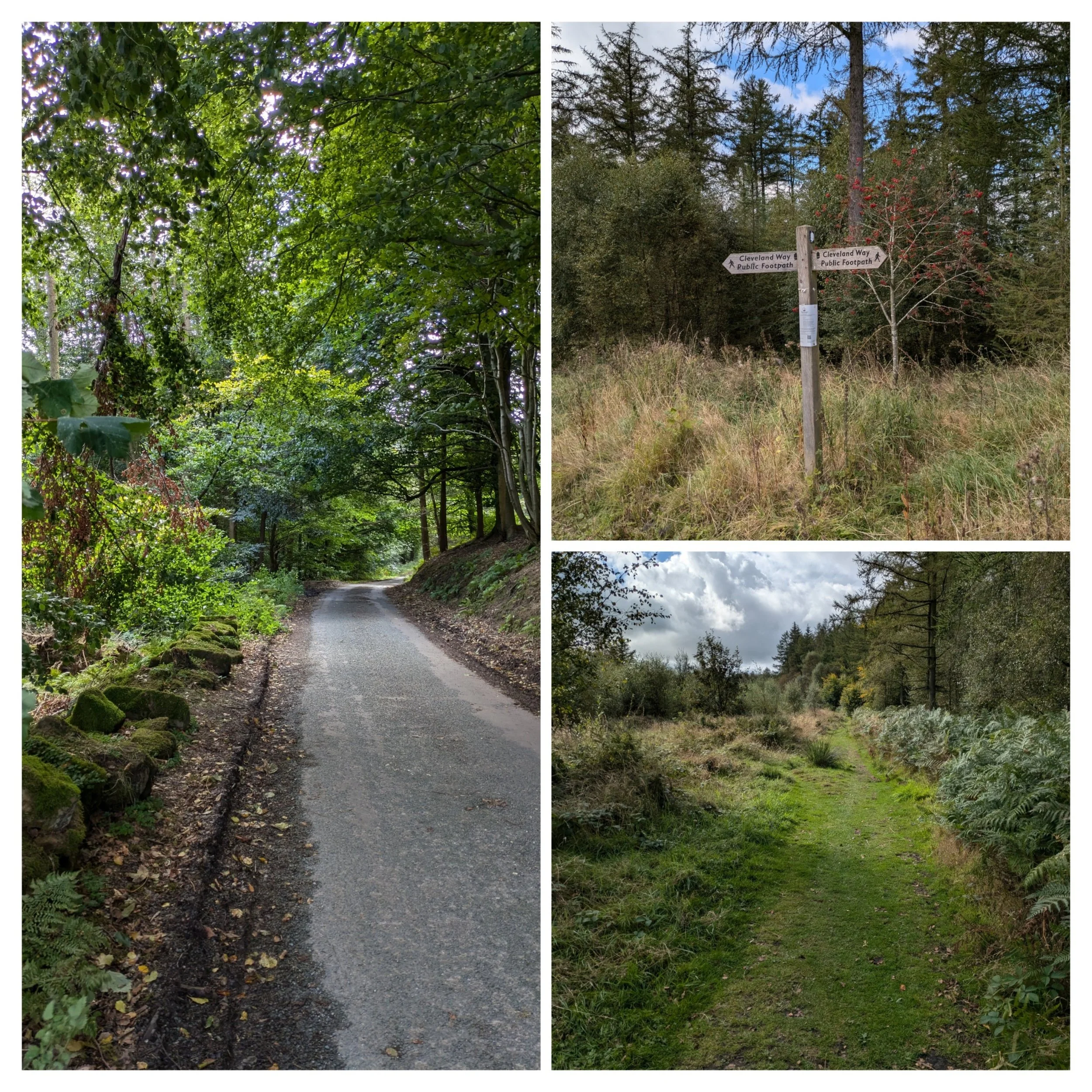
I then take a left turn at the top of the road to pick up a forest track. This track crosses Coate Moor and I only see a couple of people along here.

It starts as a narrow track and widens as it turns gravelly, then it begins to climb on a stone paved section and through a gap in a wall. Now on Easby Moor, the heather is back and ahead is the rather imposing structure that is Captain Cooks monument. The Captain Cook Monument itself was erected in 1827 and paid for by a Whitby banker named Robert Campion. The monument is 51ft high and can be seen from miles around.

Views out across the plains from the Captain Cook monument. The bottom photo zooms in on Fletchers Farm, where we are camping!

There are quite a group of people when I arrive and so Norbert and I go and look at the view from the edge. Once the group has left, I return to have a closer look.
The inscription on the stone reads: "In memory of the celebrated circumnavigator Captain James Cook F.R.S. A man of nautical knowledge inferior to none, in zeal prudence and energy, superior to most. Regardless of danger he opened an intercourse with the Friendly Isles and other parts of the Southern Hemisphere. He was born at Marton Oct. 27th 1728 and massacred at Owythee Feb. 14th 1779 to the inexpressible grief of his countrymen. While the art of navigation shall be cultivated among men, whilst the spirit of enterprise, commerce and philanthropy shall animate the sons of Britain, while it shall be deemed the honour of a Christian Nation to spread civilisation and the blessings of the Christian faith among pagan and savage tribes, so long will the name of Captain Cook stand out amongst the most celebrated and most admired benefactors of the human race".
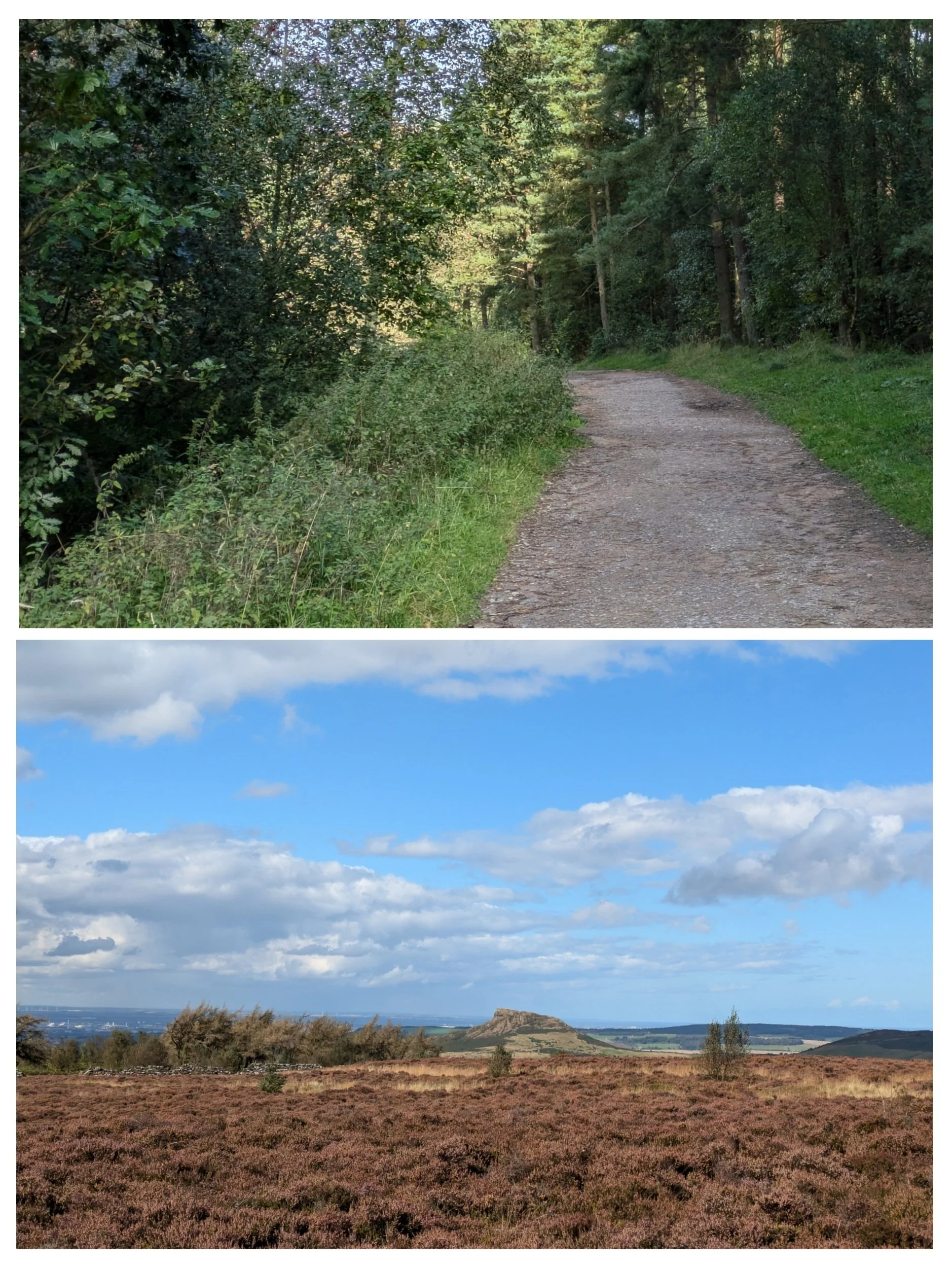
Walking away from the monument following a stone-paved path and then a track down a forested slope to the road at Gribdale Gate. Steve is parked on a little lay-by to the left sitting in the sunshine! The bottom picture is looking towards what is to come from the monument. That is Roseberry Topping in the distance!