
The Cotswold Way: Leg 10
King’s Stanley to Cam Peak: 7.31 miles
Sunday 23rd June, 10am
Moving Time: 2:55:02
Elevation gain: 1,397 ft
Steps: 17,942

Our route today
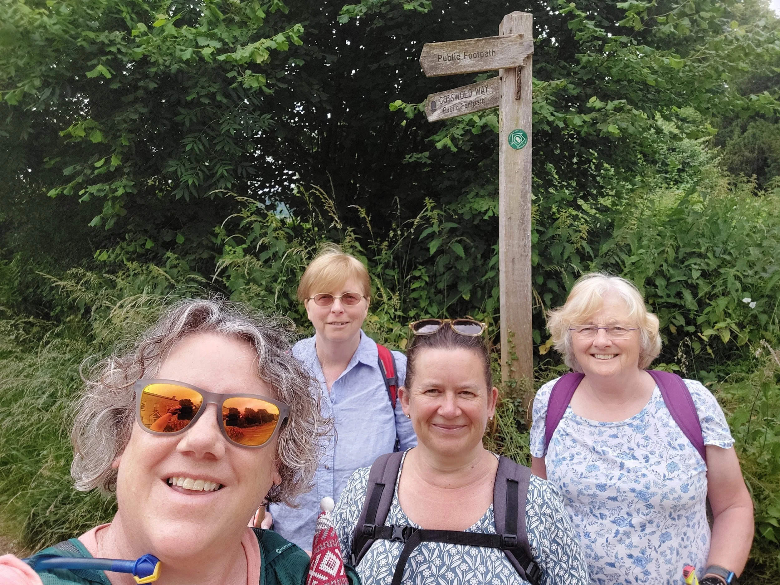
Our walk today starts back at King’s Stanley, but first we meet at the finish point – a useful free car park at Cam Peak. A select group this leg we fit into one car to make the journey to the start point. A windy fifteen minutes later and we arrive at Selwyn Close just off the Ryeford Road. Gathering our rucksacks and our poles we set off just after 10.20am. Crossing the road we pause by the Cotswold Way signpost for the obligatory start selfie.
We soon pass a post with a Cotswold Way marker and a plaque commemorating the 50th Anniversary of Stroud Rambling Club- which is now over 70 years old! This gate leads us to a grassy slightly uphill section with some lovely wildflowers strewn within the long grass either side of us.

It’s going to be a good year for blackberries, the bramble bushes are highly adorned with blooms and burgeoning fruit and promises of deliciousness come Autumn!

After the initial hill we are walking on field edges and paths that are beautifully solid with gentle undulations and views of the surrounding hills until we reach Middleyard.

We briefly walk through the centre of Middleyard and then the path once more winds it’s way uphill snaking through the backs of houses and then up more steeply through fields until we reach Penn Wood. Here you have the choice of going back North on the Cotswold Way via Selsey Common or to continue South towards Coaley Peak – we chose South!


Penn Wood is an ancient semi-natural woodland dominated by a beautiful Beech canopy which instantly brings the temperature down a few degrees upon entering – which is very welcome on this warm June Sunday. The woodland paths undulate steeply in places as we navigate through the edge of this magnificent wood following the Cotswold Scarp. We exit briefly from the wood into a field by Woodside Farm, we are greeted by the bleating of a field full of sheep accompanied by some cattle with suitably impressive horns!
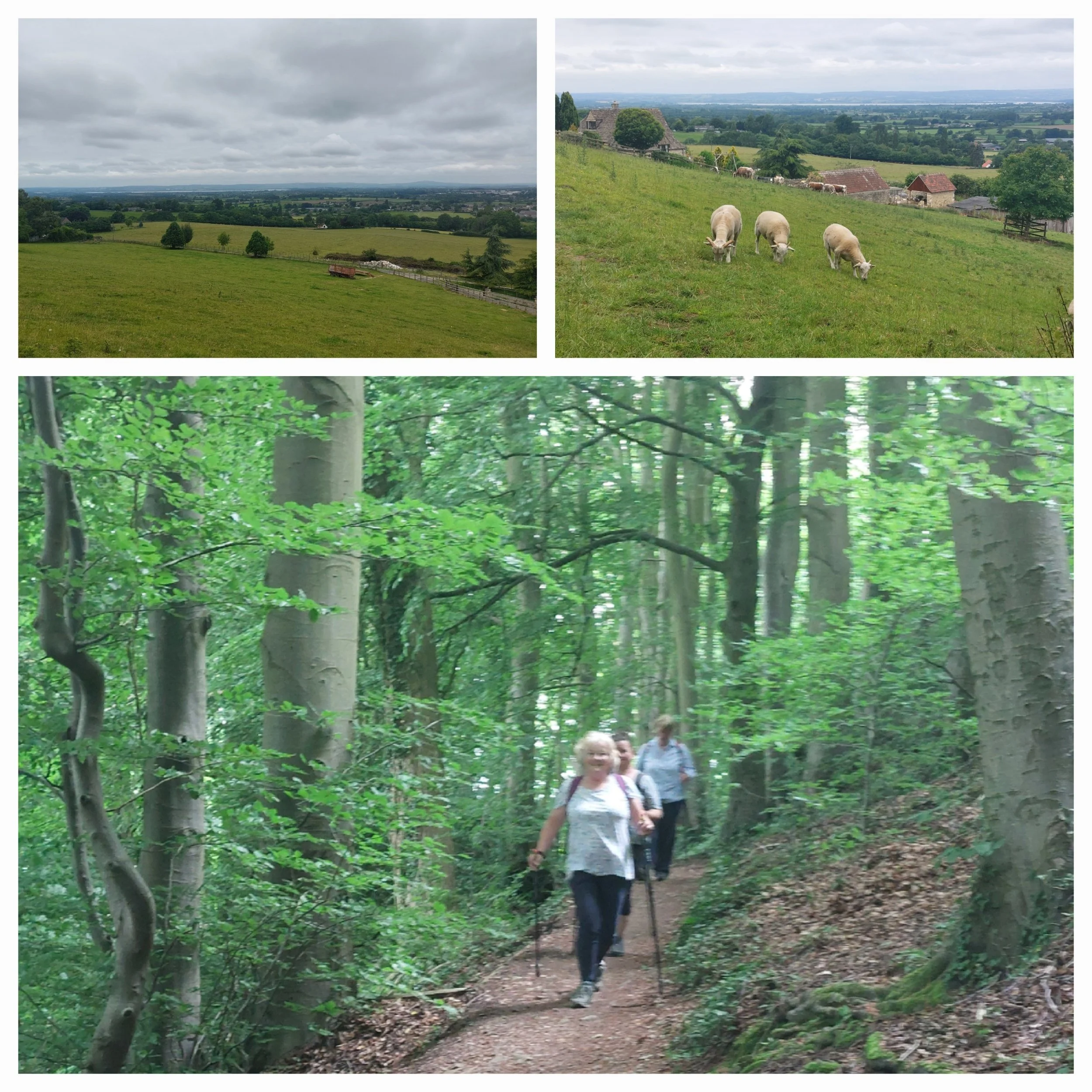
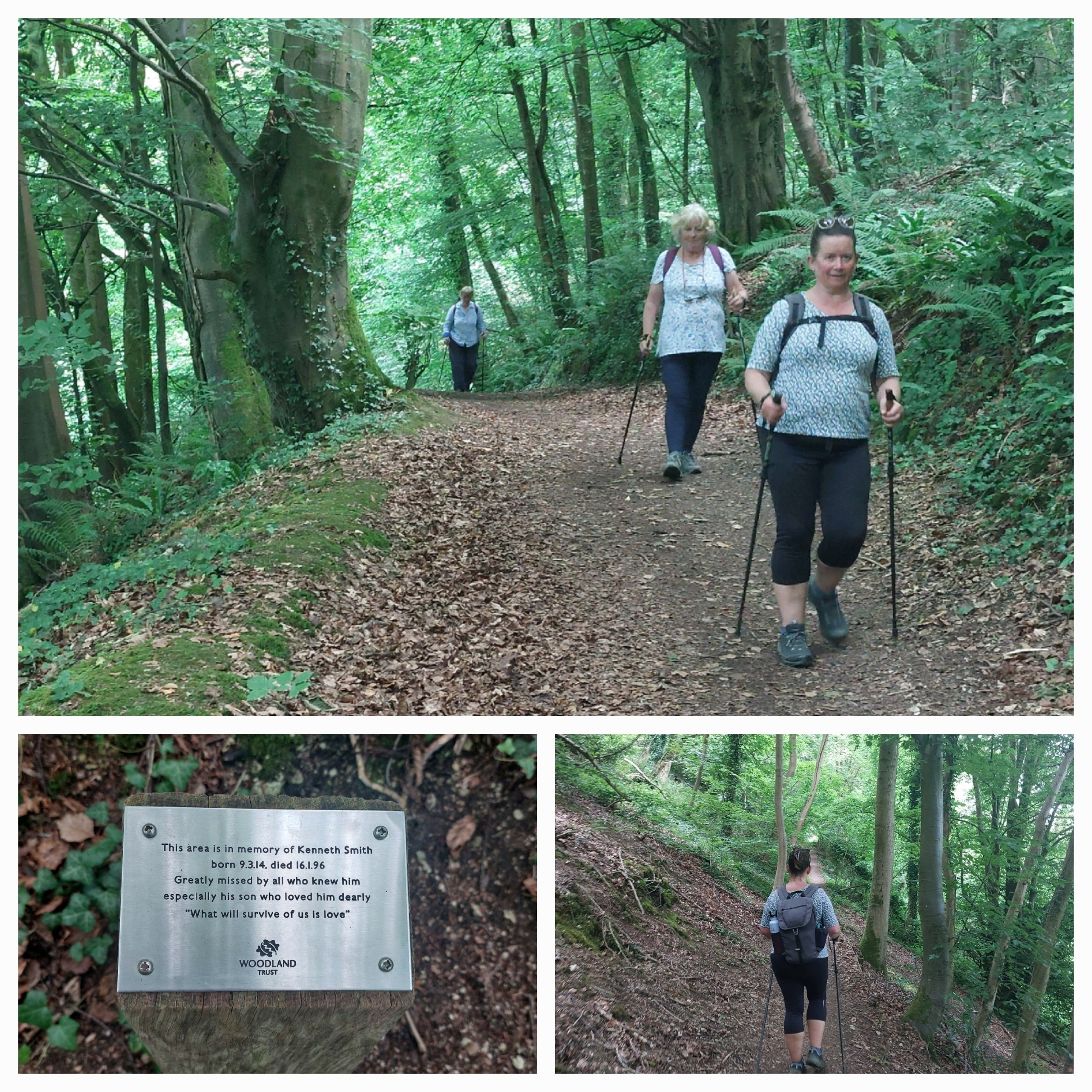
We’re now walking alongside Stanley Wood with some stunning views out across the hillside, we pass a couple of dog walkers and then head back into the cover of the trees. Here there’s a gateway with a familiar pink and yellow triangle way marker tie-wrapped to it. Yesterday hundreds of runners, joggers and walkers will have passed along this route completing the 100km Ultra Challenge Cotswold Way Challenge from Cirencester to Painswick round along these very paths to Wootton-Under-Edge and then returning to Cirencester over the weekend. The clean-up team must have missed this one! Tash completed this challenge in 2021 but doesn’t remember much of the route!

The Woodland is cared for by the Woodland Trust and part of this area is dedicated to the memory of Norris Thompson. We pause along here on a handy fallen tree to have a drink and a snack to keep us hydrated and boost our energy levels. Sitting astride a fallen tree lying down a hillside is not the most comfortable of positions!

Before long the quietness of Stanley Wood turns into another peaceful stretch as we continue through Buckholt Wood and then we climb up some wooden edged steps which opens out onto a stunning wildflower meadow.

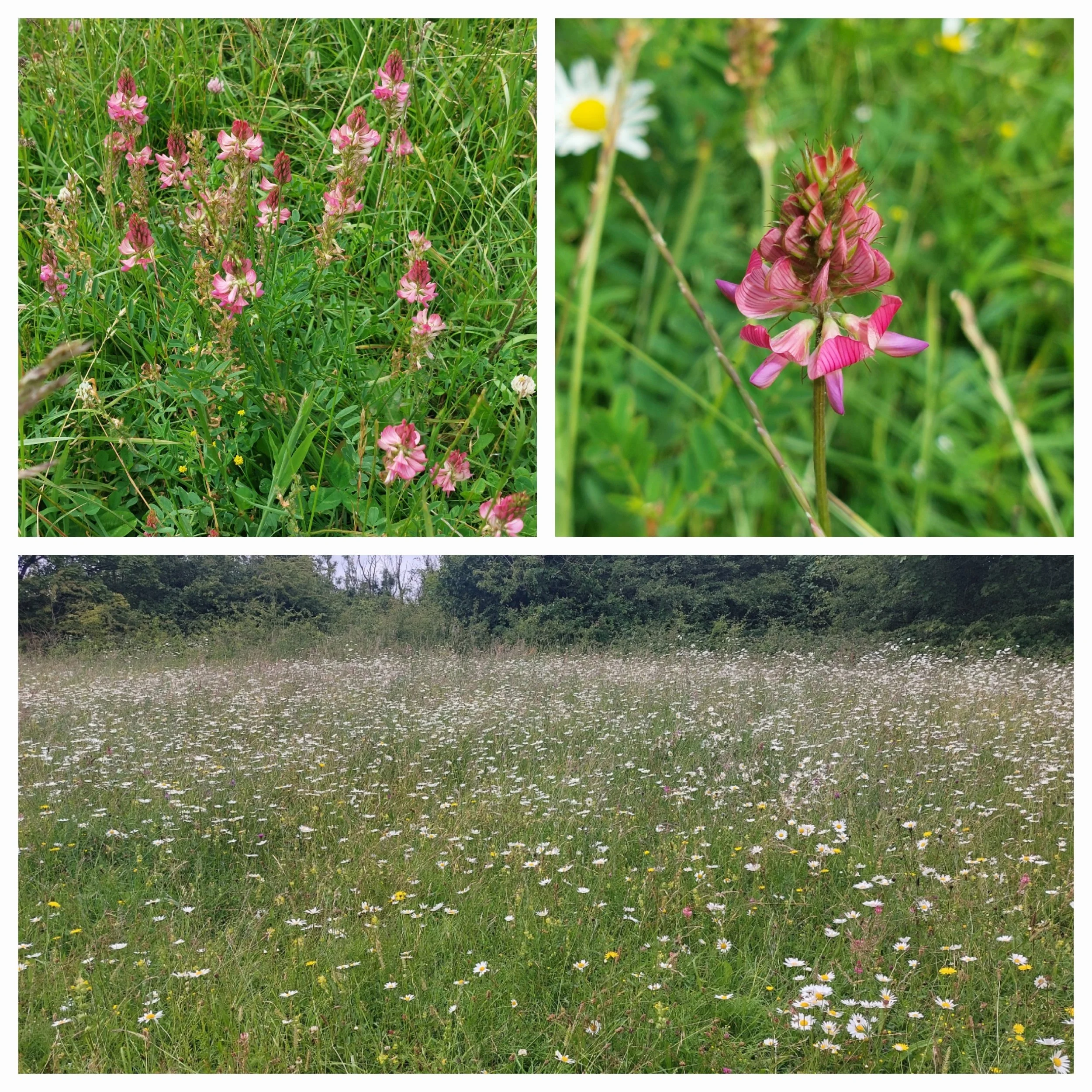
Tash is on the hunt to spot a Bee Orchid this year, but no such luck here although we did spot plenty of Pyramidal Orchids, Ox-Eye Daisies, Buttercups, Yellow Rattle, Birds Trefoil, Dandelions and a new one to all of us – Sainfoin.
This is a beautiful spot just before you get to the main area at Coaley Peak and contains within it Nympsfield Long Barrow, a neolithic burial mound thought to have been constructed in 3800 BC. It was used for around two centuries and the scattered remains of about twenty folk have been found within during excavations. We decide to make use of the empty picnic bench and stop for an earlyish lunch!

After consuming our lunch and a closer look at the Long Barrow we continue on to Coaly Peak (cared for by the National Trust) itself and stop to admire the plentiful views we are afforded from the edge of the Cotswold escarpment across to the muddy brown looking River Severn and beyond. We can see the Tyndale Monument in the distance (that’s in the next leg!)
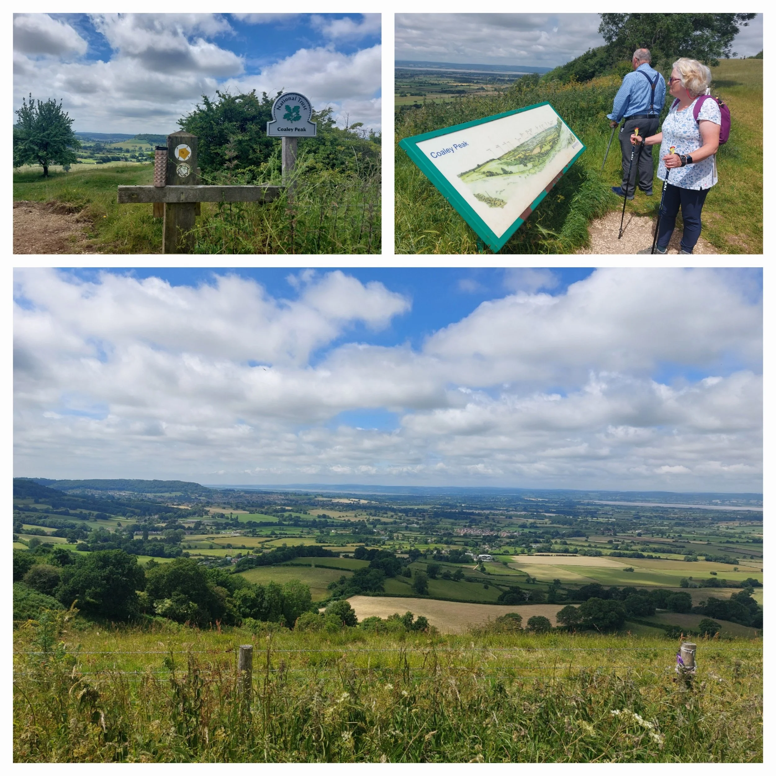
Leaving Coaley Peak behind us we pass through Frocester Hill Nature Reserve and spotting a Topograph slightly detour off the path to have a look. This topograph was erected by the Automobile Association some years back and points to various landmarks within the landscape in front of us. The River Severn Estuary, the Forest of Dean and beyond to the Welsh Foothills.

As the crow flies, we are only 1 mile from Cam Long Down, but in reality, it’s a lot further away from us along the path!
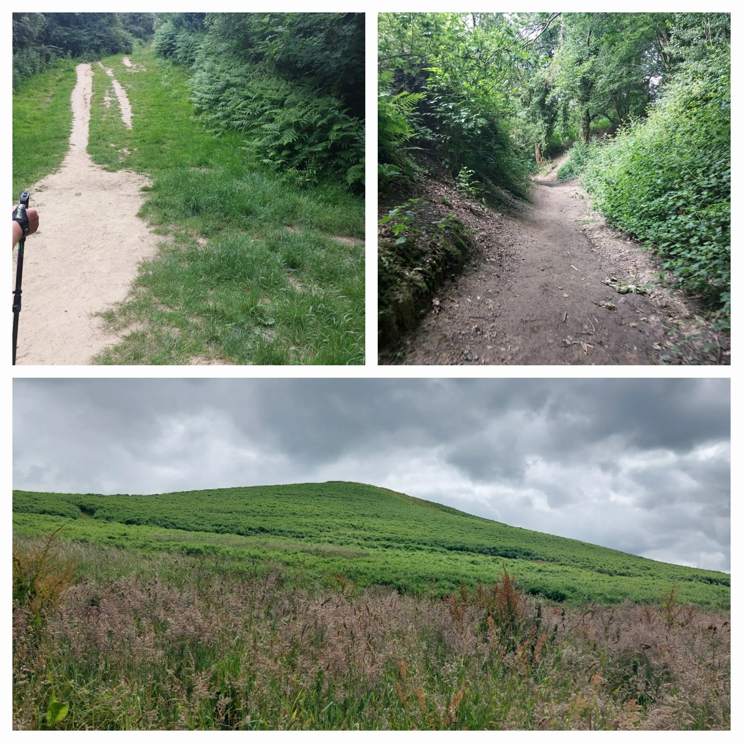
Talking of paths here there has been extensive work to repair and rebuild the footpath and it’s now a shiny compacted gravel beacon of light, rather than an uneven mud fest!

On both sides of the path are beautiful wildflowers and to our left exposed craggy rocks holding up the hillside above us! The path continues up to some steps which Tash does remember from 2021! They are quite steep, and one has a Cotswold Way way marker on the step riser which you could so easily miss, they lead up to the busy junction with the B4066, which we have to cross!

Heading back into woodland we cross through Coaley Wood which passes the wonderfully named Hetty Pegler’s Tump Long Barrow. We didn’t venture off the path to visit, but here’s what English Heritage have to say about it.
“Uley Long Barrow is a partially reconstructed Neolithic chambered mound. It is 37 metres long and overlooks the Severn Valley. It’s known locally as Hetty Pegler’s Tump after Hetty Pegler who owned the land in the 17th Century. It’s one of four Long Barrows in Gloucestershire cared for by English Heritage.”
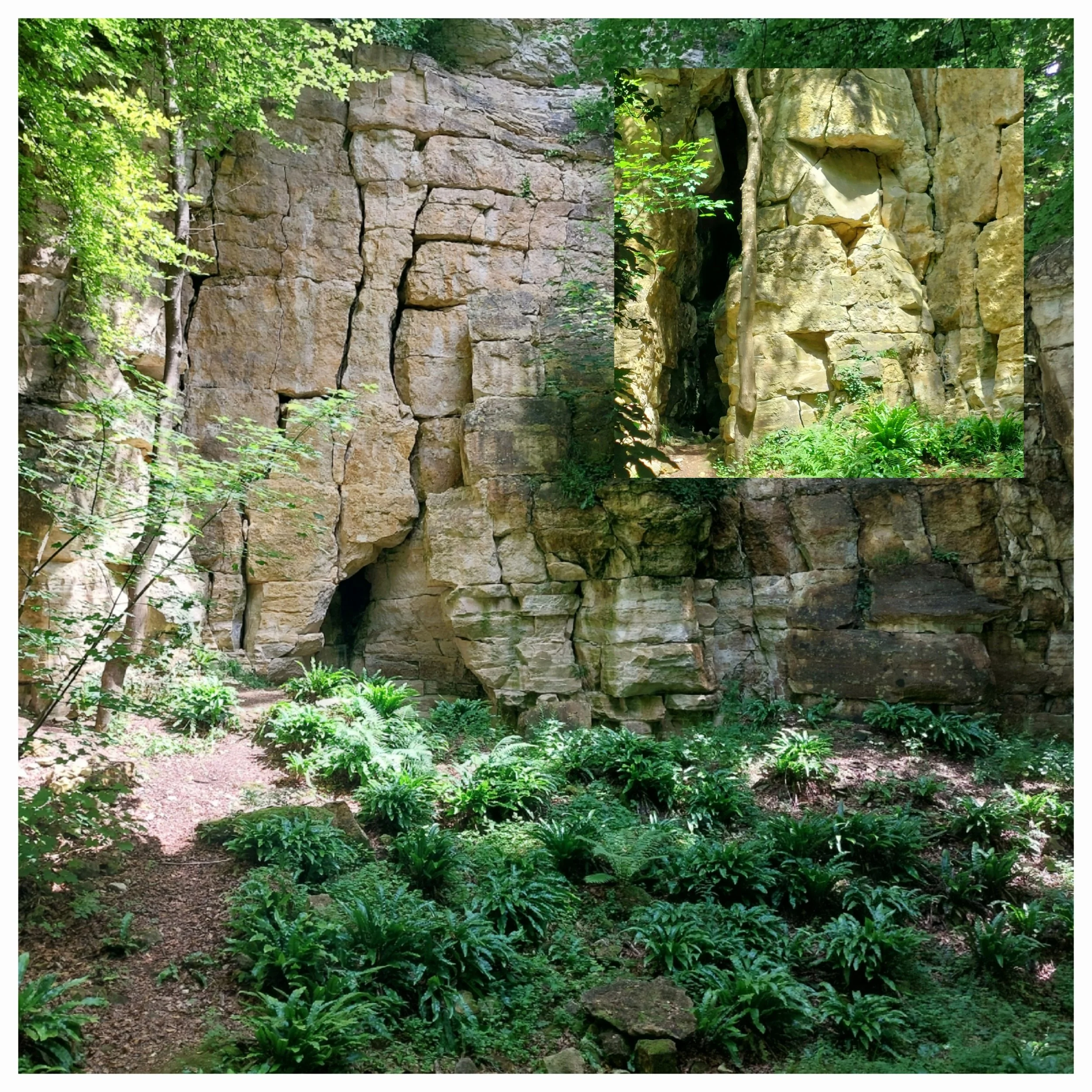
We continue on our way through Coaley Wood which is cared for by The Woodland Trust passing former quarries which have left intriguing craggy rock features along the way. Coaley Wood is an important haven for wildlife and is known to be a habitat for the rare greater horseshoe bat amongst others.

The Severn River in the distance

There are brief glimpses of the view outside the woodland in the gaps between the trees including one which looks like it should have a cable car attached to it!

This stretch of the woodland has some really gorgeous glossy green Hart’s-tongue ferns along the paths looking their best as well as other native ferns and at times we’ve been able to grab a faint scent of the last remaining wild garlic leaves before they rot completely away.
Here the path begins to descend towards Hodgecombe Farm and Tash realises she recognises this area and what it leads to…
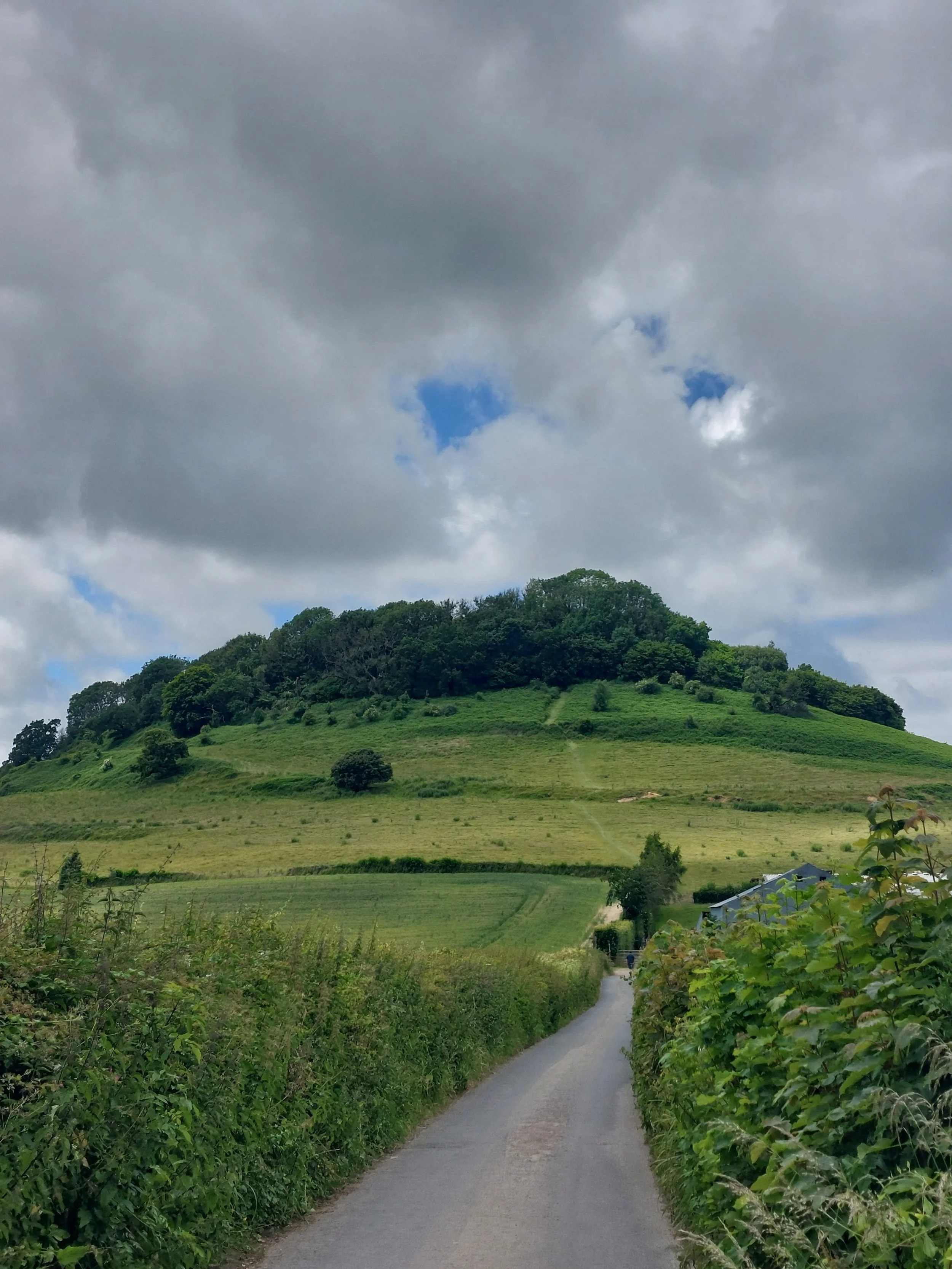
Cam Long Down!
Passing through Hodgecombe Farm glimpses of what is to come emerge through gaps in the hedges and soon the full glory of Cam Long Down rises ahead of us. During the 100km Ultra Challenge in 2021 this hill was almost a step too far for Tash and she is somewhat traumatised by the memories of climbing what she describes as a wedding cake hill with 3 or 4 tiers.

Yep folks, we are going up there!
It is a beauty though and as we walk down the quiet lane in front of it you can clearly see the three layers of path exposed on the hillside. Climbing over the stile at the bottom before the ascension we also spot Cam Peak to the left of the hill in front of us, which is where our cars are waiting to welcome us back!

Putting it off no longer we climb another stile into a field full of wandering cattle who thankfully are not in the least bit interested in us. Then the real climb begins! We decide to tackle one ‘tier’ at a time resting after each ‘summit’ to get our heart rates back down. Tash reaches the top first and disappears for a comfort break and on her return has to investigate 2 different paths to discover which one we should be following – they could do with another waymarker ahead of the stile at the top here! The fourth ‘tier’ is hidden in the trees and winds up to the top of Cam Long Down.
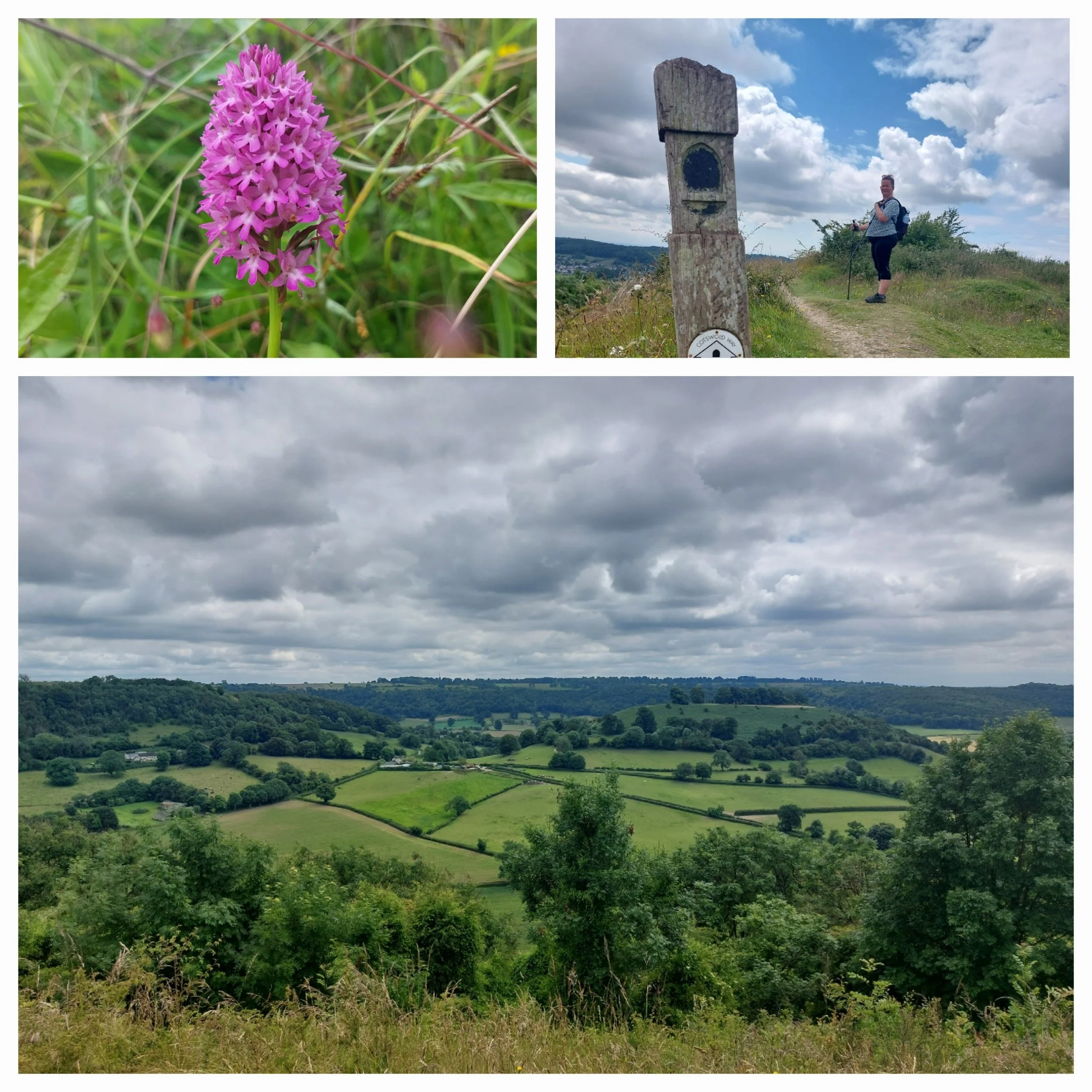
Once at the top we are greeted by a magnificent sight of wildflowers, loads of Pyramidal Orchids and 360-degree views all around!

Cam Long Down was originally part of the Cotswold Escarpment, but due to erosion became detached, but retains its long narrow shape due to a capping of lower inferior oolitic limestone. Interestingly Cam Long Down is owned by the people of Stroud district and voluntarily managed by a local group.

Views!

Norbert decides to have a closer look at the Pyramidal Orchids.
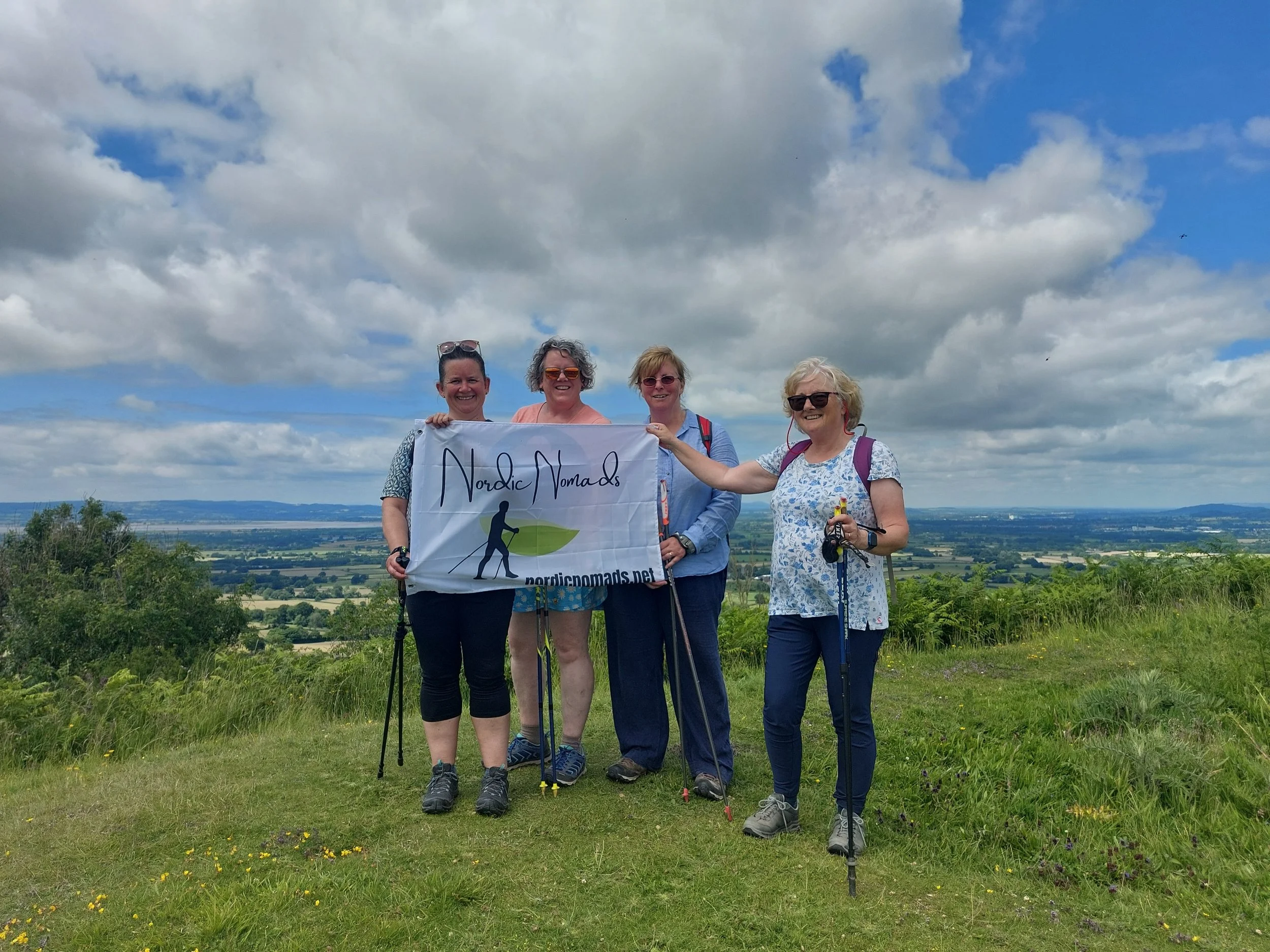
We spend a while enjoying the stunning views and having a closer look at the flora around us whilst slowly making our way along the grassy top and decide to have our end photo up here with our new Nordic Nomads flag, many thanks to the kind passing dog walker who offered to take a photo of all of us (no dodgy selfie today)

Stunning views from Cam Long Down
Continuing our way towards Cam Peak we leave the Cotswold Way path to return to the car park. Opening our cars up to release all the built-up heat of the day we stand in the car park to complete our post walk stretch routine and reflect on a good days walking!

More of Cam Peak in the next Leg!