
The Cotswold Way: Leg 9
The Edgemoor Inn to Stanley Mills 7.76 miles
Sunday 26th May, 10am
Moving time 2:55:54
Elevation gain 818 ft
Steps: 18,072

The map of our route from The Edgemoor Inn to Stanley Mills along The Cotswold Way.

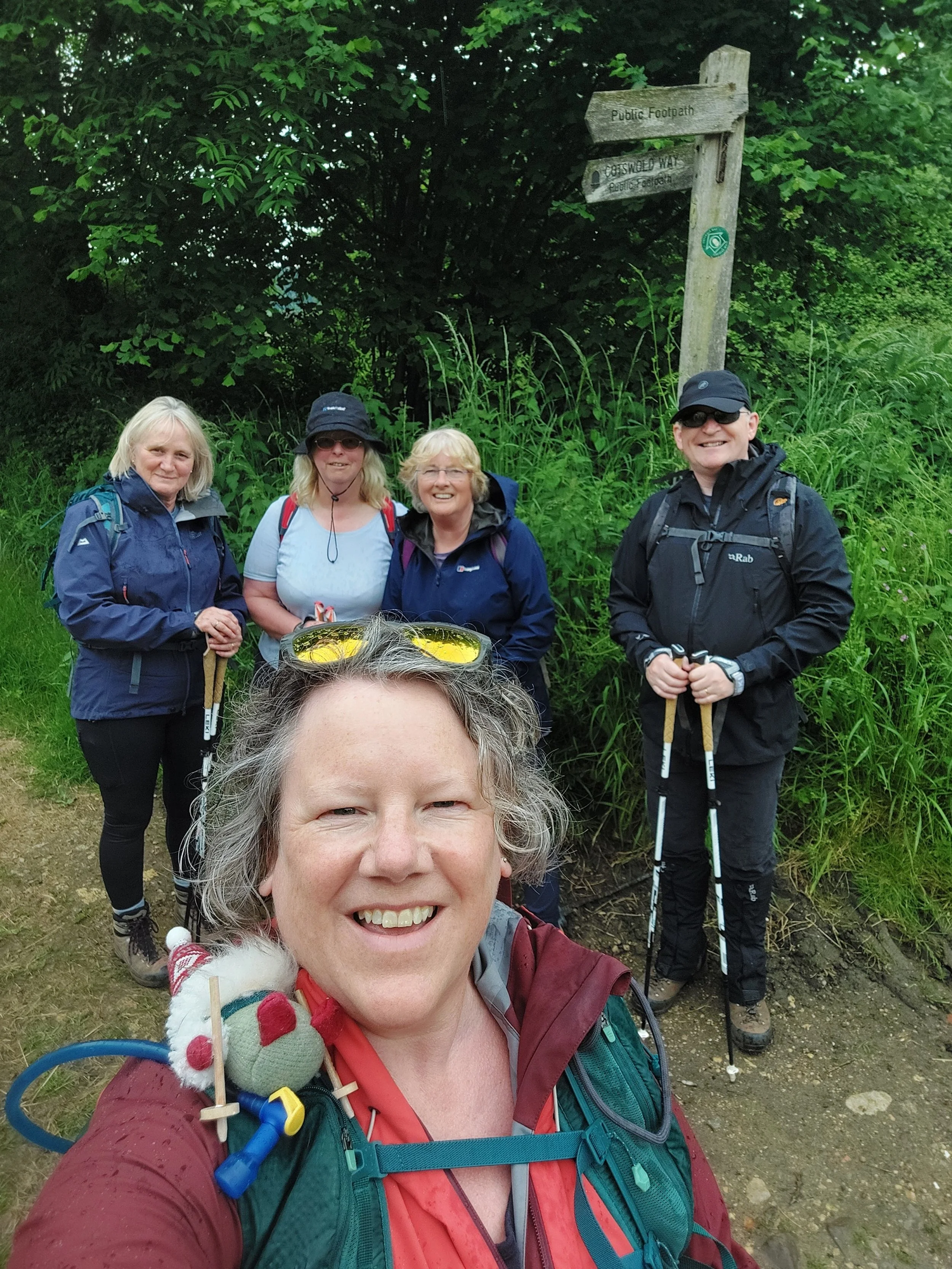
Five lovely Nordic Walkers (and Norbert of course) ready to set off on our adventure together!
The weather forecast for today is mixed to say the least with cloud, showers, heavy downpours and possibly thunderstorms thrown in for good measure. Having met at Stanley Mills, we all pile into one car and drive the short distance by car back to The Edgemoor Inn, none of us knew what to wear or pack in our rucksacks and at the last minute I decide to ditch my down gilet as the sun feels so warm, but we’re all carrying waterproofs just in case. I think we are all expecting to get wet at some point today. However at the start the sun is shining AND feels warm! We set off from the lay-by opposite the pub and immediately we’re going uphill!

We’re soon onto the Rudge Hill National Nature Reserve, which is grazed by cattle to allow the growth of rare orchids and other diverse flora and butterflies. We pass a way marker for a friendship trail twinned with one in Ontario, Canada, this 6 mile circular route is described as “A stile free walk that leads you along peaceful woodland tracks and out onto windswept hillsides with breath-taking views. A true jewel in the Cotswolds crown.”

We spot several areas with Birds Foot Trefoil, Heath-Spotted Orchids and Common-Spotted Orchids.

The limestone grassland of Rudge Hill (or Edgemoor common as it was once known) positively encourages wild flowers and this area is known to host at least 25 different species at peak season. The common rock rose (top right) was a new one to me! After briefly admiring the views we descended down some craggy steps which needed careful navigating!

Once down the steps safely we have to cross the fast A4173 and then we head into Maitland Wood which is owned by the National Trust, a beautiful Beech wood (My favourite)

The path takes us through Stockend Wood (also NT) and Holiday’s Wood.

Through this section of woodland we spot what we ponder to be an opening to a possible cave? On closer inspection of the OS map it is where there are some disused pits, probably fenced off to keep curious folk safe from exploring them! As we slowly start to climb uphill there are opportunities to glimpse at glorious views through gaps in the vegetation!

We emerge from the woodland and descend on a path beside a lane, after a few minutes we cross the road and turn up a path, passing this well, which upon further investigation is Cliff Well.
Built in 1807 this impressive Victorian well house situated over a now capped well, is right on the Cotswold Way. One side has a trough, the other side is open. Old graffiti and carvings can be seen. Inside the wellhouse there is a new, waxing moon with "Cave Adest Nox" (Take Care that The Night is Here), and a sunburst with "Instat Dies Transiit Nox" (The Day Passed into Night).
The inscription reads:
+DEO GRATIAS
Who'er the Bucketfull upwindeth,
Let him bless God who Water findeth:
Yet Water here but small availeth,
Go seek that Well which never faileth.
John c.4 v 14

At the top of one climb we stumble across three slabs of stone under yew trees and unfortunately any inscription is now illegible. The guide book tells us it is the Cromwell Stone and on further investigation I find this information “This three-part stone memorial, beside the Cotswold Way through Cliff Wood, Haresfield, commemorates the lifting of the Siege of Gloucester on 5th September 1643. The original inscription has worn away but records show 'Siege of Gloucester, raised 5th September 1645'. There is an immediate contradiction in the date here and passers by may wonder 'why here on this quiet path miles from the city'. It started on 10th August 1643 and ended when Royalist forces lifted the siege, driven off in spite of their overwhelming numbers when Parliamentarian reinforcements were on their way from London.”
There is an abundance of ferns throughout the woodland today!

This freaky doll awaits you as you come out of the woodland and turn left up a steep road! A short uphill on the road leads to more wild flower abundance as we climb to reach the entrance to the Haresfield Beacon.

Reaching the Trig point on top of the Haresfield Beacon, it is busy up here as it is a Bank Holiday weekend! We manage to get Norbert’s portrait on one of his favourite objects, but he has to be held tight as it is so windy up here!

Gorgeous scenes at the top of Haresfield Beacon.
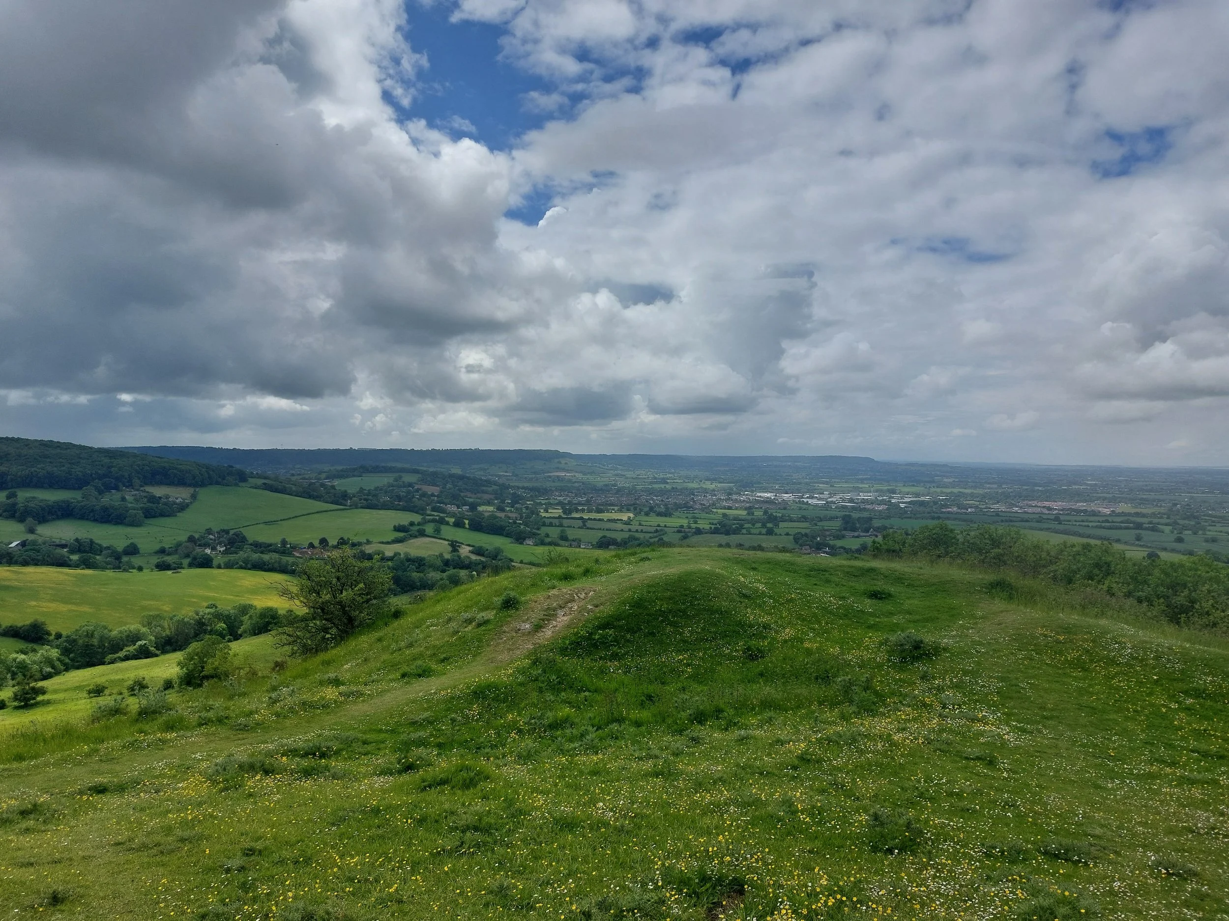
Gentle undulating scenery
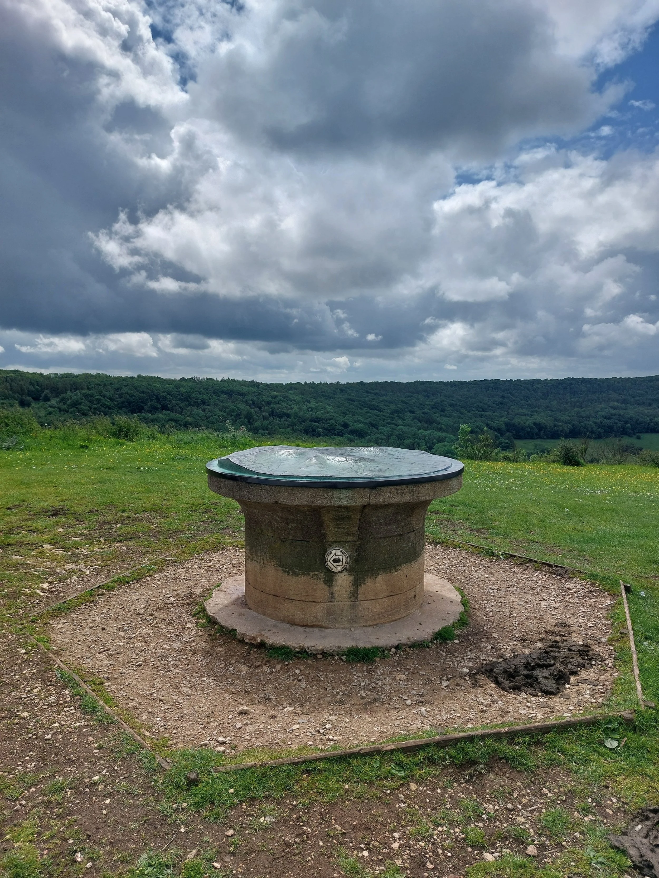
The Cotswold Way path continues right along the edge of a beautiful ridge until it reaches this topograph map.

Nordic Walking on Haresfeld Beacon "Occupying a prominent position on three spurs on the Cotswold escarpment, there are views across the Severn estuary towards the Forest of Dean and Brecon Beacons. With its dramatic topography, intimate woodlands, extensive grasslands and exposed and wild promontory hill fort the estate offers a variety of contrasting experiences.”

From the topgraph map we don’t follow the ‘daisy path’ (top left) instead we take the path to the right that leads us past some very chilled cattle and on to Shortwood car park where there is a coffee van and lots of people enjoying their Bank Holiday Sunday! We walk through the car park and turn right through a gap in the wall leading into Standish Wood.

Standish Wood (NT) has cycle tracks, many paths and Dragons apparently! It also has a lot of signs!
“The wood has a long history as it originally formed part of the wood owned by Gloucester Abbey as far back as 1297 and in 1515 was recorded as providing 12 cartloads of beechwood a year. In 1842, records show it was owned by the lord of the manor with the National Trust buying it, plus Harefield Beacon, in 1931. Trees in the wood were cut down in 1914 to be turned into pit props for the UK’s army’s mining operations on the Front of World War One.”
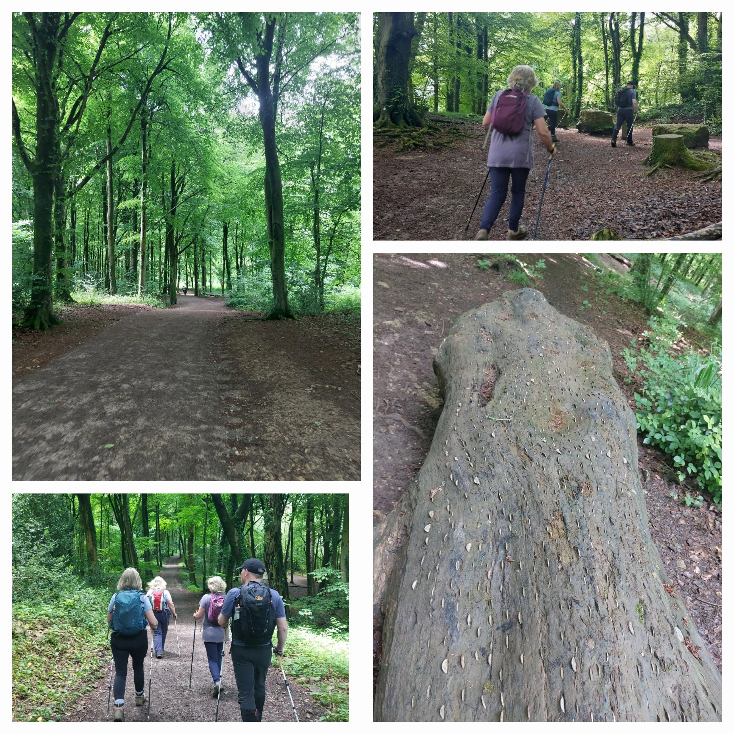
We came upon a tree trunk with coins hammered into it, this is known as a wish tree. These particular ones are known as 'coin trees' and can be found all over Britain. People hammer coins in and make a wish, usually for the end of an illness. The trees may be stumps or fallen, or sometimes living. Apparently the metal toxins may sometimes even be concentrated enough to kill the living trees.
It seems to be a surprisingly recent phenomenon, the first examples of these being recorded in the early eighteenth century. I have seen them before and there’s another one we will pass on the next leg!
We come across an area with a few options for a good lunch stop, a fallen tree trunk (without coins this time!) in the sunshine! So we decide to pause a while to replenish ourselves!

Looking down towards the Severn Estuary, we could just about make out one of the Severn Crossing bridges!

After leaving our lunch spot we continue briefly through the woodland before emerging onto a lane and taking the marked path to the right. This leads us down to a beautiful stone stile and down some steps to a track.
Brooding clouds in the distance!

Where we emerge onto a lane and almost immediately turn left over a stile, which takes us through this recently planted field of what looks like maize. Reaching another road we turn right ignoring the first footpath thanks to this handy sign and then turning left into another stunning landscape!

We’re heading downhill towards Stroud and the path passes this ancient oak which has a massive hole right through its trunk! It’s marked as a Faerie Tree on Google maps! The path leads us into a vineyard which is owned by Woodchester Valley Wines. We walk through the vineyard stepping through many iron squeeze-stiles which are hard to get the hang of, especially when encumbered with a rucksack!
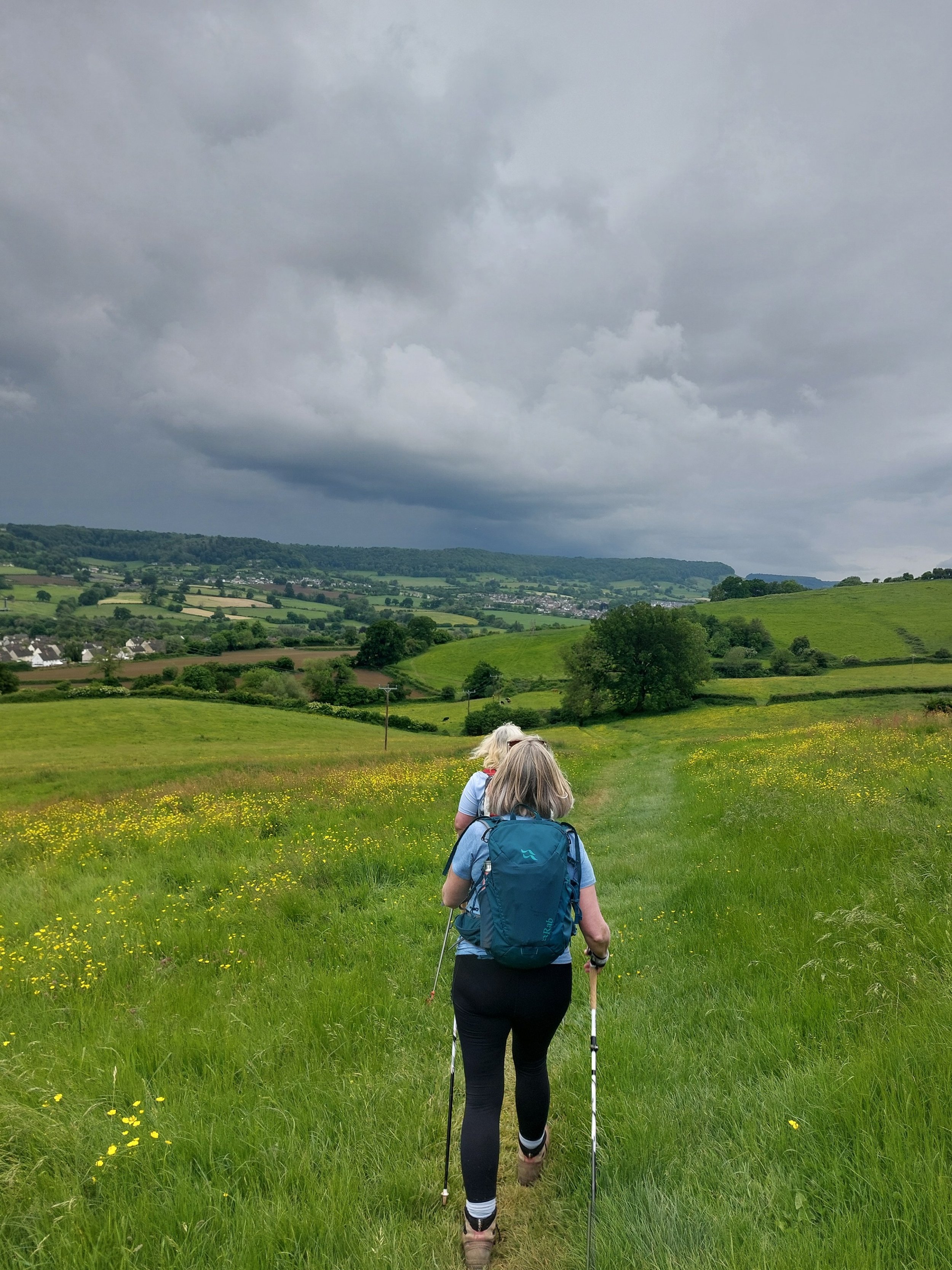
Traversing well-trodden paths through fields and past cattle who barely notice we were there. The skies were really threatening by this point!
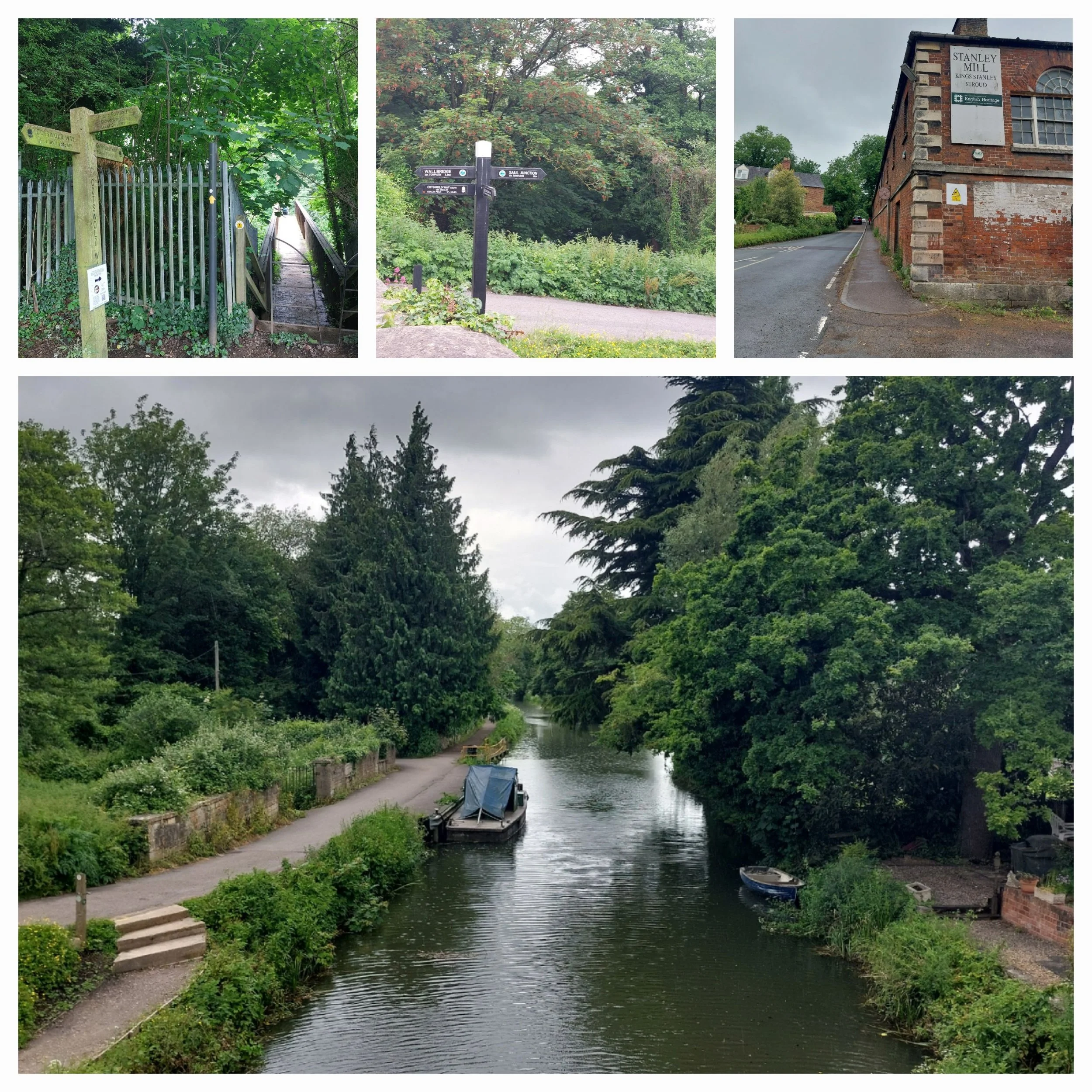
We eventually descend to a bridge across the railway tracks, where it starts to spit with rain, we cross over and walk alongside some playing fields and then come to the B4008 near Stonehouse. Here the rain has become heavier and more persistent so we stop to don our waterproof coats, continuing we walk along the roadside until we get to a small roundabout. There we cross over to take the lane that leads to the Stroudwater Navigation Canal, crossing over the bridge and keeping straight ahead until we then reach the A419 and have to wait for the crossing to light up green. We pass some other walkers with massive rucksacks! We then head up Ryeford Road South, passing the burger van in the lay-by and up past Stanley Mills to return to our cars. Stretches are completed and some of us decide to head to a recommended local cafe for a post-walk brew!
Finished Leg 9! Still smiling despite the shower!

By the time we reach The Rest, the sun is back out! Highly recommended as it welcomes walkers and has a big car park! Also the cakes are lush!
You can find it at:
The Rest, Court Farm, Broad Street, King’s Stanley, Stonehouse, GL10 3QN