
The Cotswold Way: Leg 13 (the one where Norbert got left behind)
Wortley to Horton: 7.26 miles
Sunday 29th September, 10am
Moving time: 2:22:30
Elevation gain: 790 ft
Steps: 15,358

Our route today
We met at Horton just before 10am and jumped in two cars to drive the 20 minutes to the start in Wortley. Unfortunately there was only one parking space by Elmtree Farm, so one car returns to the main road in Wortley which adds a little delay to our start.

Our lovely Nordic walkers today, but someone is missing...I have just realised Norbert has been left behind! Finally all gathered together at the start, it's a bit on the chilly side, so the gloves and warmer tops are on!
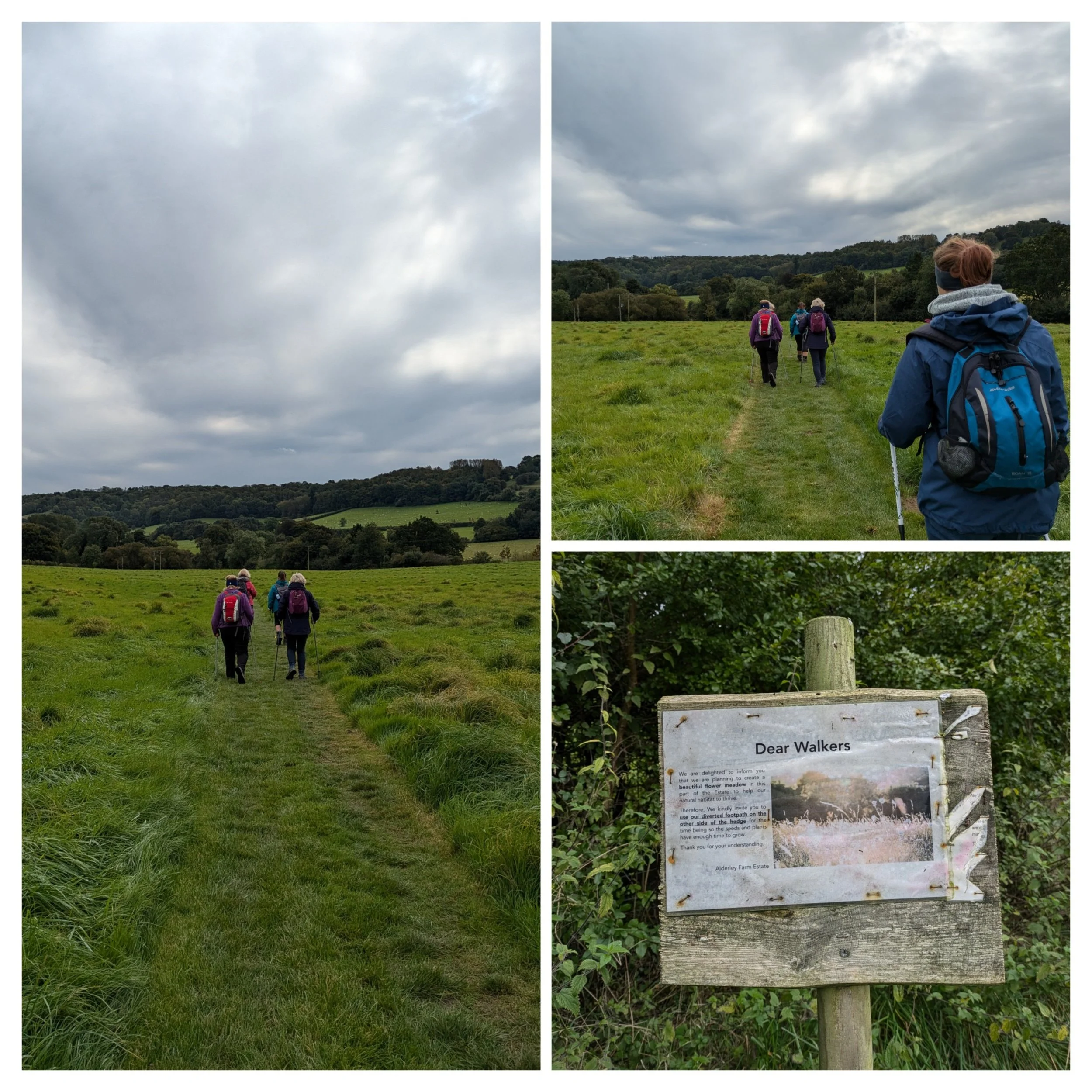
The path starts diagonally across a field and is beautifully mown so it is really obvious where we need to go. They have also planted a wild flower meadow in the next field at some point, although it's completely the wrong time of year to see it.

We carry on straight through the edge of a woodland which has a stream running alongside our path, it's a lovely sound as the water trickles along.

I'd hazard a guess that this National Trail marker has been here a while! There's a few 'waterfalls' where the water arrives in the stream from higher ground and the path is turning into a bit of a foliage tunnel.
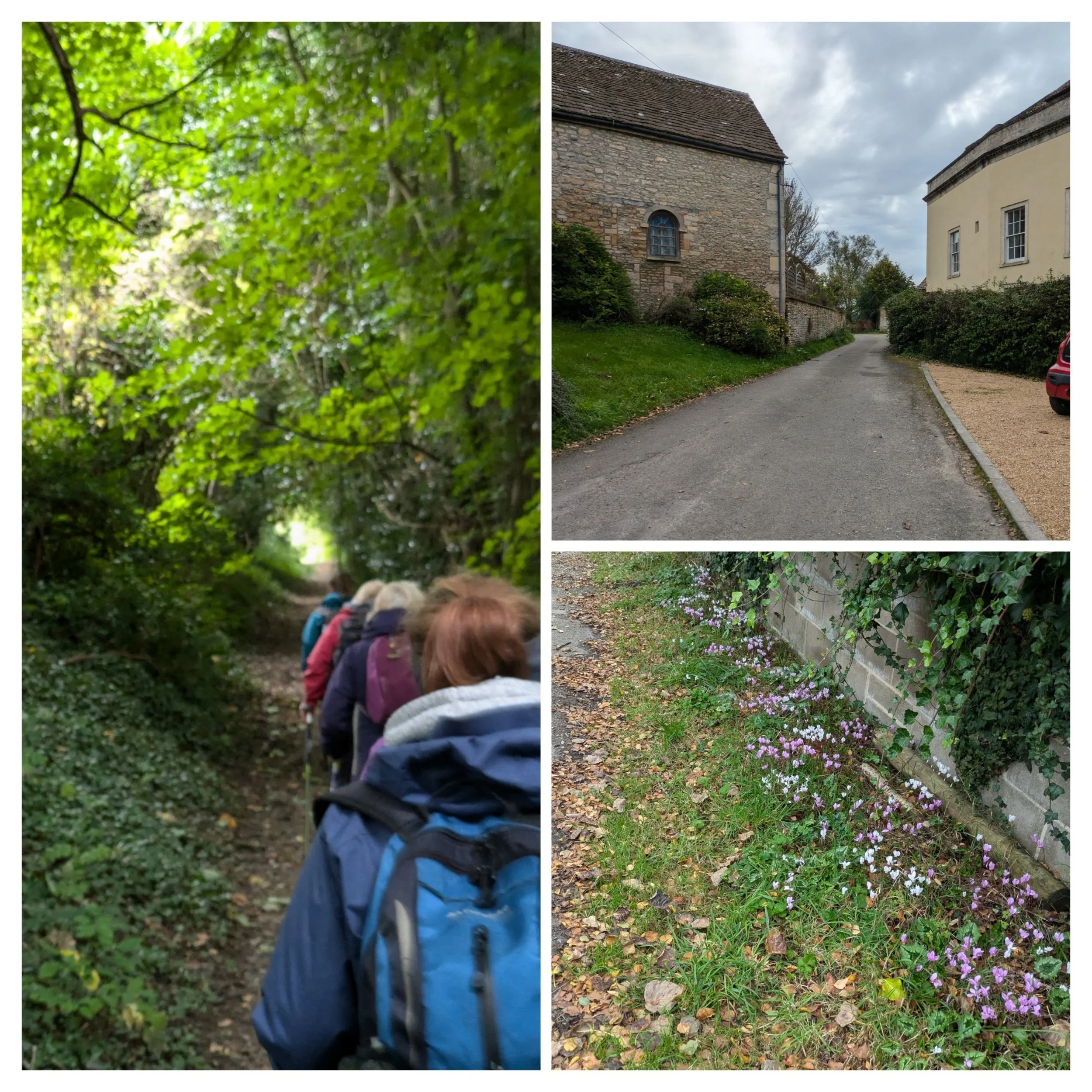
There's light at the end of the tunnel and it leads to Alderley. We turn onto a lane and pass a gorgeous patch of cyclamen flowers.

Wide-ranging views across the fields as we walk, lovely paths through Alderley and onwards.

One of the fields we are walking alongside has these stunning English Longhorn cattle grazing and lazing around and the biggest Aberdeen Angus bull I've ever seen! He was a beast! Glad they were behind a fence!

The sun pokes it's head out from behind the dense layer of cloud occasionally and it really is very pleasant walking these wide paths strewn with the beginnings of the Autumnal leaf litter.

Gentle paths through still quite green trees and plants, but most of the blackberries we pass are already hard as bullets!
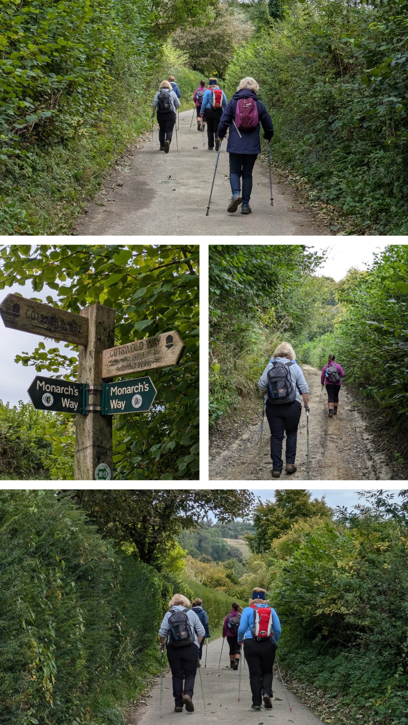
We cross paths with the Monarch's Way which is a 625 mile long-distance footpath that approximates the escape route taken by King Charles II in 1651 after defeat by Cromwell. We continue along a lane, which leads to a muddier path and onto another lane as we head towards Lower Kilcott.

Lower Kilcott has a brook running alongside the lane we are walking on passing cottages and a farm.

The Cotswold Way passes stunning cottages, the one behind the bridge in the top pic is called Bridge Cottage! One of our Nordic walkers used to live in Stream Cottage (lower left hand pic) The Cotswold Way leaves the lane and turns up a hilly path so we decide to pause for a snack by the gate and one of our walkers finds a handy nail in the gate to hang her rucksack on (no soggy bottom).

The path uphill is very stony and tricky to navigate in a few places and at the bottom it looked quite steep, but actually levels out quite quickly.

Running water has been washing the path away in places.

At the top of the path some of us pause for a comfort break and then we continue on towards the Somerset Monument. The paths here are grassy or wide and easy for Nordic Walking and so we try to up the pace where we can.
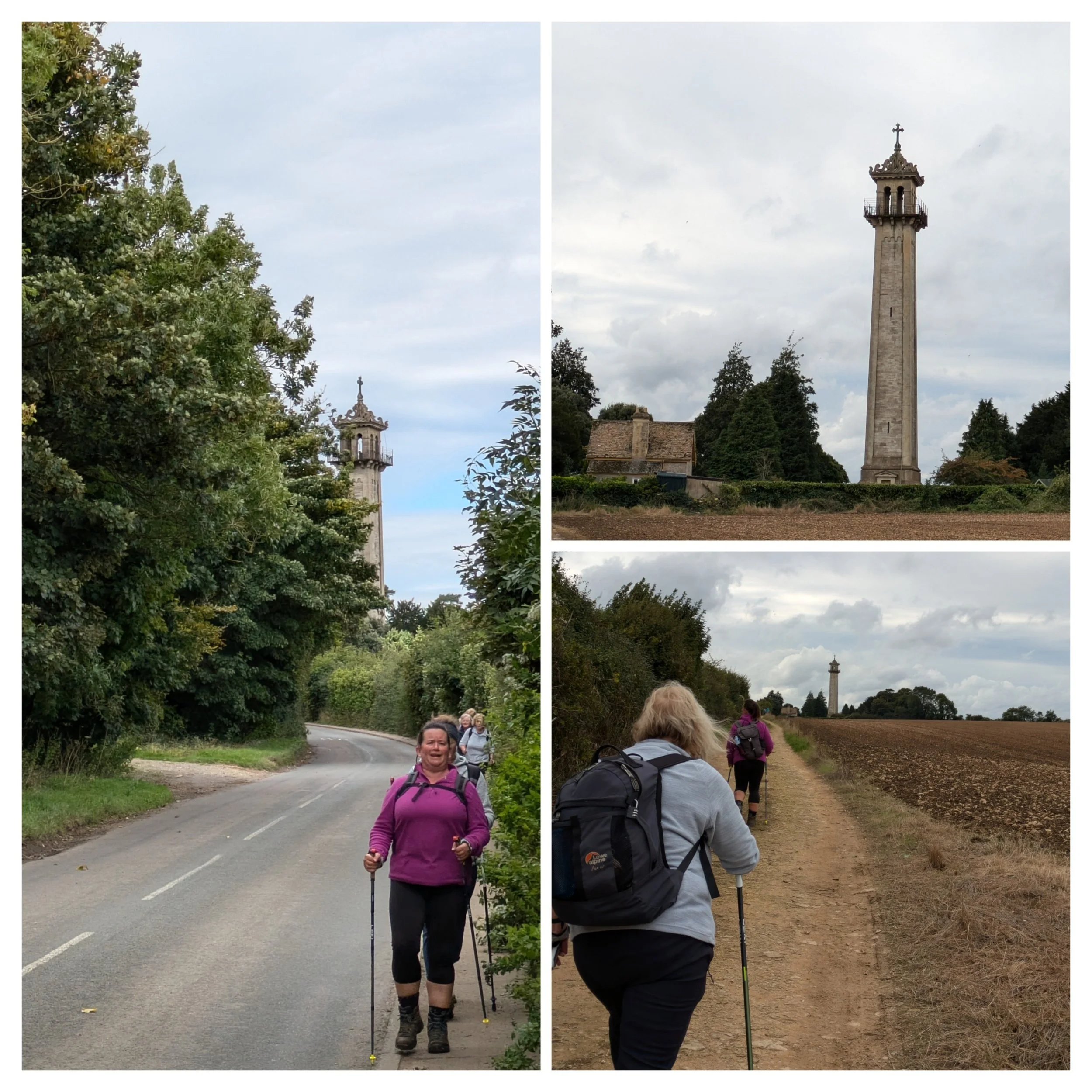
The Somerset Monument was erected in 1846 in memory of General Lord Robert Somerset, a British soldier who fought at the battle of Waterloo. The stone tower is more than 30 metres tall, unfortunately this Monument has been allowed to fall into disrepair and you can no longer climb to the top where there is a viewing platform.

We reach the outskirts of Hawkesbury Upton and the Cotswold Way takes a right turn past a boggy pond area and a very posh looking field gate! We have passed signs for Starveall and it got me thinking about place names, how and what does it mean? After a bit of research it turns out the name Starveall is a common and possibly humorous description in central southern England for land of poor fertility and means what it says - the land was poor and so didn't feed the locals - ie it starved all.

We turn left onto this wonderful wide gravelly path between hedges, which is great until the left-hand hedge runs out and we are exposed to a really chilly and strong wind - I end up with an ice-cream head!

Once we reach a slightly more sheltered area with a wide grassy path we stop for a lunch break, there's some chatter about "once we're down we may not get up again!" It's fine though as we do all manage to get up again after refuelling and resting! Once on our way again, it is possible some of us might have felt a few rain drops, but were shushed after mentioning it so as not to invoke proper rainfall.

More grassy paths.

We pass through a woodland near Horton Court which has some stunning ancient trees in it.

After saying I hadn't seen much fungi, I spot these and a couple of other different clumps of mushrooms on my way through this patch of woodland.

We come out onto a fairly high area which has a couple of benches, so we pause to sit and take in the view, which is very clear today. We reckon we can see across to the peaks of the Black Mountains in the distance. Shortly beyond here we pass diagonally through the grassy banks of the Iron-age Horton Camp hillfort.

We descend on a grassy path down towards the Millennium Folly on Horton Hill, the tower was built in 2000 here on the Cotswold escarpment, just below the Iron Age hillfort of Horton Camp, as a millennium project to provide nesting places for swallows and barn owls. It's called Swallows and Owls House. I think it looks like Rapunzels tower.

Continuing to descend towards Horton, the path is a bit slippy in a few places and unfortunately one of our walkers looses her footing and falls, thankfully she was ok. We pass this little nook that had a couple of benches carved out of logs and we soon arrive back at the school where our cars are parked. Stretches are completed and our end photo taken. We head home - some of us via the start to collect our cars!

Finished! At the end of todays leg with our flag!

On our way home we pass this lovingly knitted creation in the village of Alderley, shame we didn't pass it on foot earlier!